
Peru, Part 1: Bagua Grande and Kuelap
— Peru, South America — 12 min read
June 16 - 22, 2010
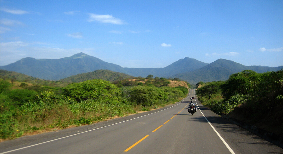
Comprising the heart of the Inca Empire, Peru has become well known for its archeological sites, such as famous Machu Picchu. However, the varied landscape, ranging from dry deserts to rain forests up to glaciated peaks was the main draw for me. The Andes start much further north, but here is where it starts to become majestic. The sensation that this is the highest mountain range besides the Himalayas is felt as the road climbs ever higher and clings to cliff faces.
I followed a route staying primarily in the mountains thru northern Peru, climbing up and down the Cordillera Blanca down to Lima on the coast. From there, I rode the desert down to Nazca before climbing back up to Cusco for a trek to Machu Picchu and then exiting via Lake Titicaca.
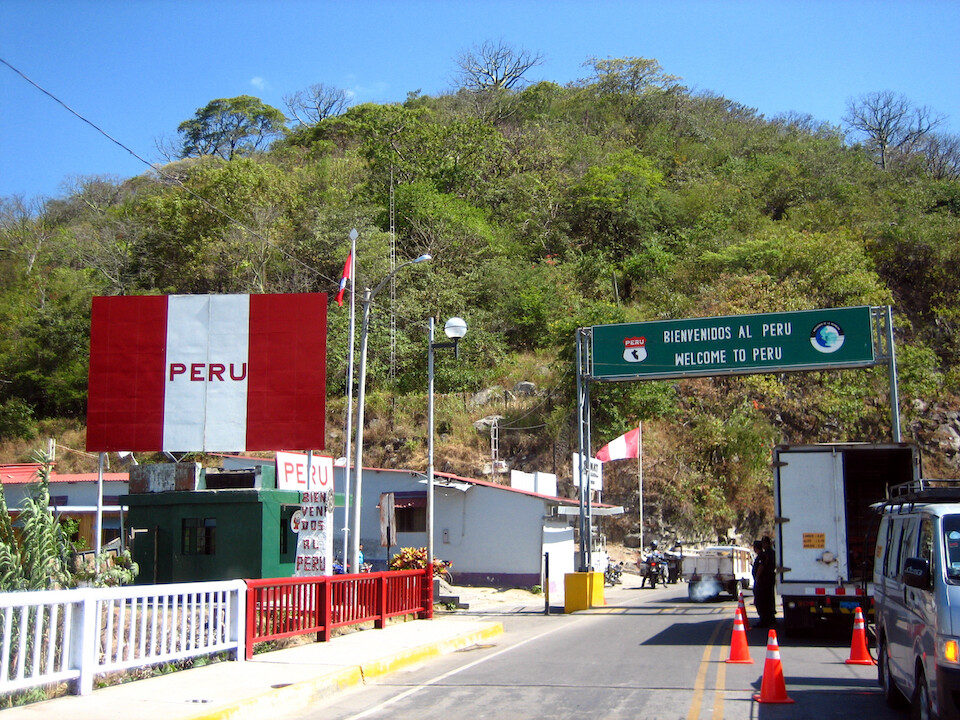
There are three land borders with Ecuador and I crossed at La Tina. Tumbes is the main one down on the coast and La Balsa is further east in the jungle.
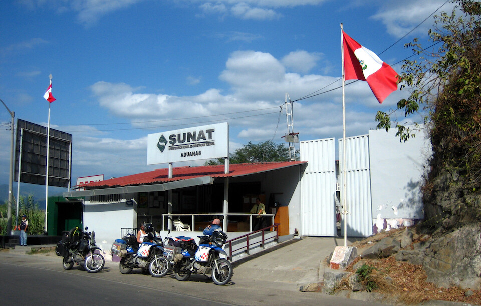
Immigration was a breeze, even with my visa needing to be inspected by national police, and as usual, getting the bike processed through customs is what takes more time. But everything went smoothly. This border was very relaxed and surprisingly there were no money changers around. I found a taxi driver who was willing to change a few Dollars into Nuevo Soles for lunch. I crossed with Holger and Anja (Anya), touring around the world from Germany. We met in southern Ecuador and would be riding together for the next few days.
Nice first impression. The road was in much better condition than just across the border in Ecuador. We spent the night in Sullana.
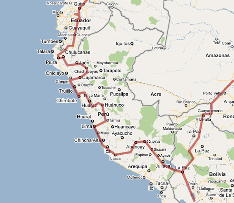
My route through Peru. Click on it to go to the interactive version in Google Maps.
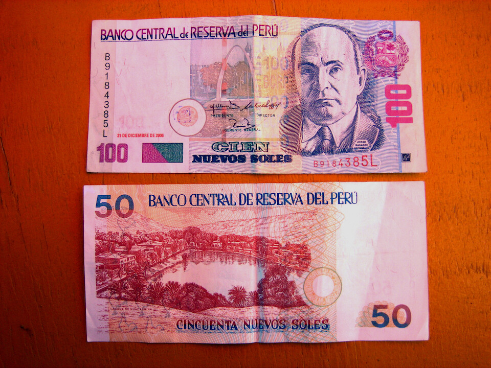
The Nuevo Sole, Peru's currency. USD 1 = 2.90 Soles (written as S/.2.90). The scene on the back of S/.50 note is of Huachachina, a desert oasis on the way to Nazca.
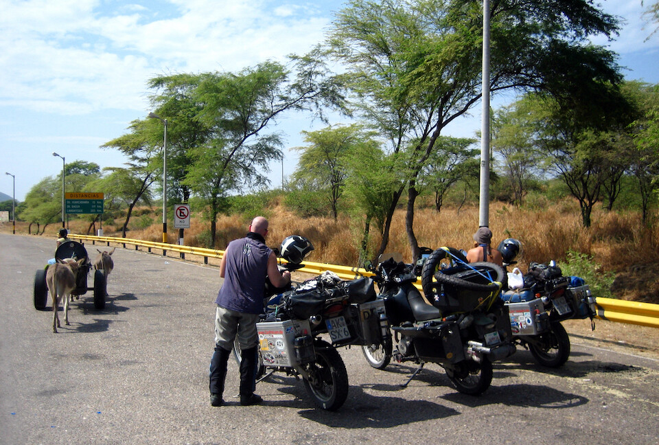
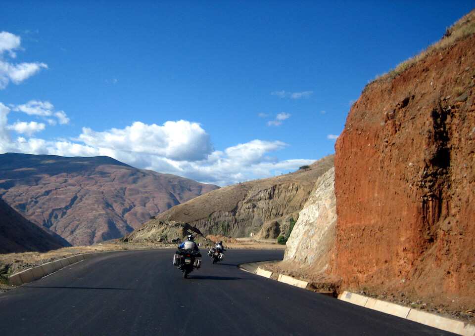
Regrouping after a toll booth as we watch a donkey cart pass. Motorcycles don't have to pay tolls in Peru, but it's very important not to go through the main toll gate, there's probably a vehicle counter. We were directed to go around the toll booth, but there's no dedicated moto lane like in Colombia.
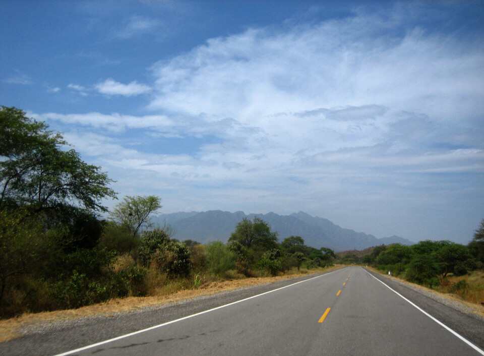
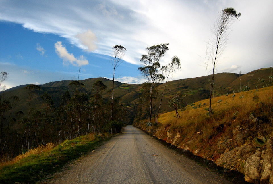
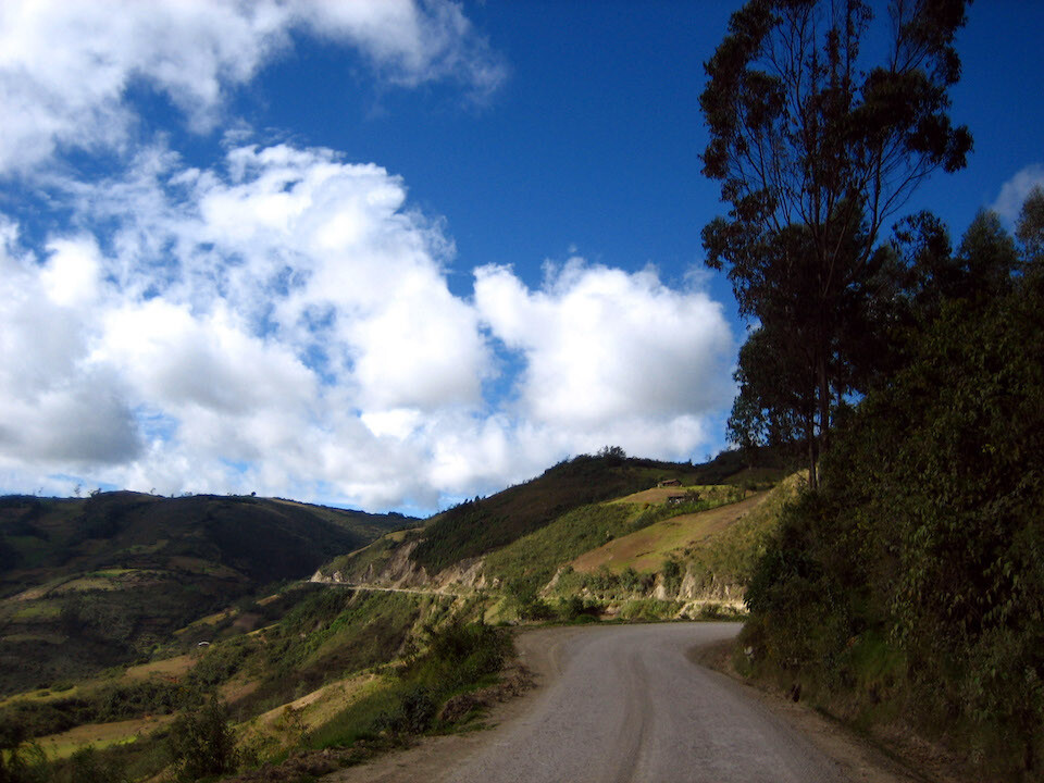
Looking forward to getting back into the Andes. From Olmos, we turned east to climb up.
Nice, new pavement as we climbed into the clouds.
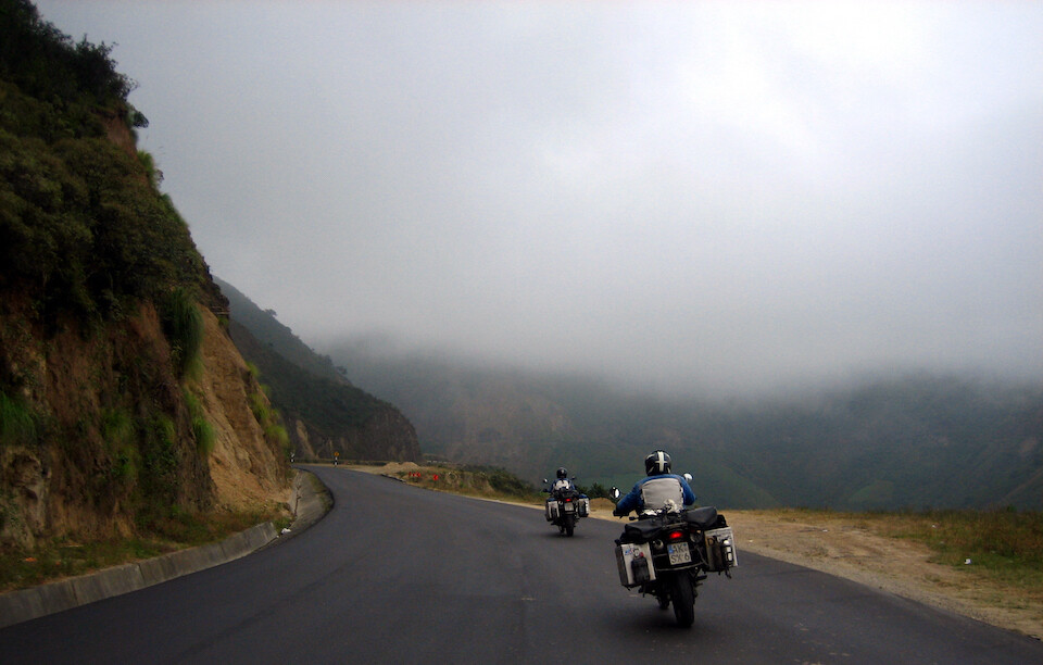
It got chilly and we stopped to put on our liners, but the road peaked at only around 2,000 m (6,560 ft)...
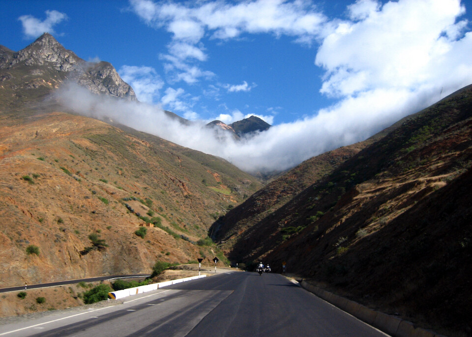
...before dropping down on the other side. Note the clouds caught in the hanging valley.
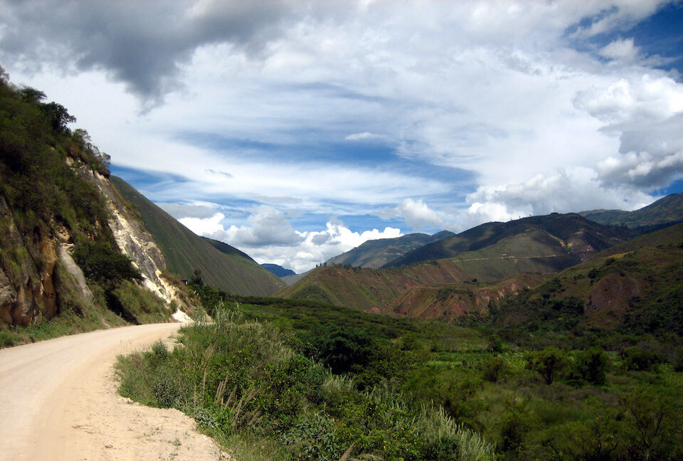
The landscape got dry as we rode into a rain shadow (all the water gets dropped on the other side).
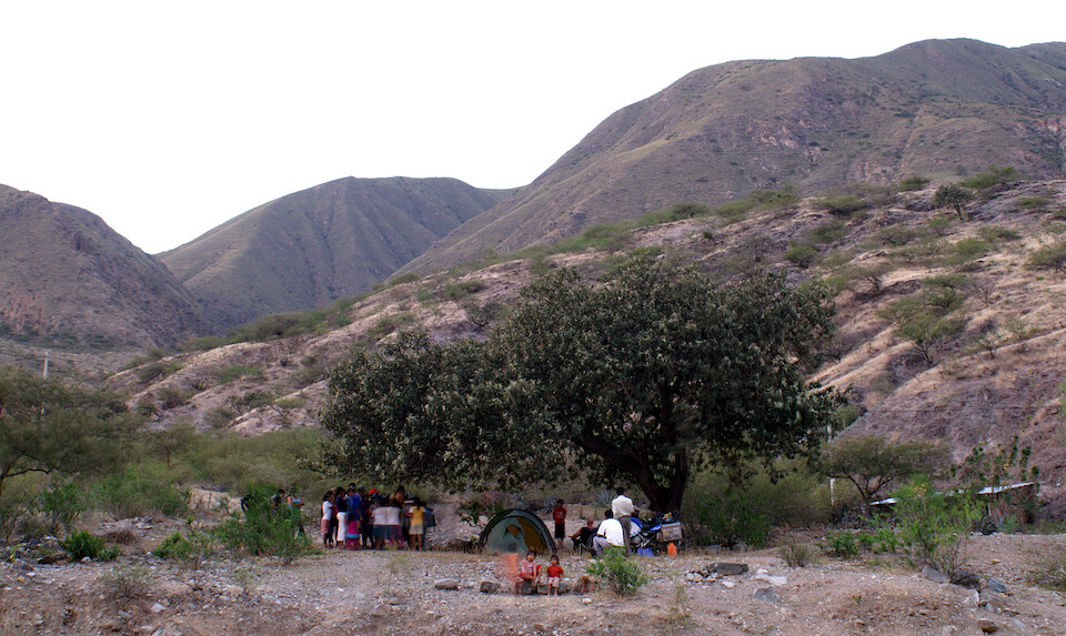
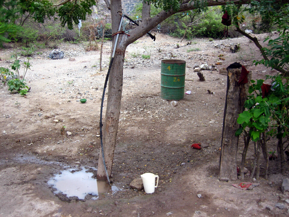
It was getting late in the day and we figured we weren't going to make it to Bagua Grande, so we stopped in the small village of El Arenal and asked if we could camp somewhere. The elders and children lead us to this tree.
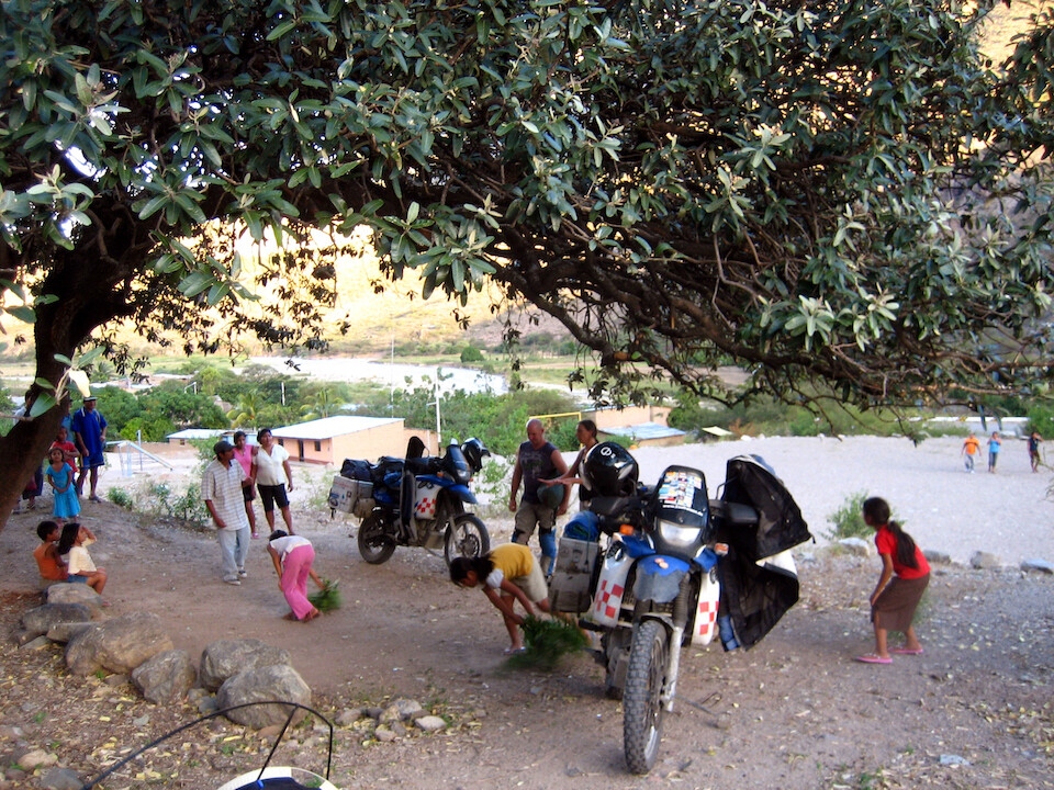
Everyone was so excited to welcome these strange travelers. The kids grabbed some leaves and started sweeping the area for our tents. Very nice of them, but it kicked up a lot of dust. Almost everyone in the village came over to introduce themselves and curious onlookers hung around to see all the fancy equipment on display: tents, sleeping bags and stoves. Anja was entertaining the kids by showing the flags on her bike of all the countries that they've traveled through . You don't get privacy when staying in a village, but at least there's some security from banditos.
It was a pleasant valley and we prepared dinner as the sun went down on a warm evening.
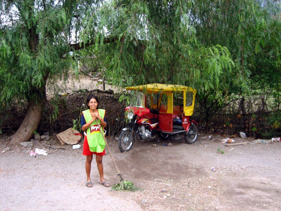
The next morning, Naomi here brought over some mangoes. That's her husband's moto-taxi, a source of income.
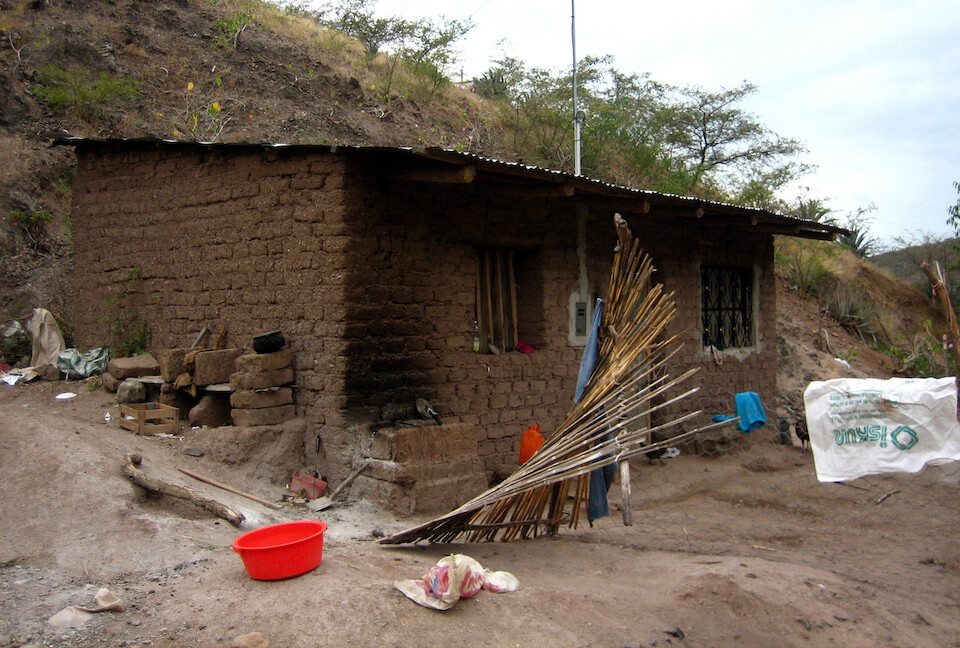
Their home, made with mud bricks and an outside stove.
She allowed us to use her outdoor shower to wash up.
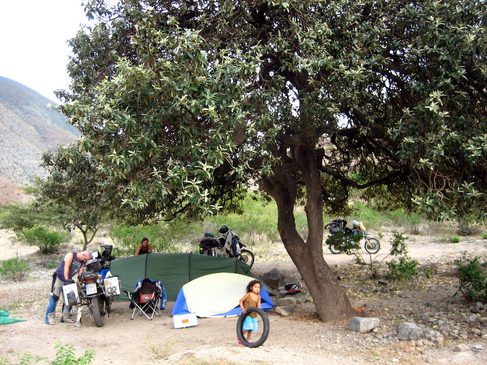
The kids showed up as soon as they saw we were up and about. Holger kept joking to the kids that he knew where there were two new tires (on my bike) that would make great toys. I cable-locked them at night, just in case.
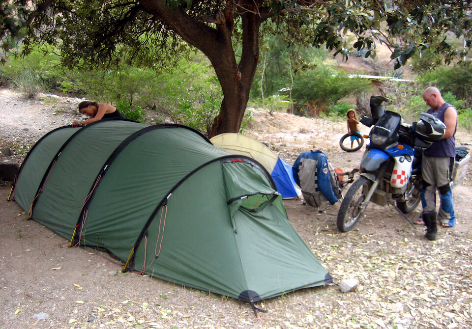
This is their huge tunnel tent. Looks like they could park the bikes in there too. But with all that space, it's nice to be able to cook when it's raining. Another creature comfort Holger allows himself is a folding camping chair.
Heading east to Bagua Grande.
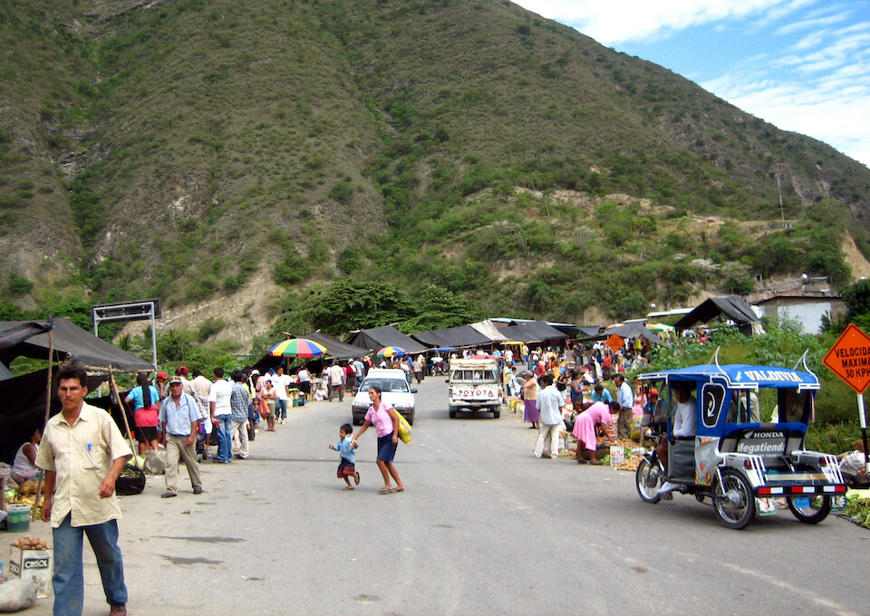
Passing by a busy market on the highway.
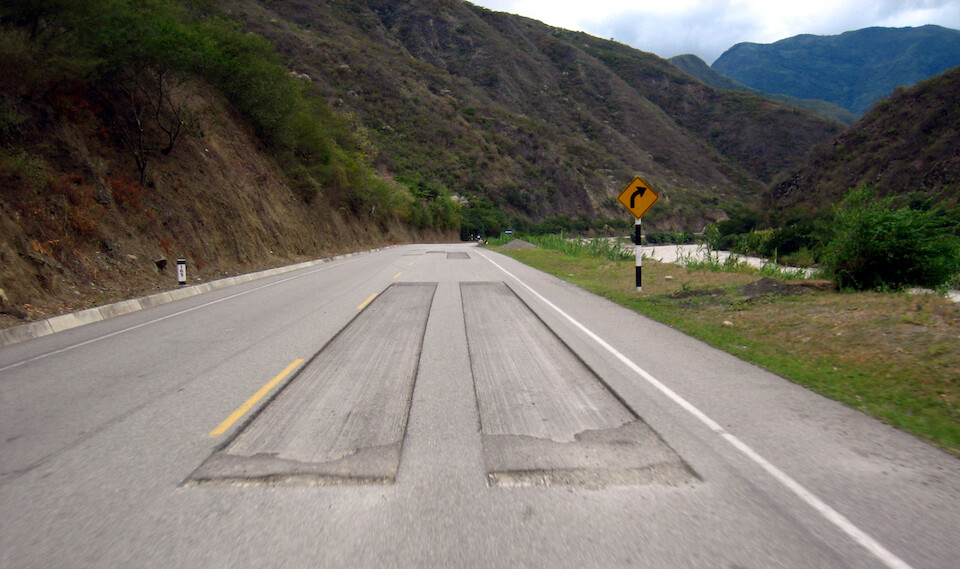
From Olmos onwards, there were these strange cuts in the otherwise good-conditioned road, about 5 cm (2 in) deep at varied intervals. We couldn't figure out why they were doing it. Some of them were repatched and looks like a case of ensuring job security ("let's cut holes in the road, then we'll have to come back and patch it up"). Most of the edges were not ramped and it was quite rough on the suspension if you couldn't avoid going into one. We rode the shoulder mostly.
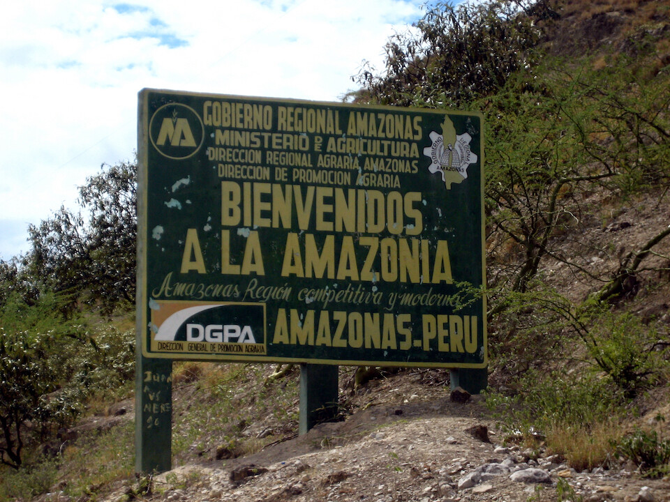
Welcome to Amazonas state of Peru. I wouldn't be going into the Amazon itself (not just yet, that's for Brazil), but this state covers a lot of area.
The elevation dropped to about 500 m (1,600 ft) and the terrain flattened out.
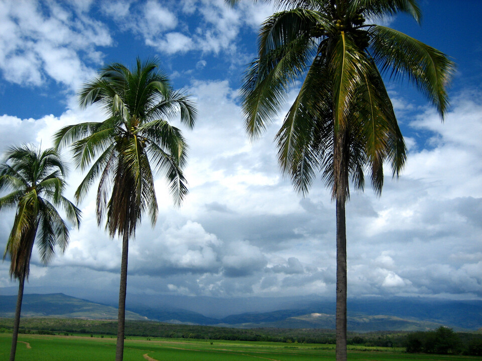
Seeing coconut trees after a long time and rice (paddy) fields.

Being welcomed by Jeong-Rae (Julio) in Bagua Grande, through CouchSurfing. He's an overseas volunteer from South Korea (similar to the US Peace Corps) and he's teaching computing at a local school.
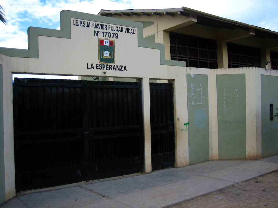
At the school where Julio works.
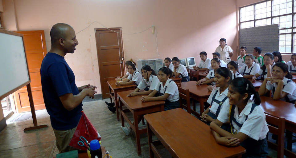
In our correspondence, Julio requested if I could speak to his class about my trip and India. They were quite excited and kept peppering me with questions about the food, culture and history. They even asked me to sing the national anthem of India and in return, I asked them to sing Peru's national anthem.
I managed to keep them entertained for an hour and a half. It's been about two and half months since I crossed into Mexico and my Spanish is pretty decent by now. I can convey most of my thoughts.
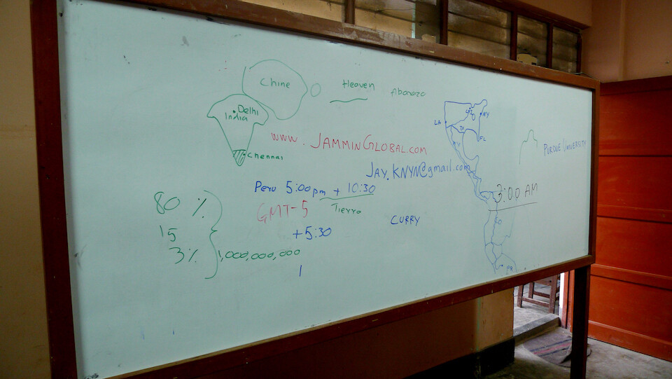
Can you figure out what I talked about? Location of India, close to China. Religious break-down in India (Hindus, Muslims, Christians). And how that makes up a population of over 1 billion compared to Peru's 30 million. Time difference. They wanted my contact info. My route from Chicago. The heaven reference is because I was trying to explain how there's no real heaven in Hinduism, compared to Christianity, which is the de facto religion across Latin America.
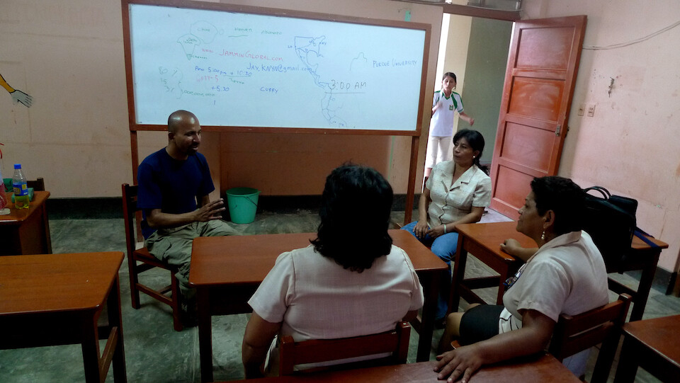
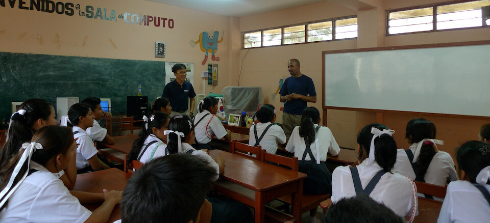
Talking with the teachers after the class session. I've been regularly asked what's my mission, what's my purpose? and I simply say, to know the land and its people and they understand.
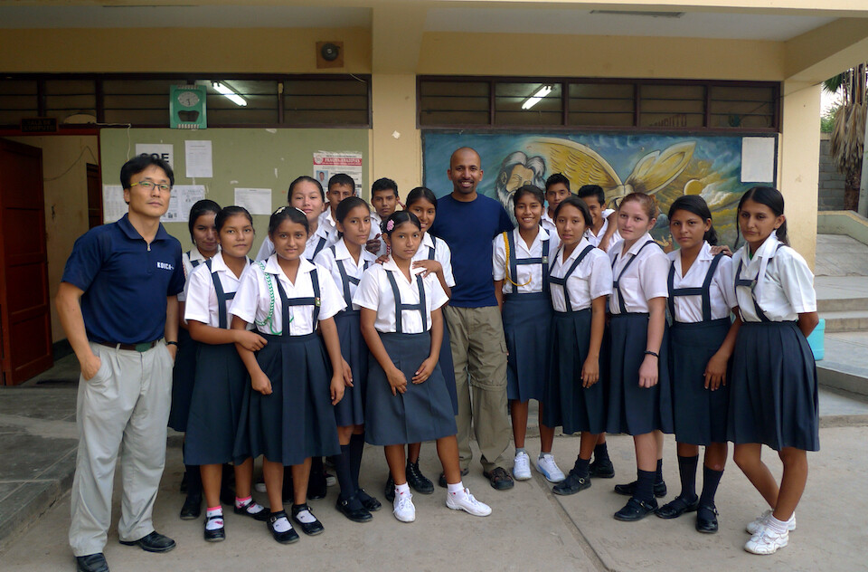
With my students for the afternoon. I had fun sharing with them about my trip and India. Julio said in his experience, so far, he sees a general lack of ambition and drive in some of the students. Hope I could throw some inspiration their way.
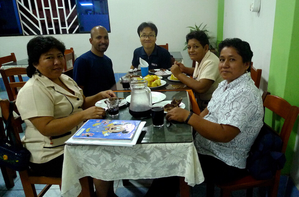
Being treated to a dinner of cuy (roast guinea pig) by the teachers.
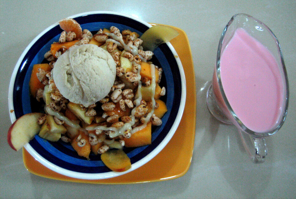
Later that evening, heading out with Julio to a yogurt place for a desert of fruits and ice cream with yogurt. Yum.
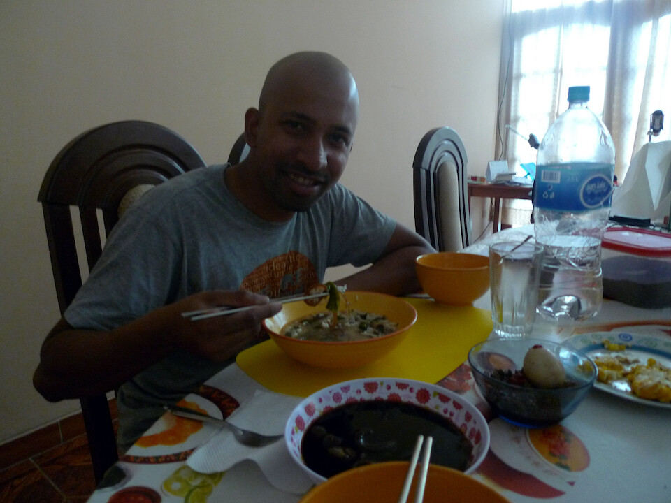
Next morning, Julio prepared a traditional Korean breakfast, which was very tasty and a welcome change to the taste buds.
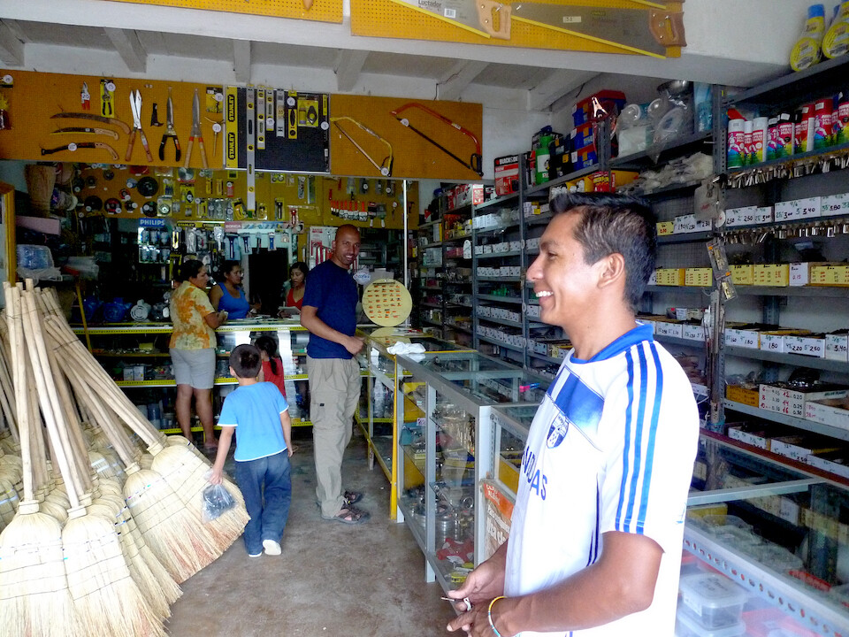
I kept blowing fuses in my accessory panel on the bike and here, Julio's moto-taxi friend, Percy is helping me buy some spares at a hardware store.
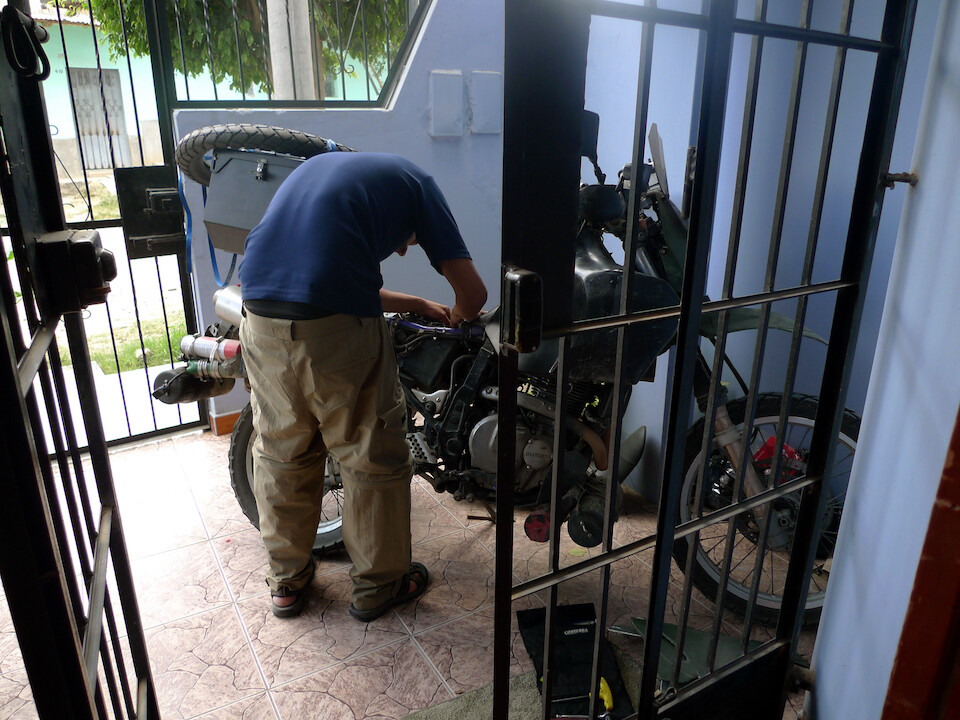
Re-routing all the main electrical accessory wires. A reader of my ride report on ADVrider.com suggested that the Centech fuse box might have some debris, which bridged the positive and negative lines, causing the main Centech fuse to trip. It sounded right and since the next stretch of the trip was going to be rough roads, instead of trying to make the fuse box work properly, I just by-passed it.
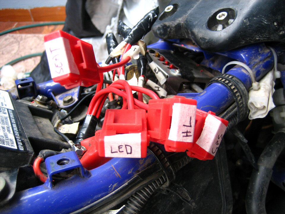
Individual in-line fuses installed for the main electrical accessories (LED lights, head light, GPS, 12v power outlet). Everything was working good again but I would have to remember to turn off everything when I shut the bike down, since they were now hot-wired direct to the battery. The nice thing about the Centech fuse box is that it has a relay that knows when the bike is turned on or off, preventing an unaware battery drain. Oh well, I'll fix it further down the road when I get some down time.
Julio took me on a tour around Bagua Grande and here we are at a lookout (mirador) of the town.
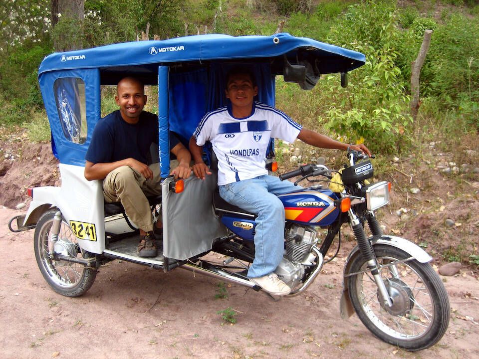
Riding with Percy in his moto-taxi. This is the standard low-cost way of getting around. It's the front end of a Honda 125 cc motorcycle with a carriage welded on to carry two people and some cargo. sanDRina was feeling smug with her additional 525 cc's to only lug me and my cargo around compared to what these little engines have to struggle through.
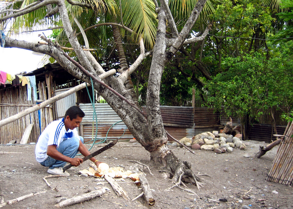
Percy took us to his sister's house for a refreshing drink of coconut water.
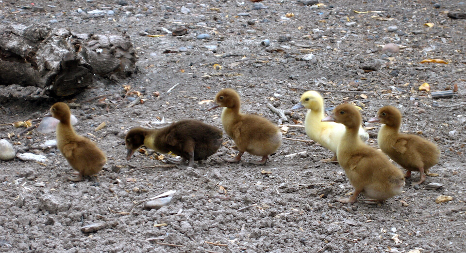
Ducklings running about. Looks like a good representation of global human skin color, mostly brown with a few darker and a few lighter :)
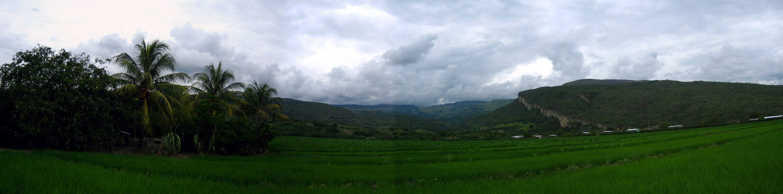
Panorama of a rice (paddy) field. Looks just like my dad's fields outside Madras, India.
Click here to see the high resolution version.
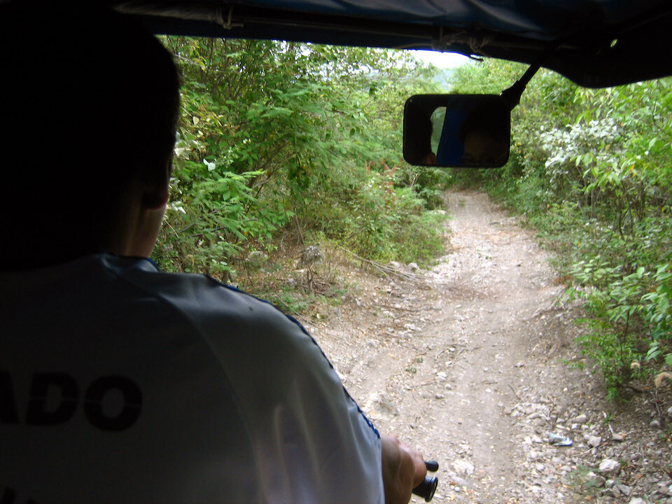
Percy promised us one more attraction. We went down this narrow, rocky pathway with branches snapping at us.
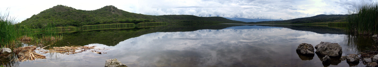
And what an attraction it was! Panorama of the beautifully still Laguna Burlan near Bagua Grande.
Click here to see the high resolution version.
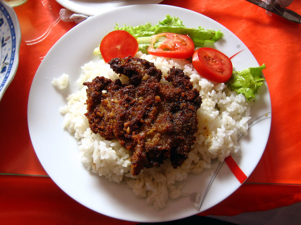
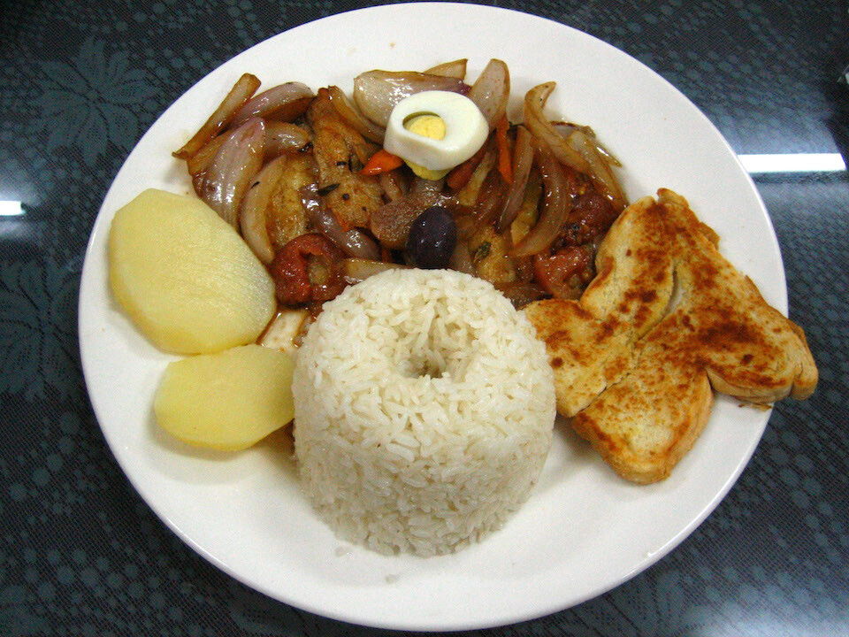
Lunch (almuerzo) of breaded beef with rice and some salad. Being Indian, my taste buds are accustomed to eating rice with something liquid (lentils, curry, etc).
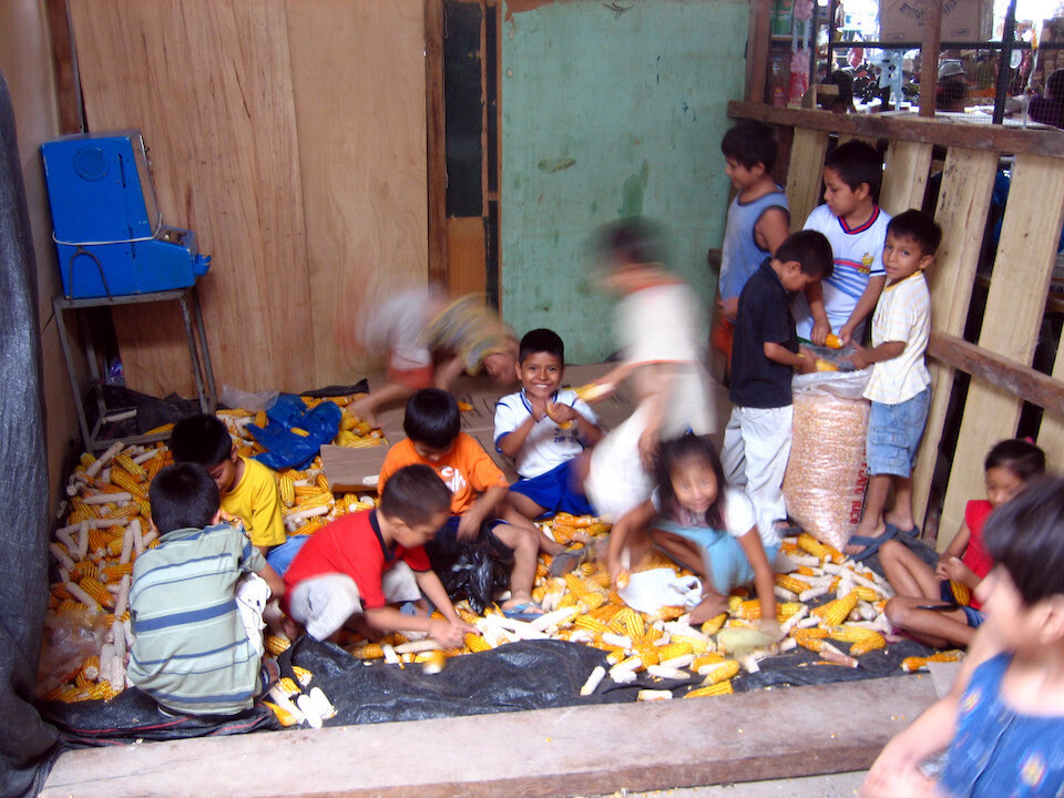
Taking a walk through the local market and seeing these kids jumping up and down on dried corn to break loose the kernels. Not really child labor when they're having so much fun.
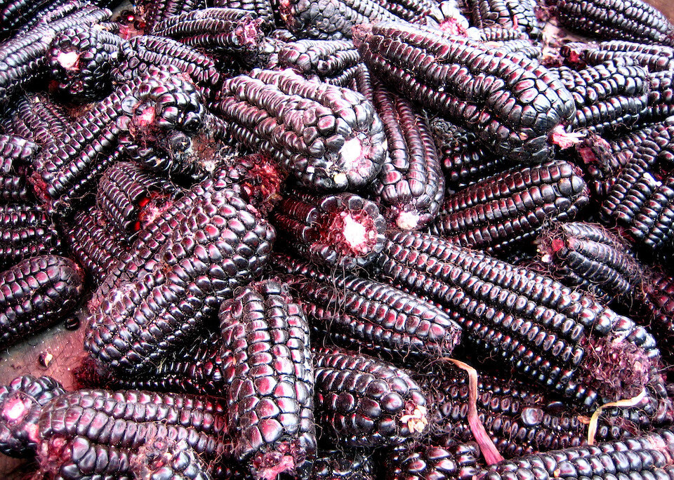
Black corn (more like deep purple) that's used to make the local beverage of choice, Chicha Morada, which tastes similar to iced tea and is served with most meals. The alcoholic version is called simply Chicha.
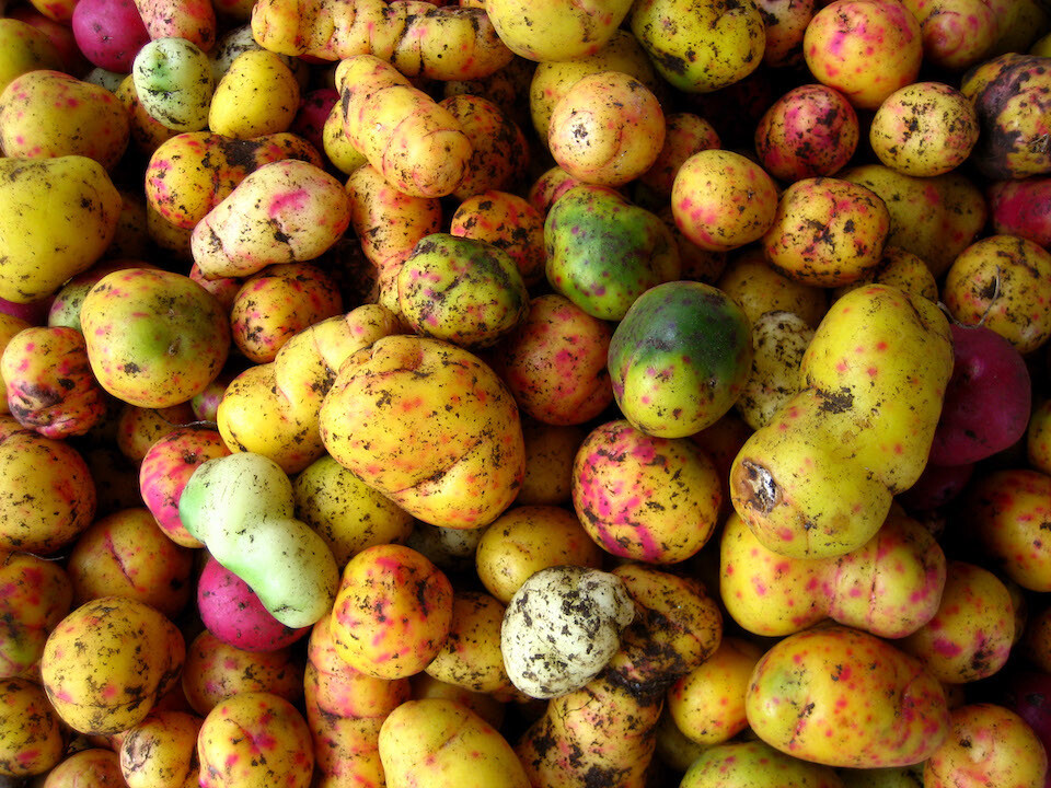
Colorful potatoes. I was told these were not potatoes exactly, but can't remember the name and looks similar.
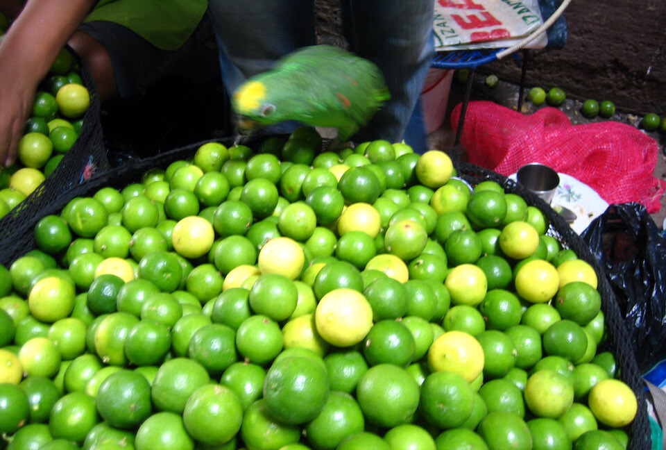
Well camouflaged parrot among green and yellow limes.
Dinner that night at Bagua Grande's fanciest restaurant of 'Pescado a la Chorrillana con arroz' (grilled fish with rice).
Heading out of Bagua Grande to the capital of the region, Chachapoyas.
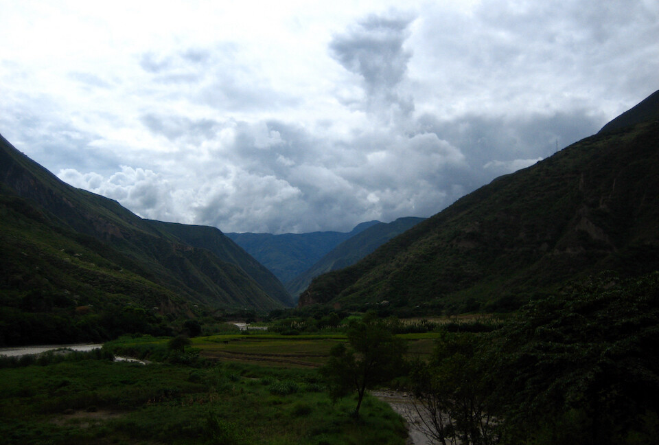
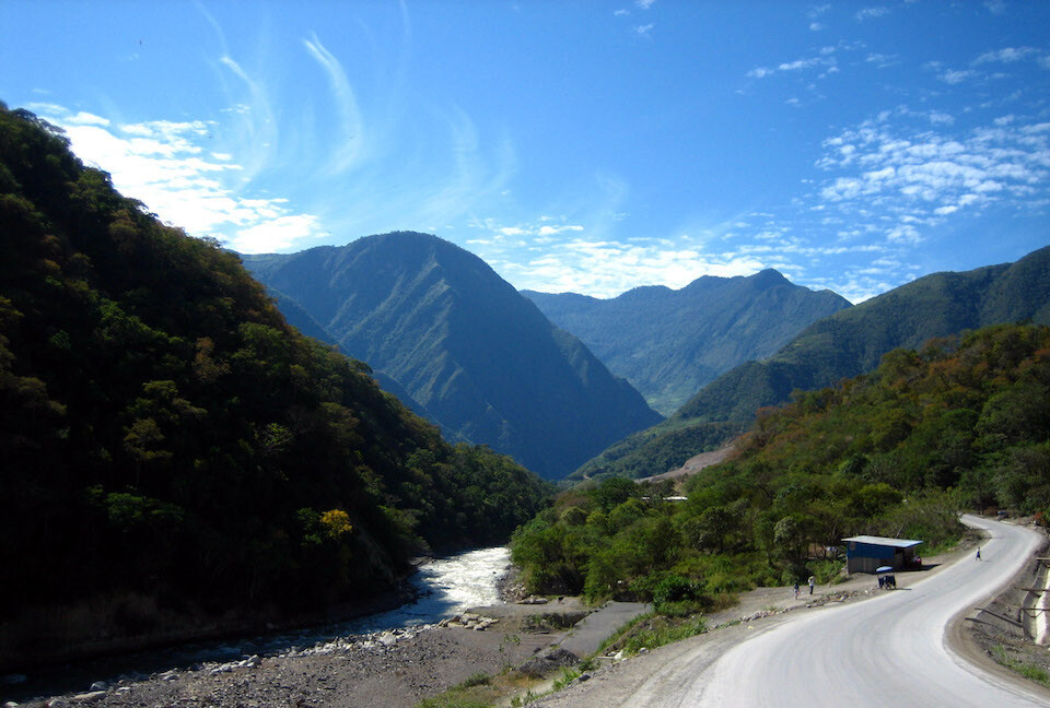
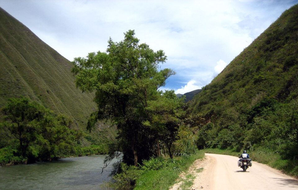
The ride was excellent, twisting through a narrow canyon with the sun shining strong.
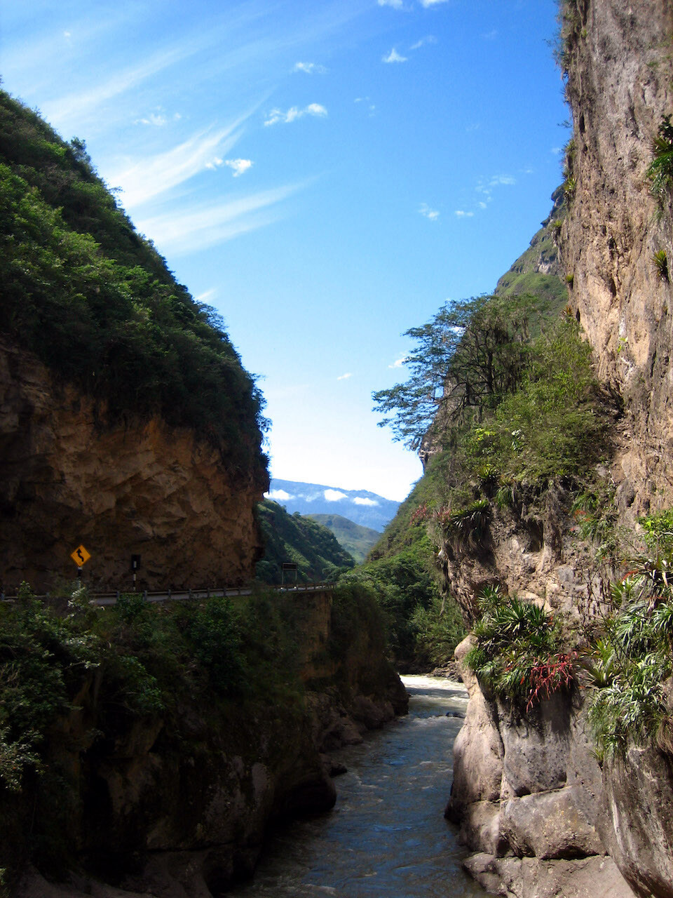
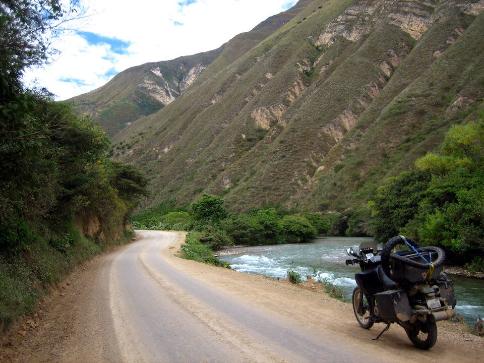
Following Rio Utcubamba.
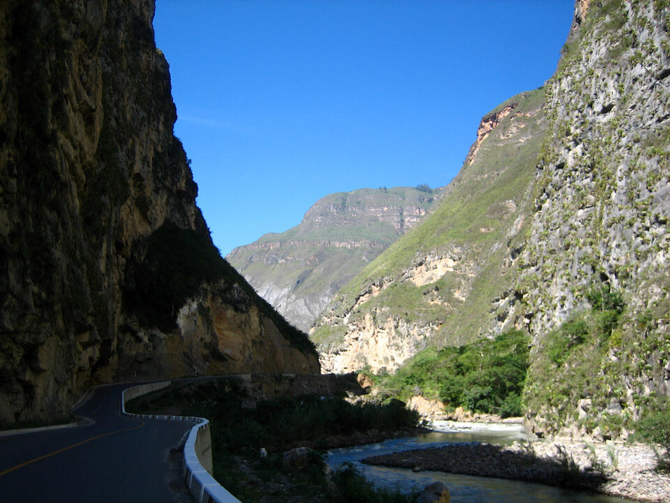
Well-maintained road heading to the turn off at Pedro Ruiz.
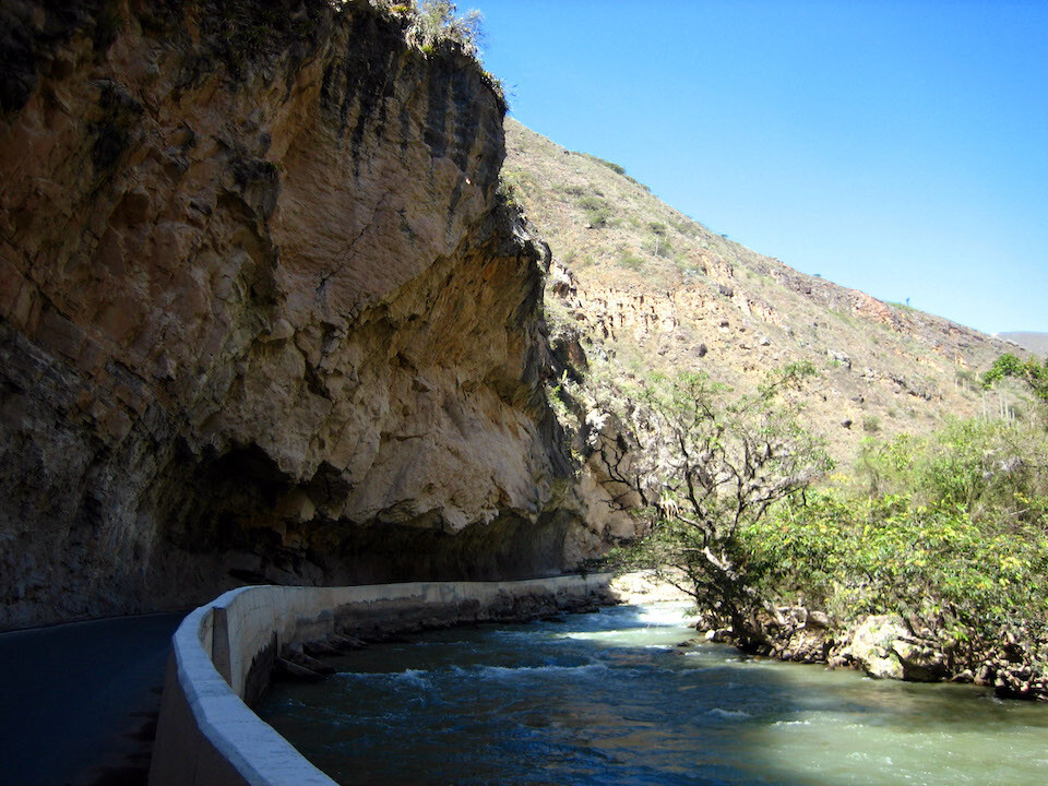
Full flowing river with the road cut into the cliff side.
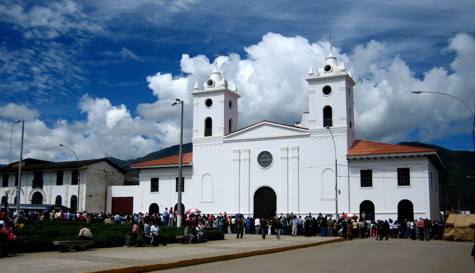
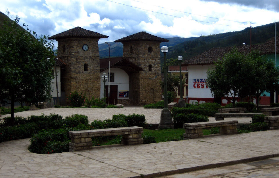
Taking a lunch break at Chachapoyas, a small colonial city, which wasn't that attractive but is used as a hub for nearby attractions.
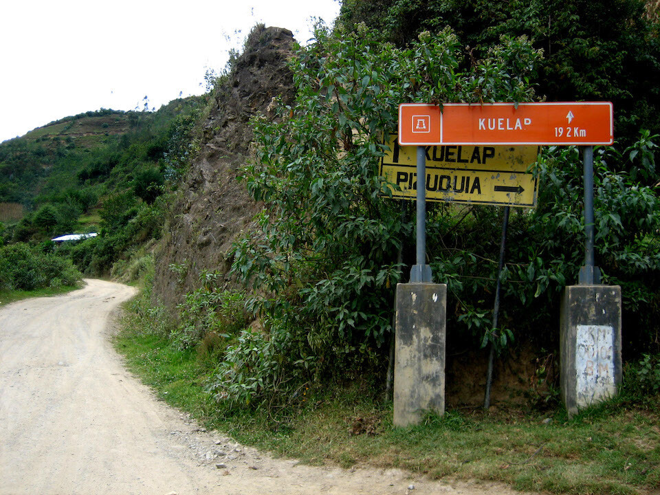
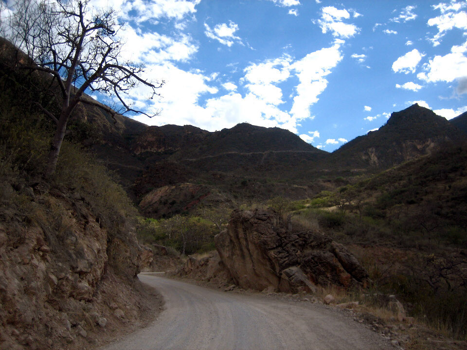
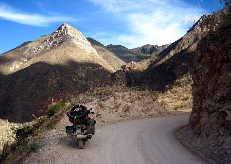
On the dirt road to Cajamarca, about 330 kms (205 mi) away.
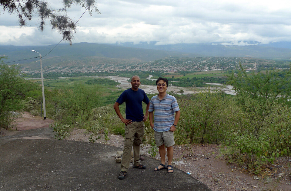
I ran into Holger and Anja again. They spent two nights in Chachapoyas and since we were all headed to the ruins at Kuelap, we rode together.
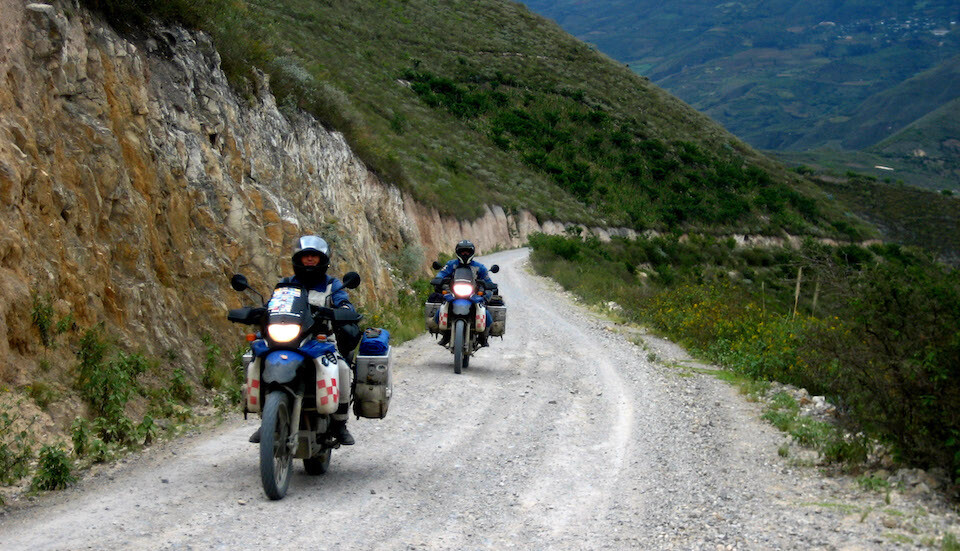
Riding up to Kuelap from the main road, about 40 kms (25 mi) up the mountain.
A beautiful two-hour ride. We kept leap-frogging each other as we took breaks at different times.
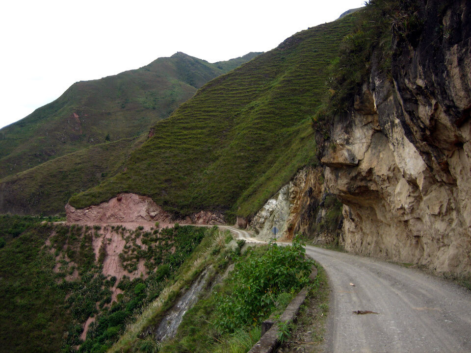
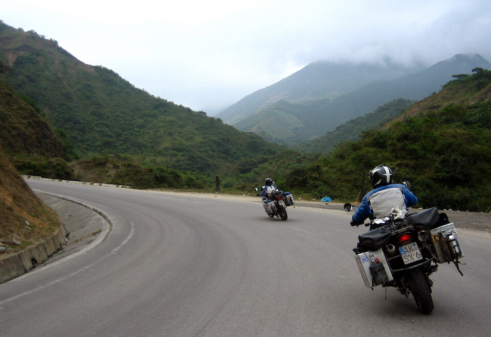
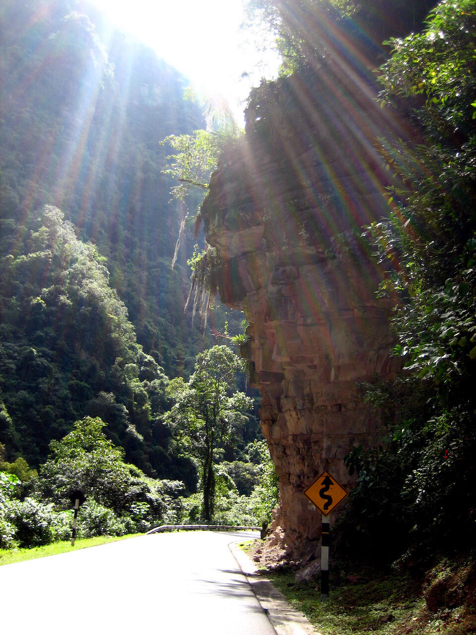
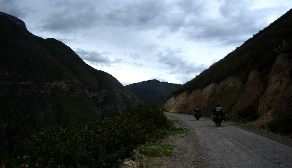
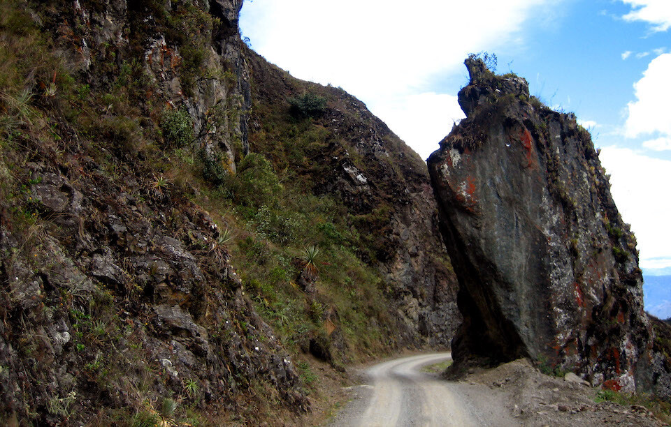
Being introduced to cliff-hugging roads with no guard rails.
Which was enjoyable besides the fear of reckless on-coming traffic around blind corners.
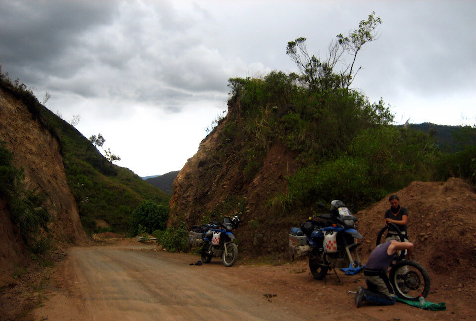
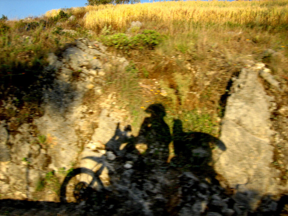
Anja got a flat in her front tire coming around this hair-pin turn. I helped out with my air compressor. They had a hand pump and Holger said he was going to buy an air compressor in Lima after seeing how easy it was with mine.
Halfway to Kuelap.
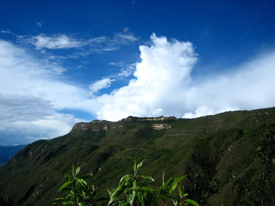
First glimpse of the fortified ruins of Kuelap, perched on the edge of a ridge at 3,000 m (9,840 ft).
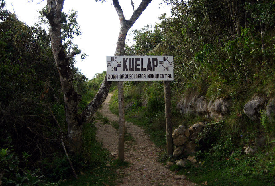
The road ends at the park entrance and then it's a twenty minute hike up to the ruins.
The fortress of Kuelap, a citadel built by the cloud-forest dwelling civilization of Chachapoyas around 1000 AD, before the Incas.
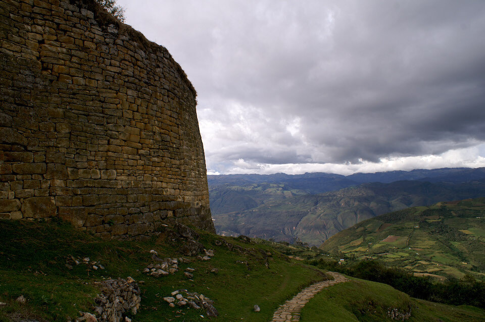
The stone work is very impressive and it's nicknamed the Machu Picchu of Northern Peru.
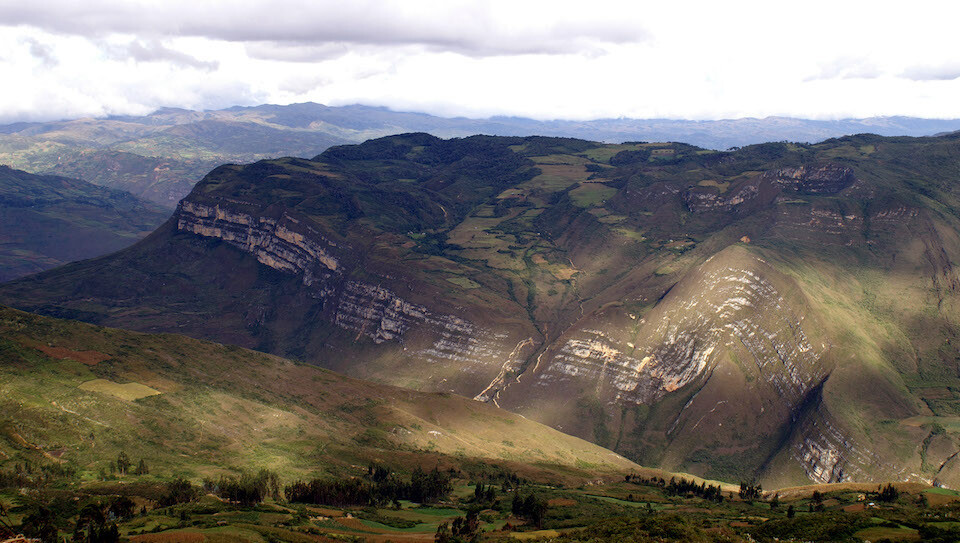
Besides getting a glimpse into our human past, what I found even more interesting was this view from Kuelap with a glimpse into our geologic past. The lines in the rock tell the story of what happened to the land here. The lines were laid down flat at the bottom of the ocean, millions of years ago and through the process of plate tectonics, the Andes have risen. For there to be such a sharp kink in the sedimentary layers, imagine the forces at work and the strength of the surrounding rocks. Always impressed by the power under our feet.
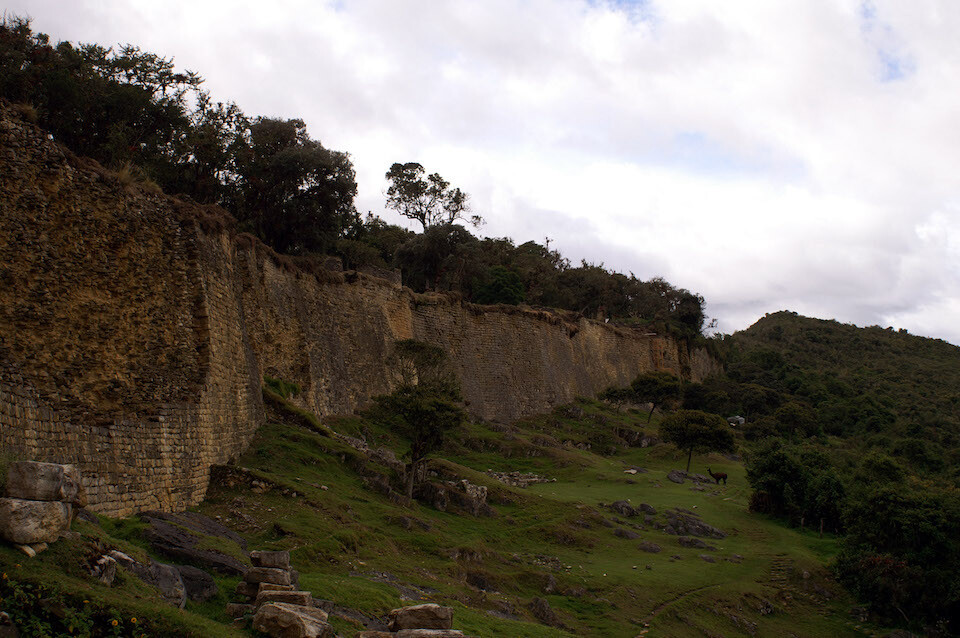
Back to some human past and the respect that must be paid to our cousins for undertaking such a formidable construction project with very limited tools ten centuries ago. The thick wall runs around the whole fort. Note the llama under the tree.
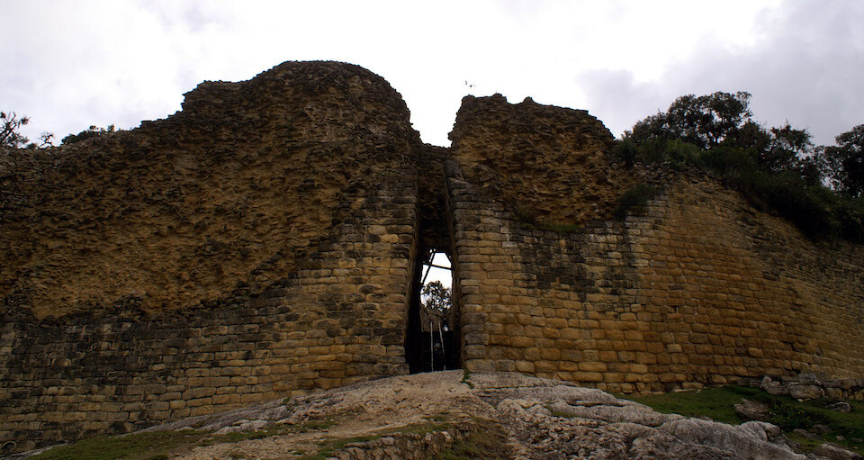
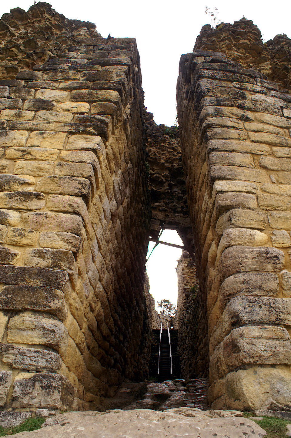
The entrance to Kuelap. This little slit is the only entrance to the fortified compound, a good security measure.
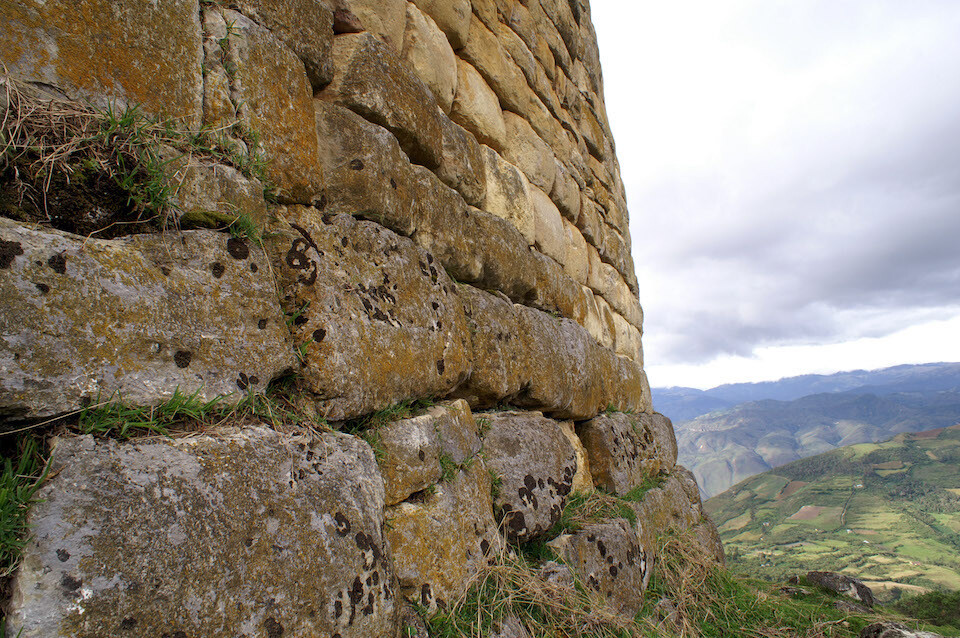
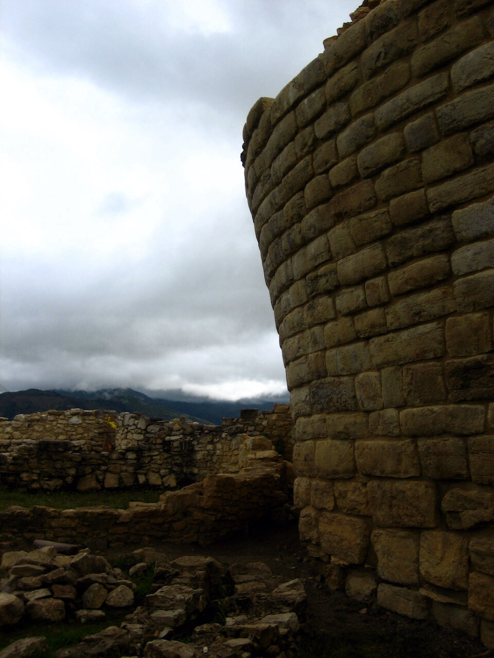
The walls lean in towards the top and amazing that they haven't fallen down yet in this seismically active region.
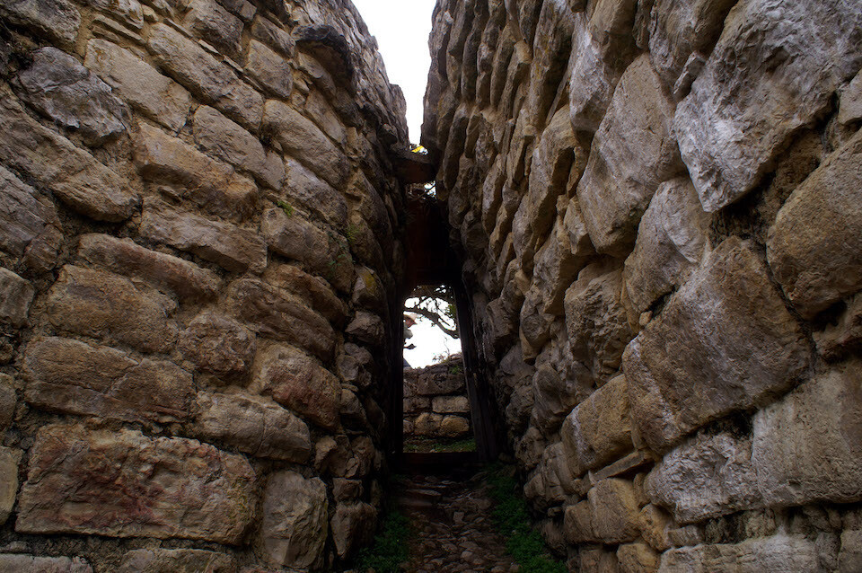
The entrance path squeezing down to this little doorway, the actual entrance into the compound. This is all very good for preventing invading armies but what about if everyone had to leave in a hurry?
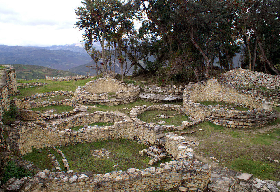
The remains of the base of the buildings inside the compound.
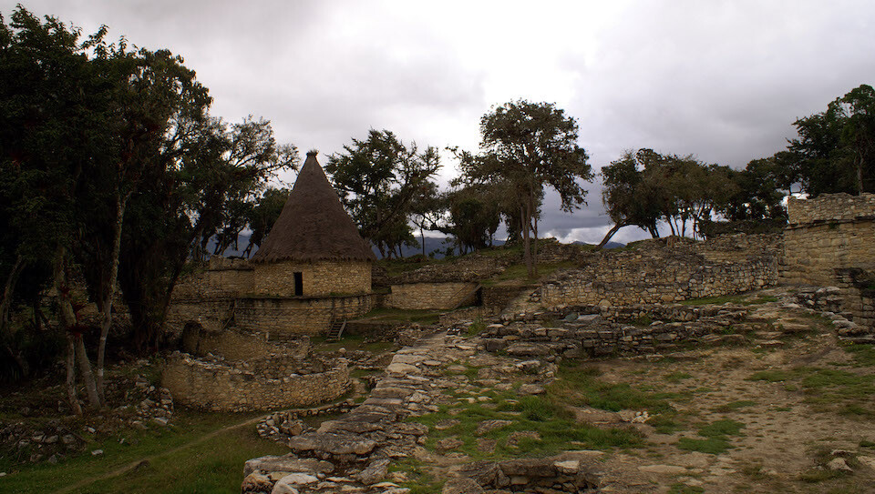
A recent reconstruction. There's on-going archeological research to understand who exactly built this structure and what its purpose was.
A funerary tower with the trademark design of the walls leaning away from the base.
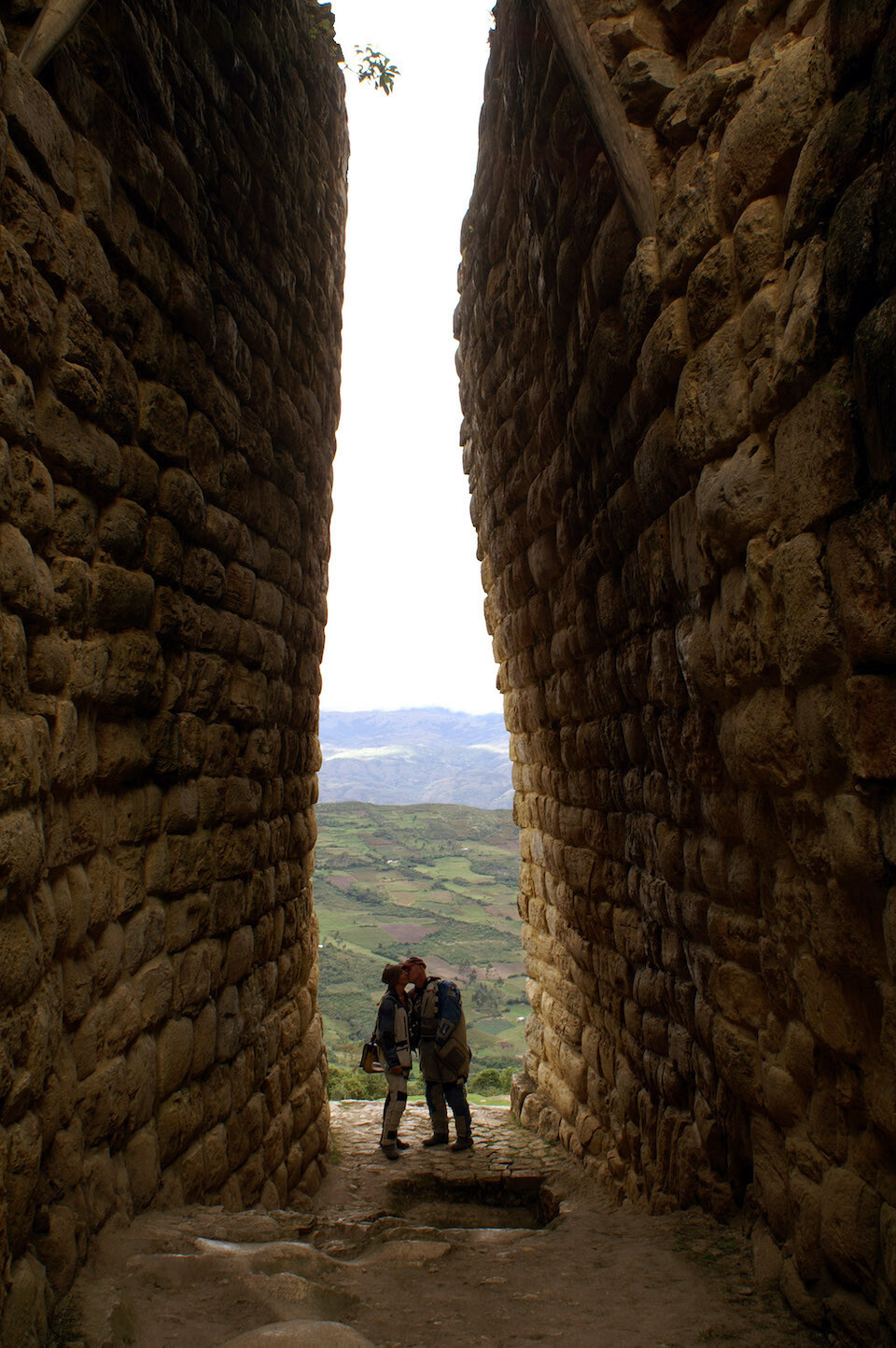
Aww, the happy couple framed at the entrance of Kuelap.
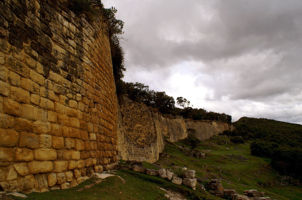
Another look at the impressive walls of Kuelap.
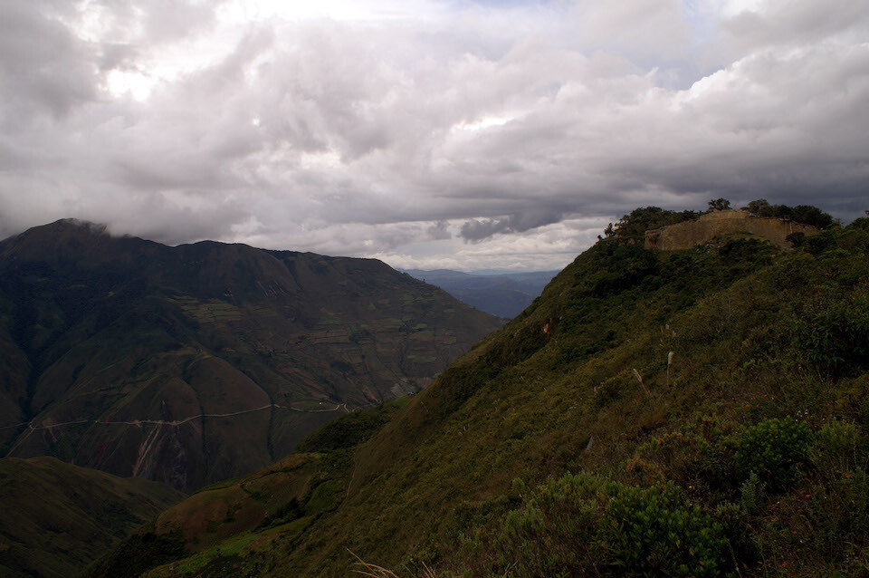
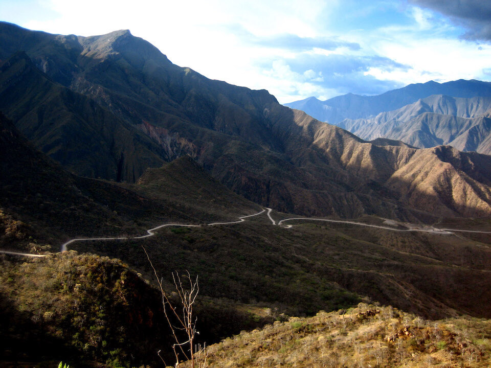
The fort of Kuelap perched on the edge of a ridge with a view of the access road snaking across the opposite mountain. Being a remote and difficult destination to get to, the nice thing is, there's very few to no tourists around. It was a very peaceful and calming site.
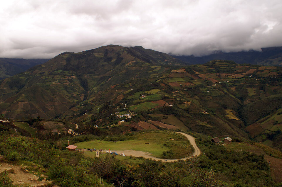
Walking back to the park entrance and the open space of the parking lot where we camped for the night.
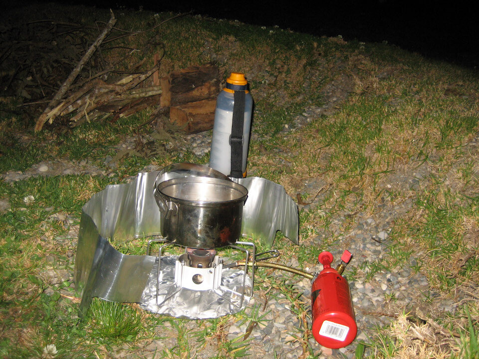
Using my MSR Dragonfly stove for the first time on this trip.
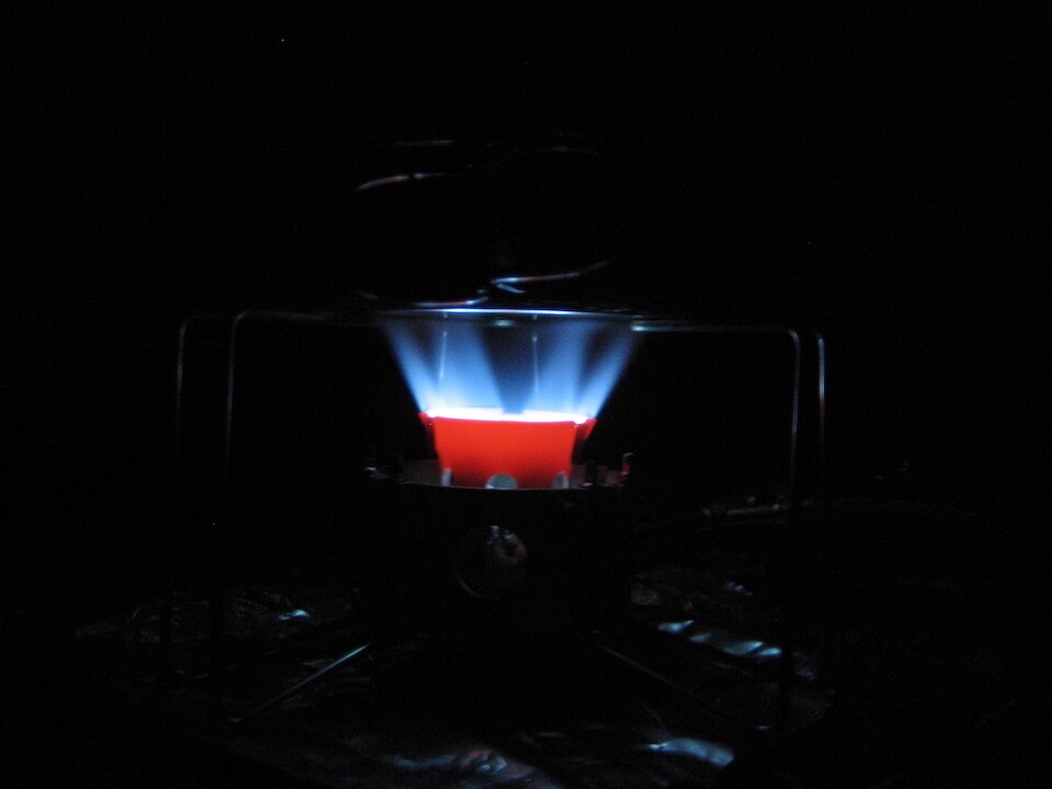
It's powered by pressurized petrol (no need to source another fuel) and has the ability to control the strength of the flame, useful for some real cooking.
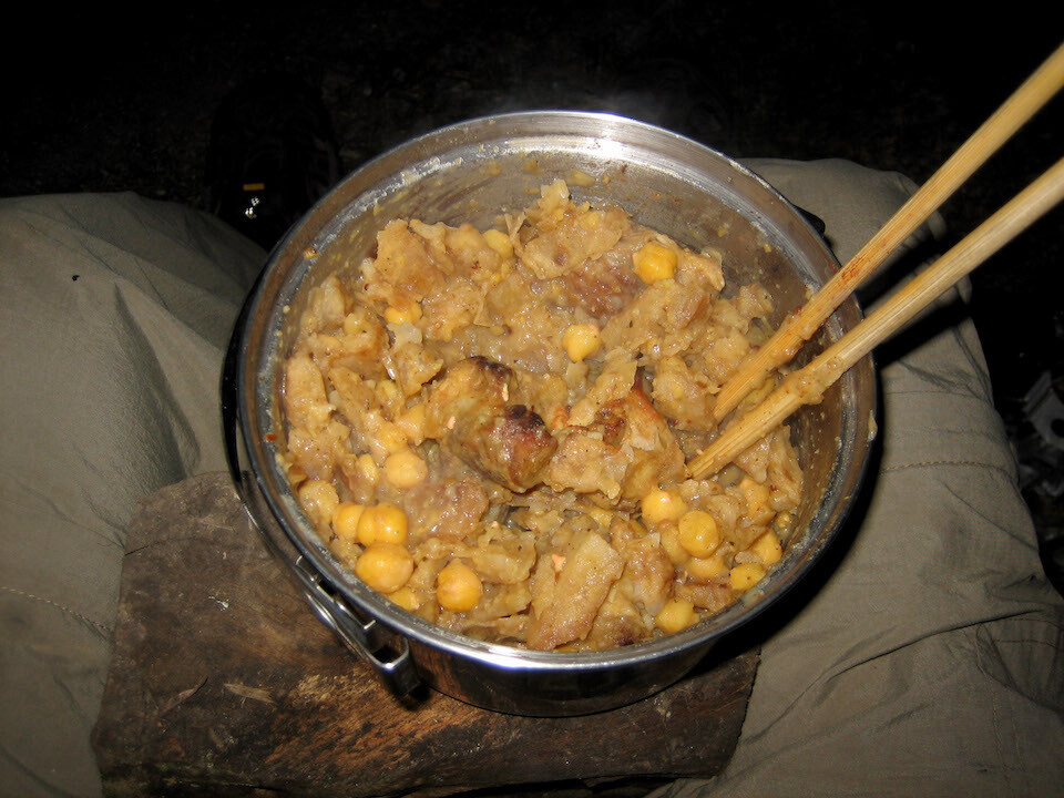
I mixed a can of garbanzo (chick peas, channa) with some left over lunch of meat and potatoes. A dash of some spicy curry-leaf powder (homemade by my mom) and voila, tasty meal.
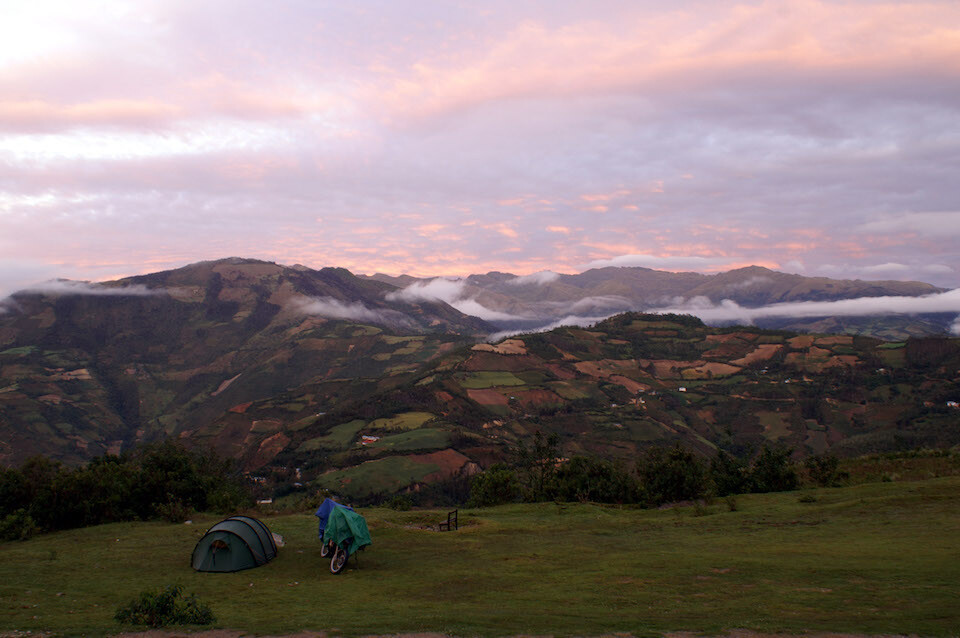
Beautiful sunrise. I got up early since I wanted to keep going, but Holger and Anja wanted to go back and explore the ruins some more.
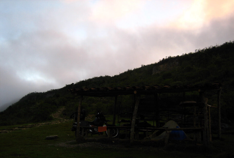
I camped under this shed. I wore all my layers for the cold night and slept well.
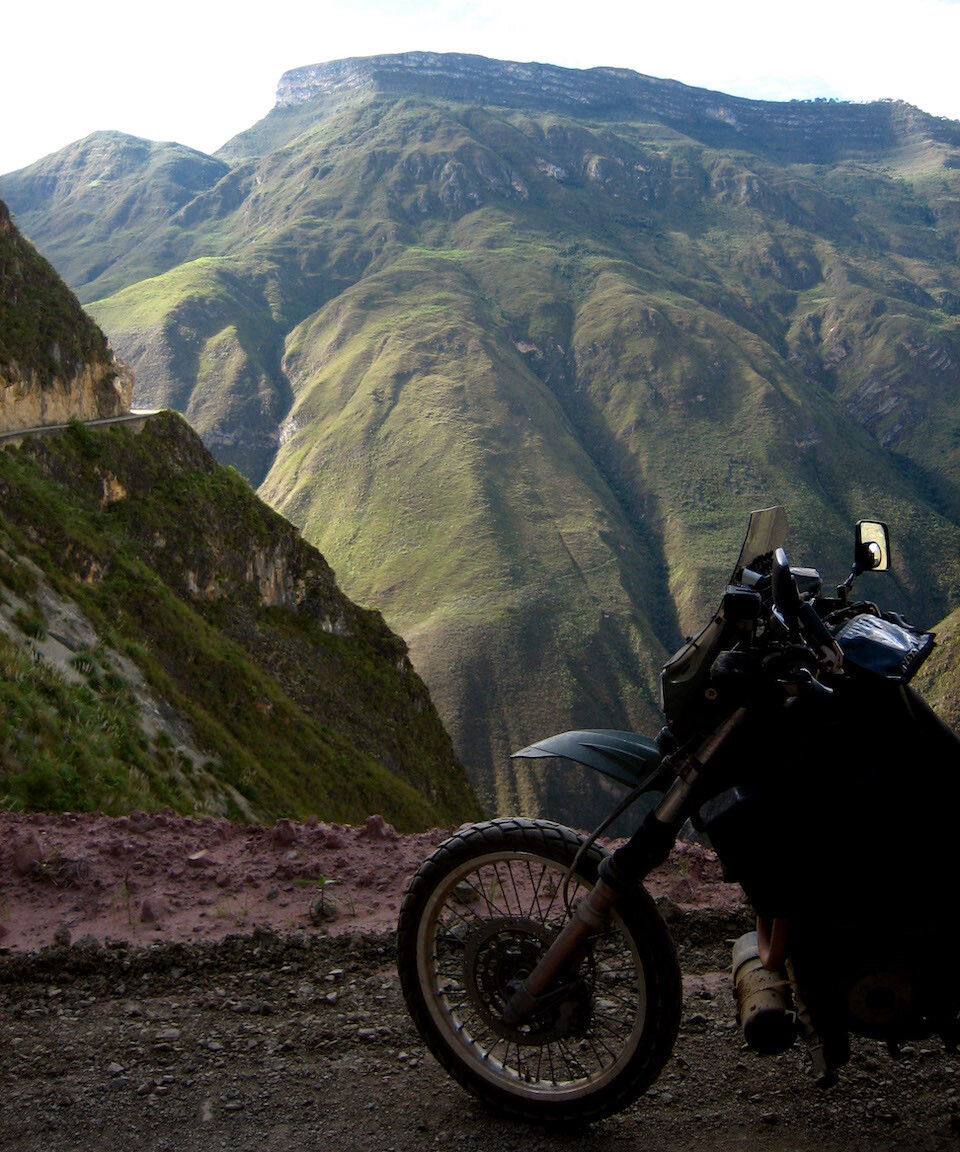
On the road back down to the river.
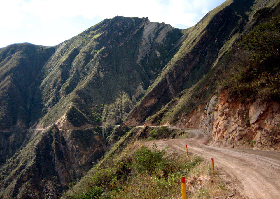
I was aware of not getting too close to the edge. From Kuelap, the road drops 1,200 m (4,000 ft).
Passing by some farms.
Back on the main dirt route heading to Cajamarca.
Passing through the sleepy town of Leymebamba, the last bit of civilization for the next 150 kms (94 mi).
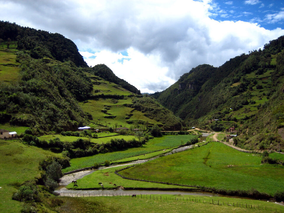
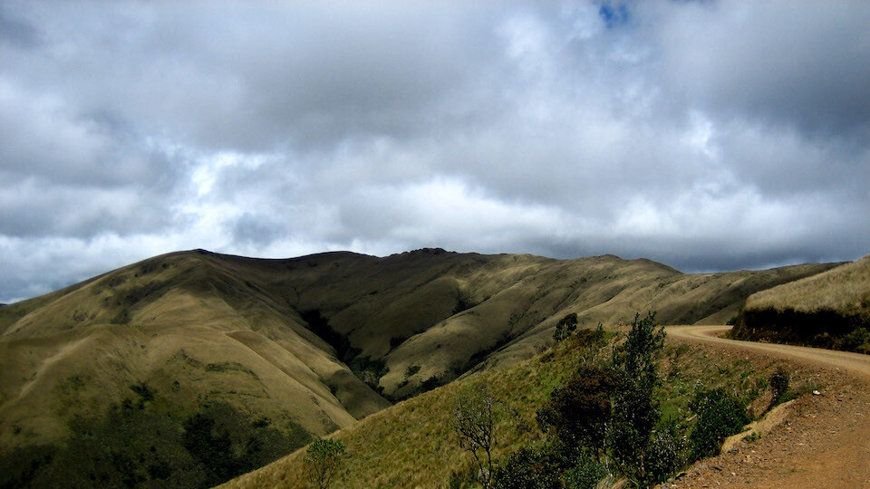
Riding past beautifully lush valleys.
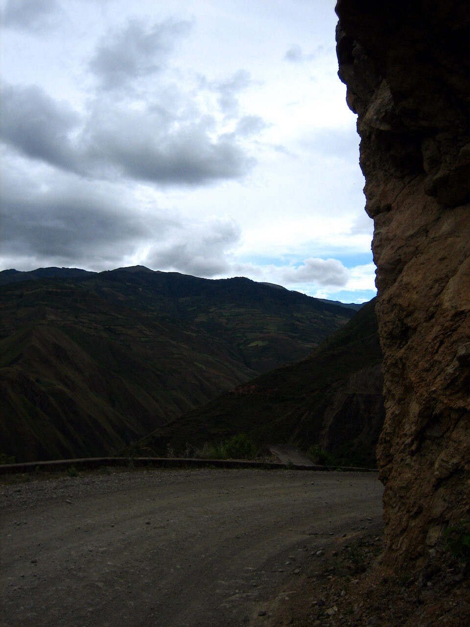
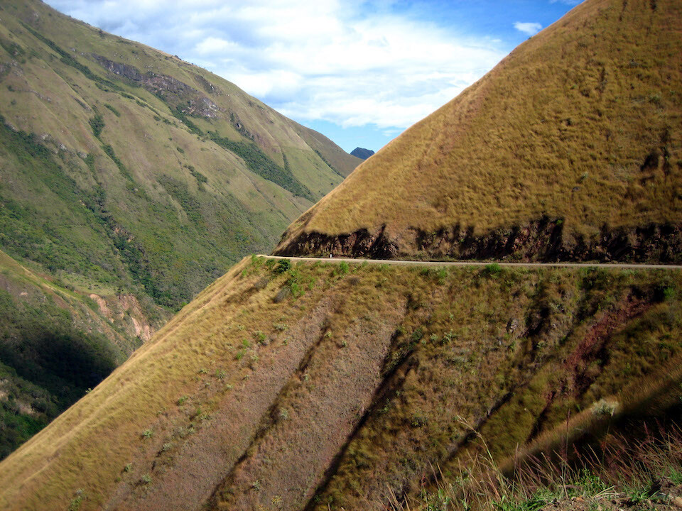
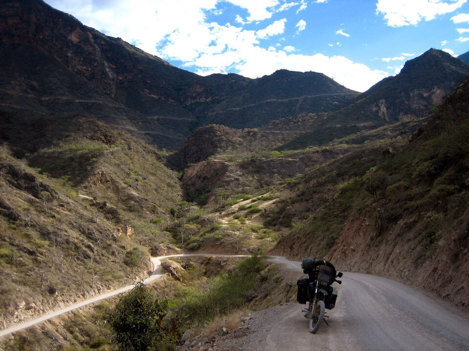
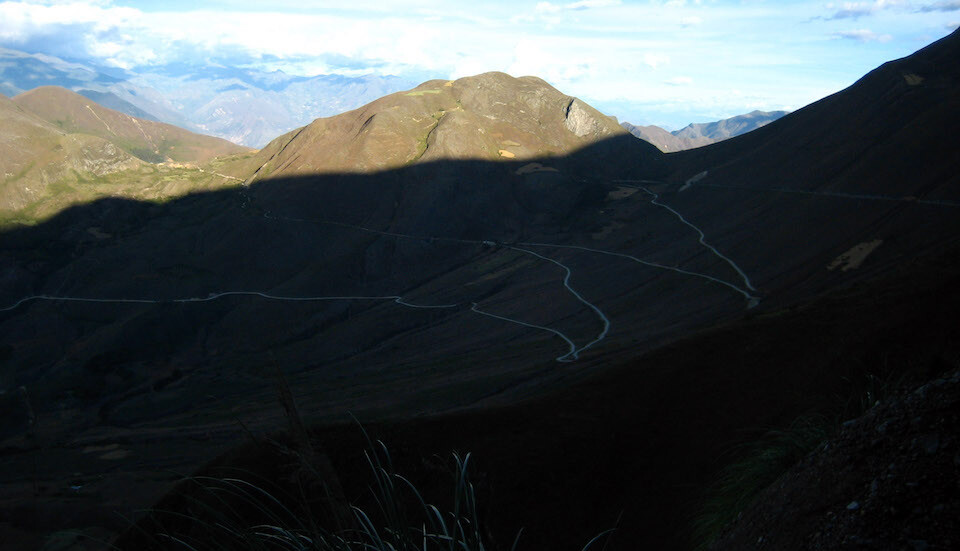
The remote road climbed high into the Andes.
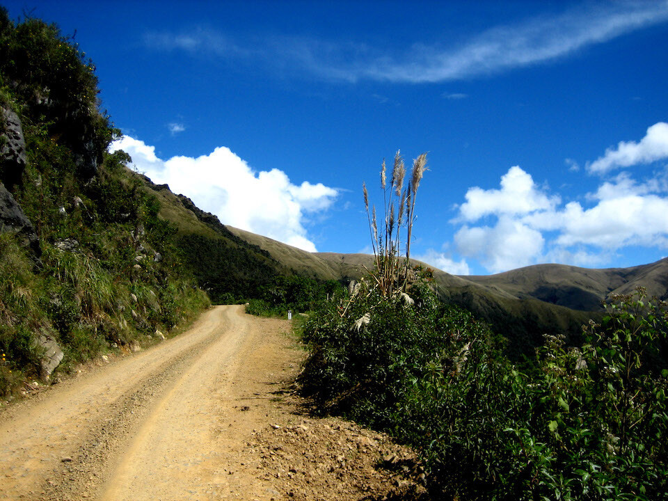
It was generally a well-maintained hard-packed, gravel, dirt road.
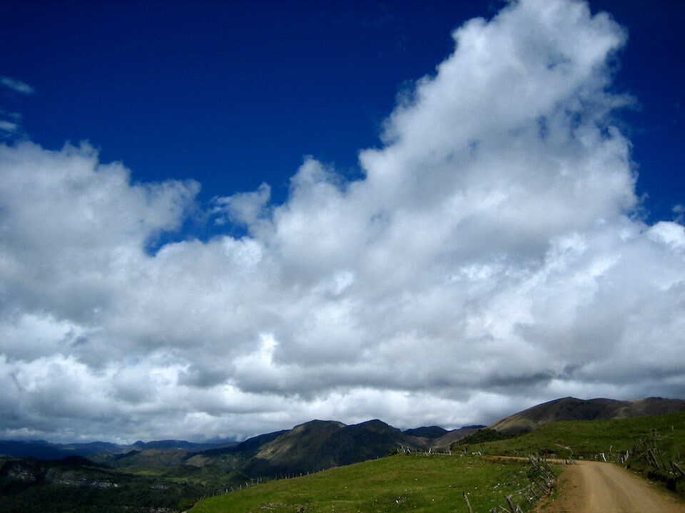
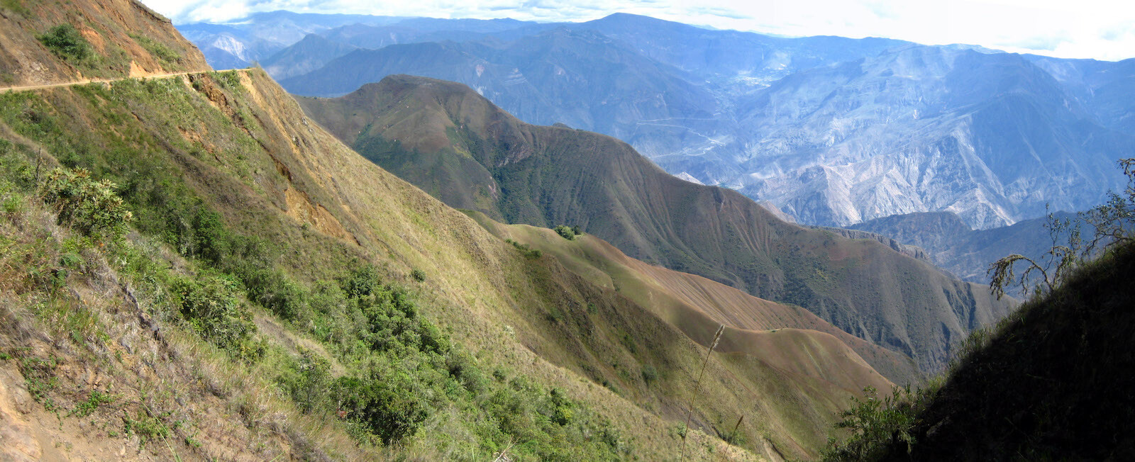
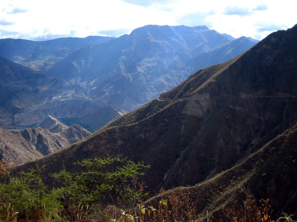
The road peaked at 3,600 m (11,800 ft) and the weather was iffy at top with fast moving rain clouds.
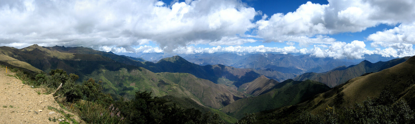
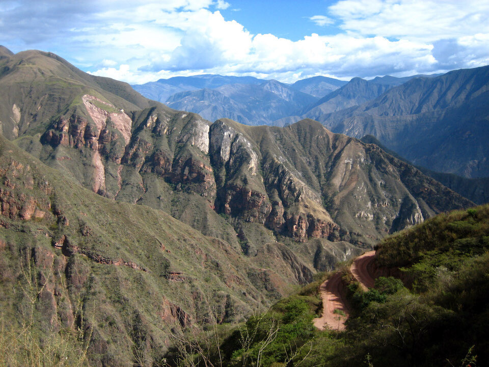
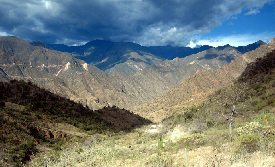
But I had to stop for this stunning panorama of the bare Andes.
Click here to see the high resolution version.
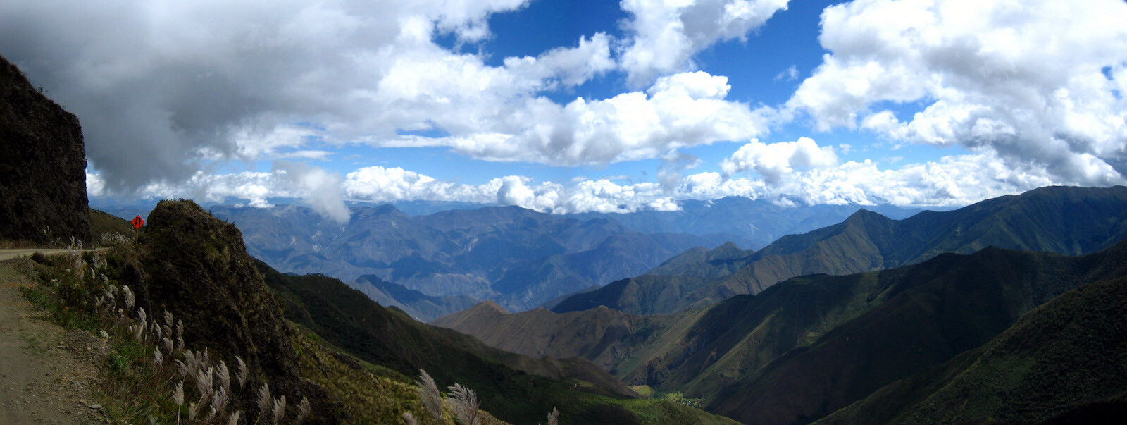
Another panorama with the road on the left and expansive valleys straight ahead.
Click here to see the high resolution version.
sanDRina enjoying the ride and the views.
The route slicing through some rock.
A look back at where I came from and a look forward at where I'm going.
A beautiful ride with great views all around.
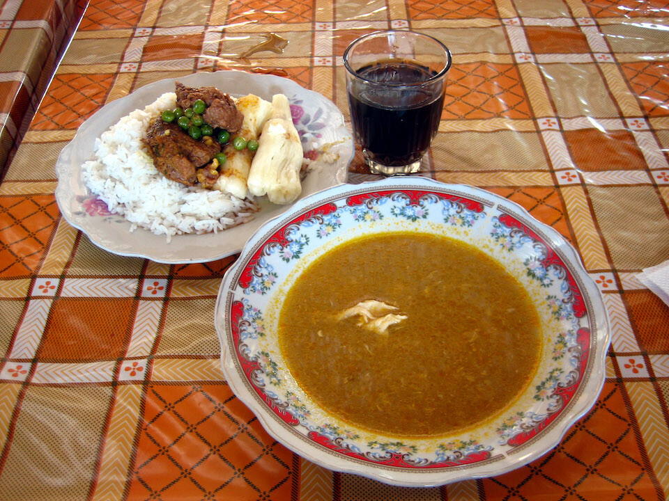
Having a hearty meal for S/.5. I ate the soup and the yuca and saved the rest (don't want to get the sleepies after a full meal).
The cut of man into the hardened rock to allow cultures to spread.
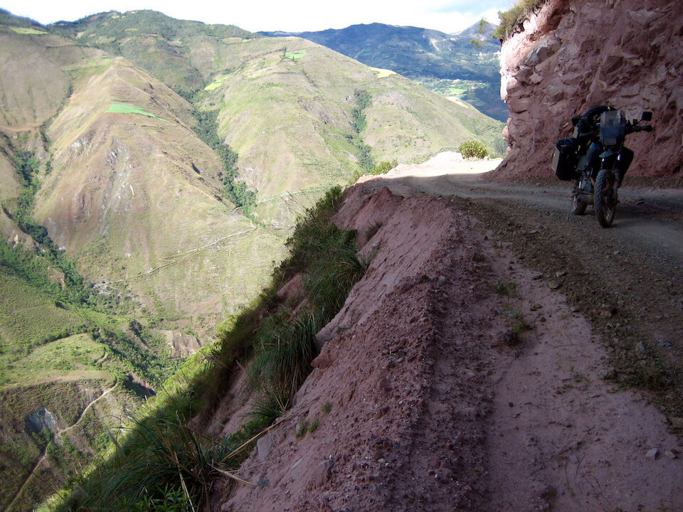
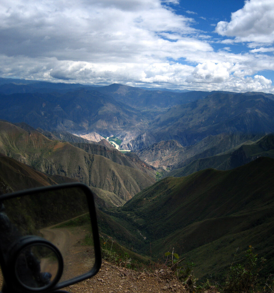
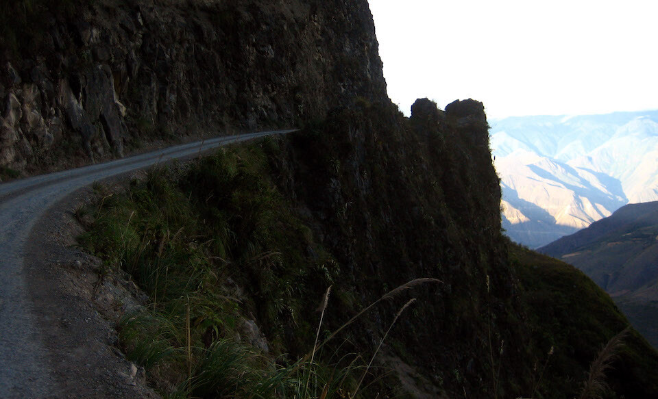
The road dropping down with beautiful erosional views.
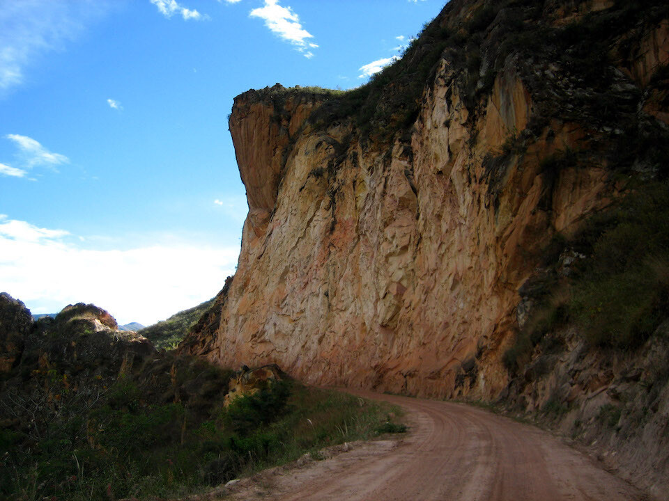
Steep cliffs. This is where you want to pay attention to the 'watch for falling rocks' sign, if there was one, that is.
The enjoyable route following the contours of the geology.
The route dipping down quickly to the low point of Balsas before climbing back up the other side (off in the distance).
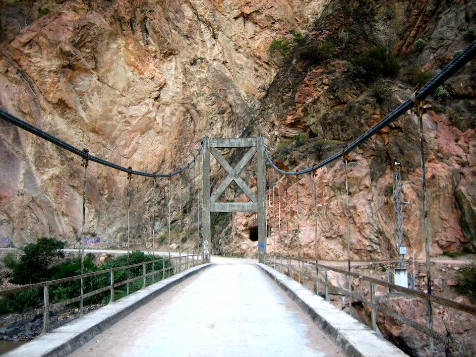
The bridge across Rio Maranon at Balsas, at an elevation of 860 m (2,820 ft).
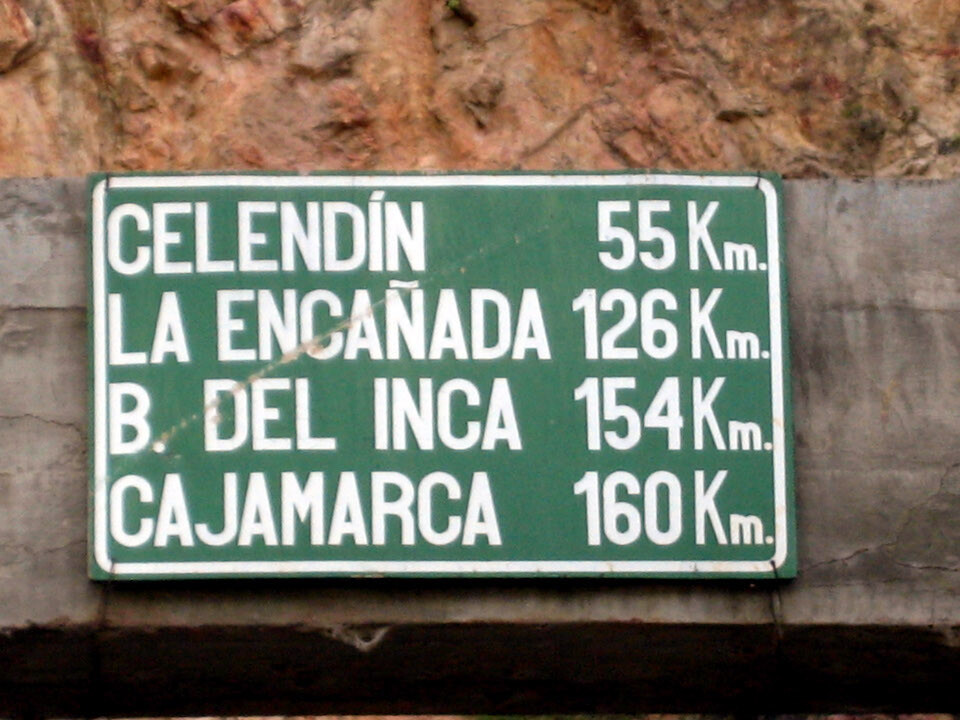
A distance board at Balsas. It would be another two hours to Celendin.
Climbing up the other side with a look back at the route dropping down to Balsas. The dark clouds at the peak were just gathering when I went through there and it was spreading.
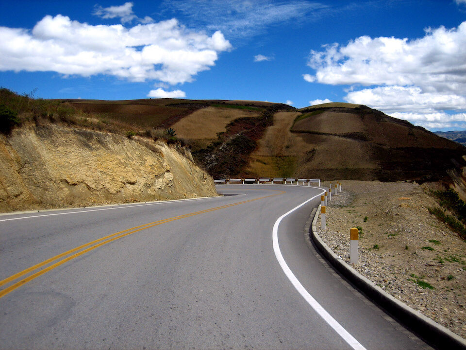
The route was drier on this final summit to Celendin.
Climbing up in the late afternoon.
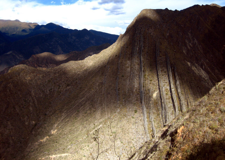
More awesome geology on display. I can't help but be stunned knowing the fact that these lines were once flat and some force has pushed them up right, that too without deforming them. Who needs television when nature provides so much drama that makes the mind ponder.
I was thinking about camping again but wanted to find a spot away from the road for security and this cliff-hugging track didn't provide any opportunity for such a site. I decided to push for Celendin.
The road snaking up.
This climb was more gradual with the route snaking all over the gentle mountain slope, gaining elevation slowly but surely.
Near the summit it got back to road-sliced-into-sheer-cliffs. And yes, I'm taking pictures with my left hand while riding. Don't tell my mom.
Peaking at 3,100 m (10,200 ft) and enjoying the setting sun as I dropped down into the valley to Celendin.
Well, hello Mr. Shadow. Today, from Kuelap to Celendin, together with climbing and dropping, in 230 kms (143 mi), I covered a total of 8,280 m (27,300 ft) in elevation changes! I knew the Andes would be fun. Good girl, sanDRina.
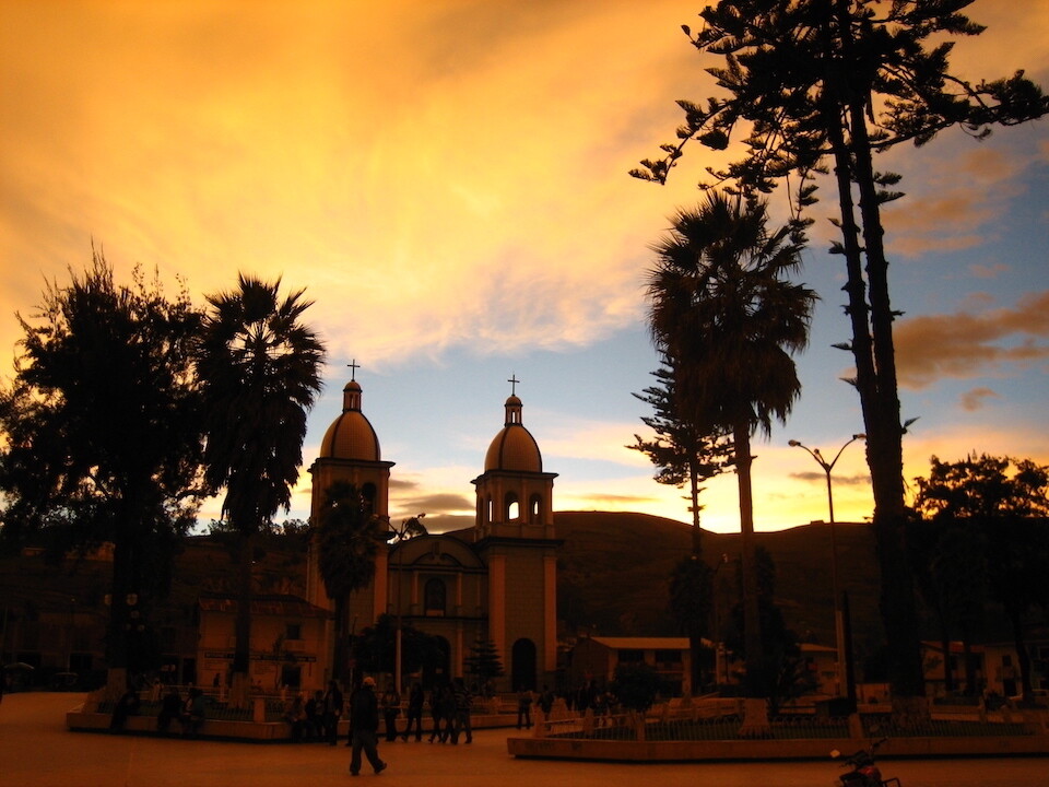
Stunning sunset lighting in the main plaza of Celendin, a colonial outpost. I found a room with parking for the bike and hot water for S/.15 (~USD 5).
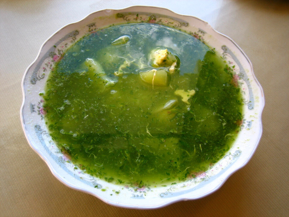
Breakfast of Caldo Verde (green soup), a thin soup with potatoes and egg and a herb similar to mint giving the main taste and color. Quite filling for S/.1.50.
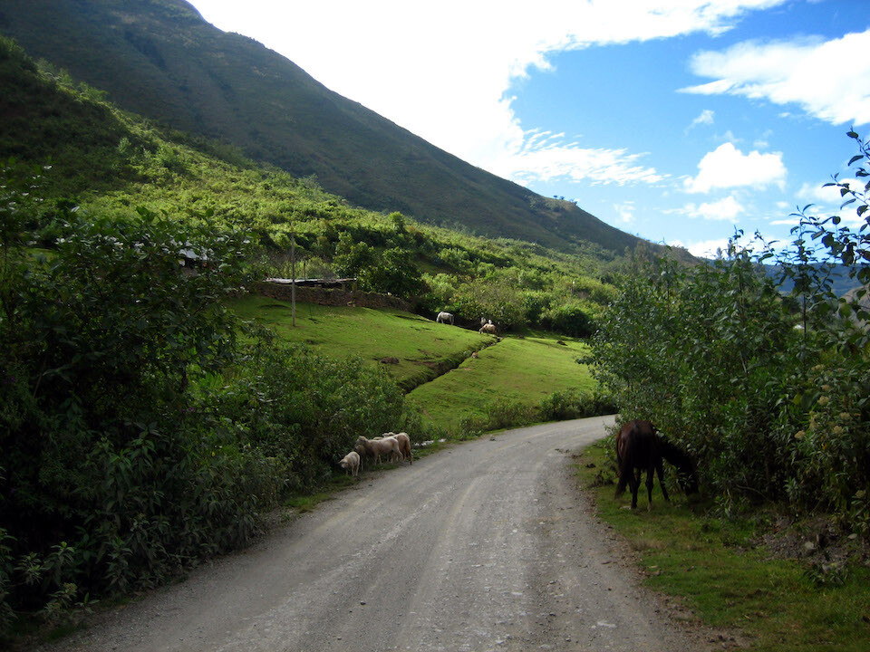
The route continuing out of Celendin towards Cajamarca.
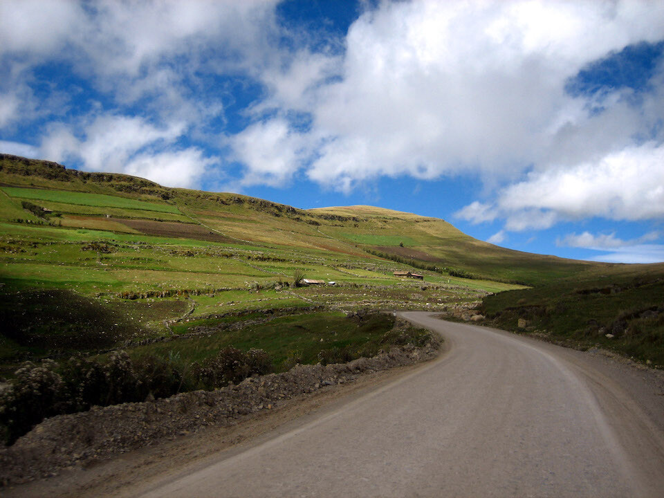
The scenery wasn't as dramatic as yesterday, but pleasing, nonetheless.
The pavement started about 70 kms (43 mi) from Celendin, down to Cajamarca.
Next: Peru, Part 2: Canon del Pato and Huascaran
Previous: Ecuador, Part 3: Cuenca