
Patagonia, Part 5: Perito Moreno Glacier and Torres del Paine
— Argentina, Chile, Patagonia, Ruta 40 — 16 min read
January 22 - 28, 2011
After being on the road in the solitude of the vast, sparsely populated expanse of Patagonia in the past few weeks, I was now to enter the prime tourist circuit of Southern Patagonia. Besides the crowds, it's the increase in prices that puts me off from developed tourist sites. However, if the attraction is large enough, I'll put up with anything and these sites are not to be missed.
I spent a few days in the town of El Calafate before getting up close to the Perito Moreno Glacier and then crossed back into Chile to pay a visit to the Torres del Paine National Park.
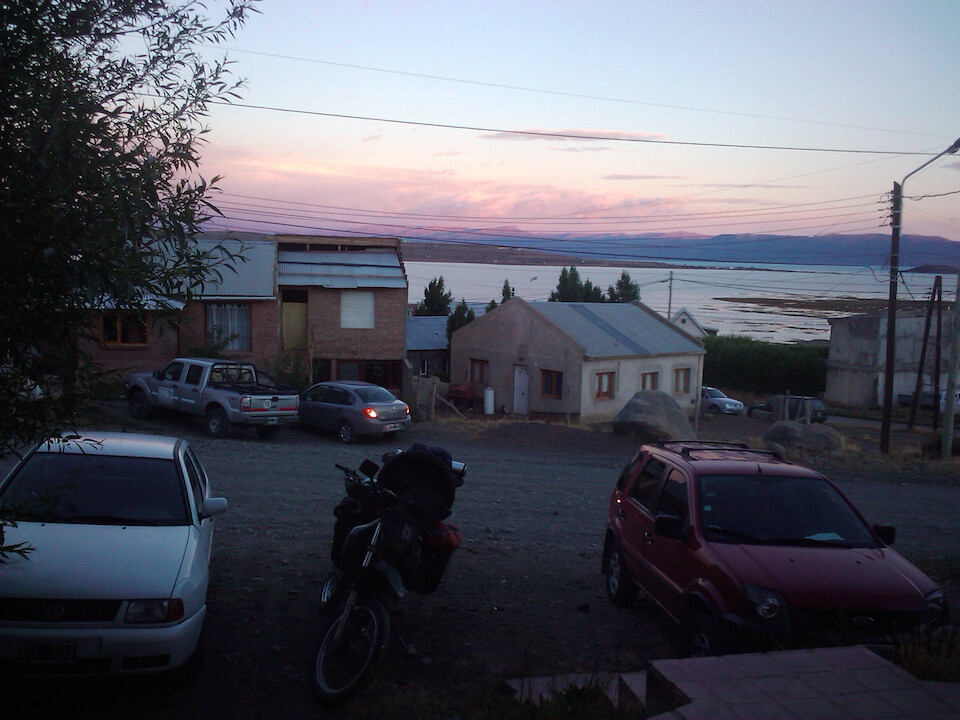
I stayed with Matias in El Calafate thru CouchSurfing and took a day off to just rest my bones and enjoy some hot showers, since it had been about five days since the last one. I also got a chance to wash some clothes and my sleeping gear after the dusty camping experiences in the past few days. A nice sunset over Lago Argentino.
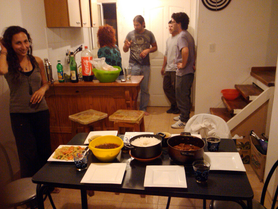
So, first order of business, I prepared my chicken curry. Almost everyone mentions it now on my CS profile and new hosts ask me to prepare it right away. I love it cause it's a great way to connect with people. That's Celine, a couchsurfer from France who was also staying with Matias and he invited a few of his friends over for dinner.

I think this one came out pretty good. I love all the boney parts and offal (internal organs) and this is the rib cage. It adds good flavour to the curry. Argentines are so European that they need to eat everything with some bread. I pointed out the obvious that there's carbohydrates already in the rice, but it's their habit of taste.
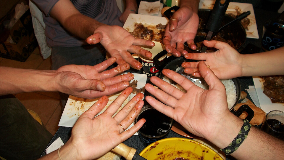
Dirty hands. I love to eat with my fingers and usually everyone gives it a try. I give a little demonstration about how you make a small ball of rice with some chicken, pick it up with your forefingers and then push it into your mouth with your thumb. I also point out that you must wash your hands right before eating and then it's hygienic. I don't need a metal tool to get between me and my food. Argentines have been taught from a young age, I guess after 5, that to be proper, they should not touch their food with their hands and I enjoyed seeing the smiles when the environment was right for them to break this taboo.
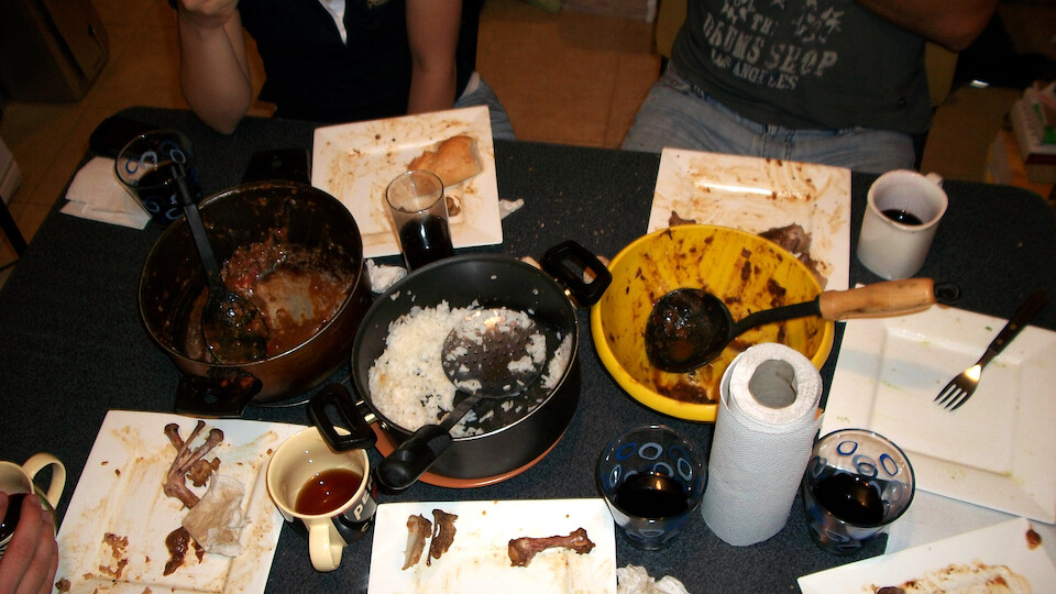
Ahh, a pleasing site for a cook: ravished pots of food and cleanly finished plates.
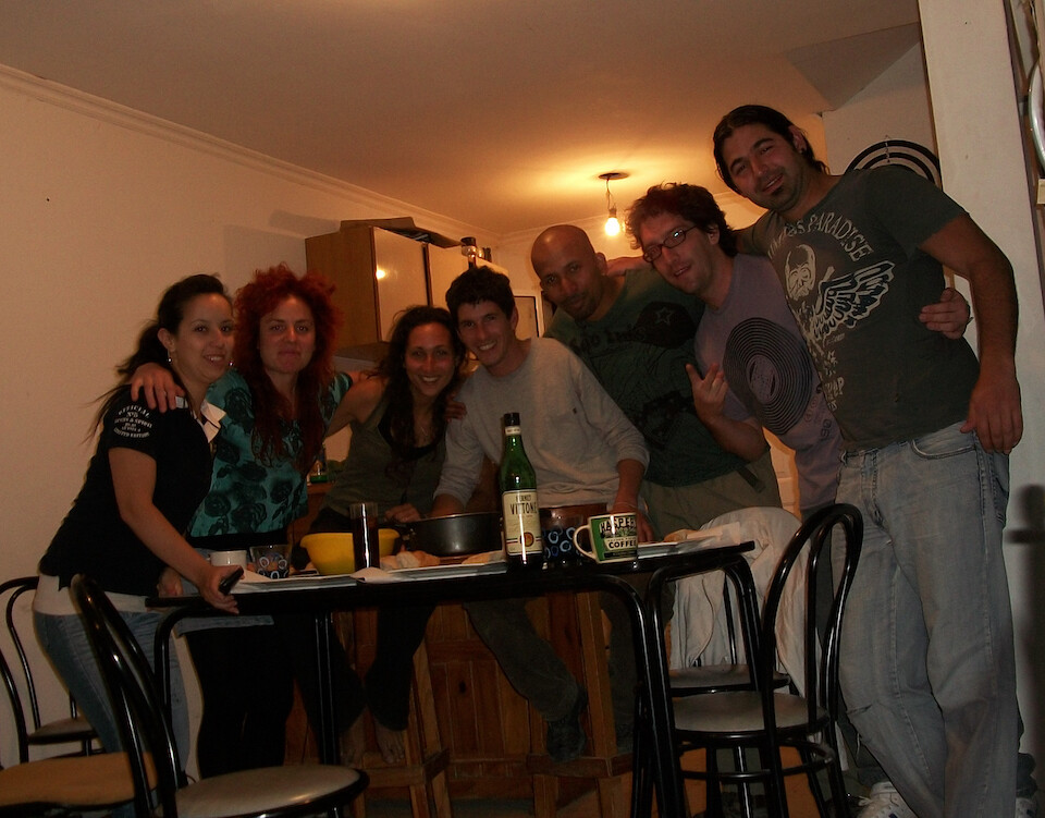
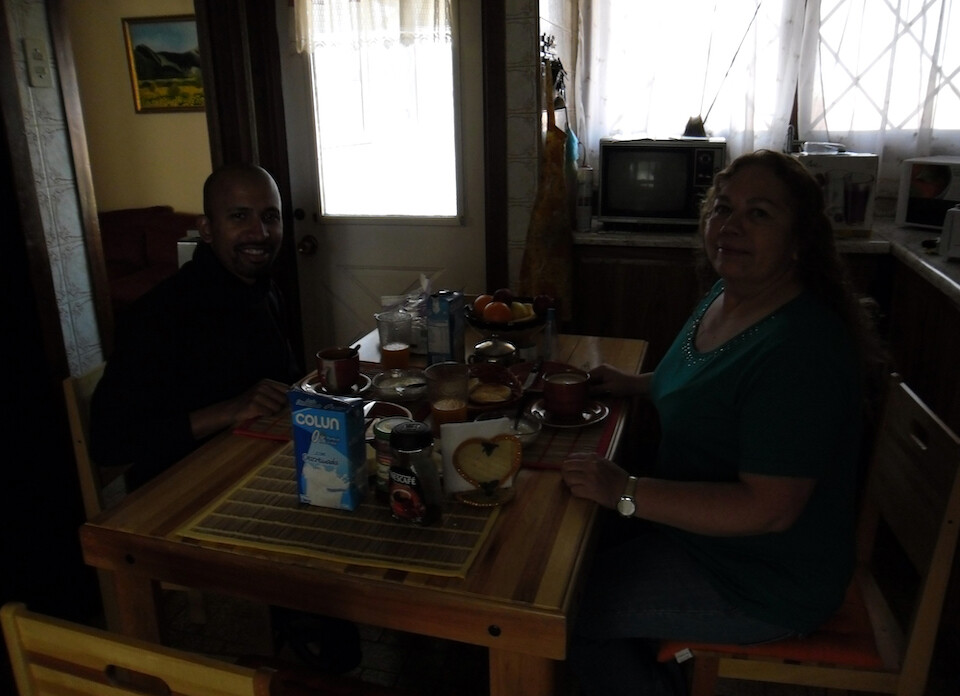
Enjoying a nice dinner with CouchSurfers and local residents of El Calafate.
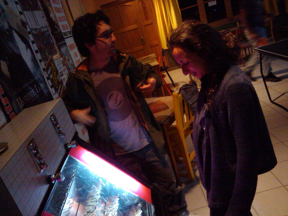
We went out on town that night and Celine here was captivated by this money-sucking machine at a bar. It's the kind where if you drop a coin at just the right moment, it'll push other previously dropped coins into the jackpot. It's designed so well to keep enticing you to part with your money.
Having a few drinks at the only club in town. El Calafate is a big draw due to the glacier and tourists fly directly in, giving it very much a destination resort feel where everything is built in mind with pleasing the tourists.

Being treated to a Super Pancho (mega hot dog) at 5 am.
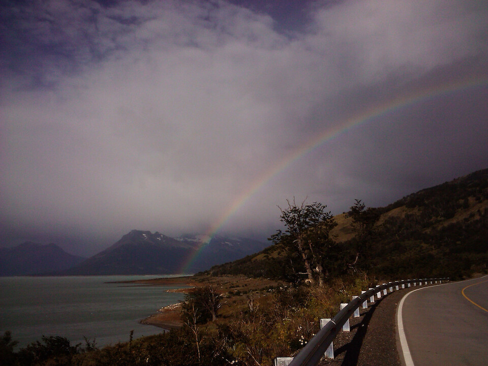
After a short nap, it was time to see what this glacier was about. A nice rainbow welcoming me to the Parque Nacional Los Glaciares, about 73 kms (45 mi) west of El Calafate. This time, I had to pay to enter the park, which was 100 Argentine Pesos (USD 25). If you enter before 7 am, there's no fee.
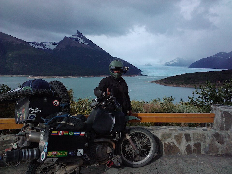
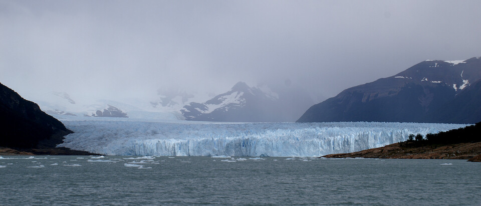
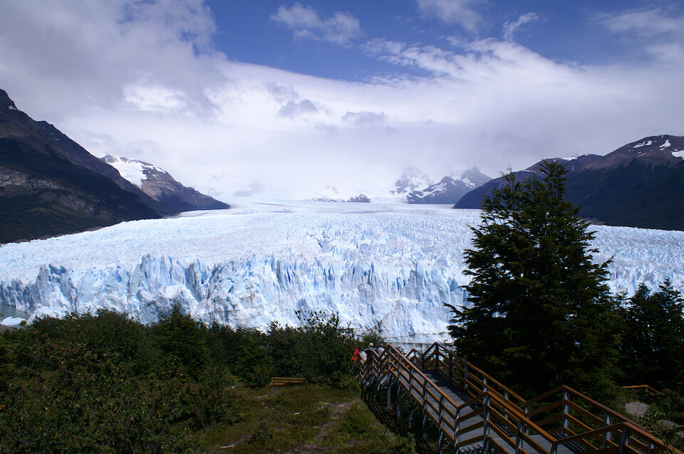
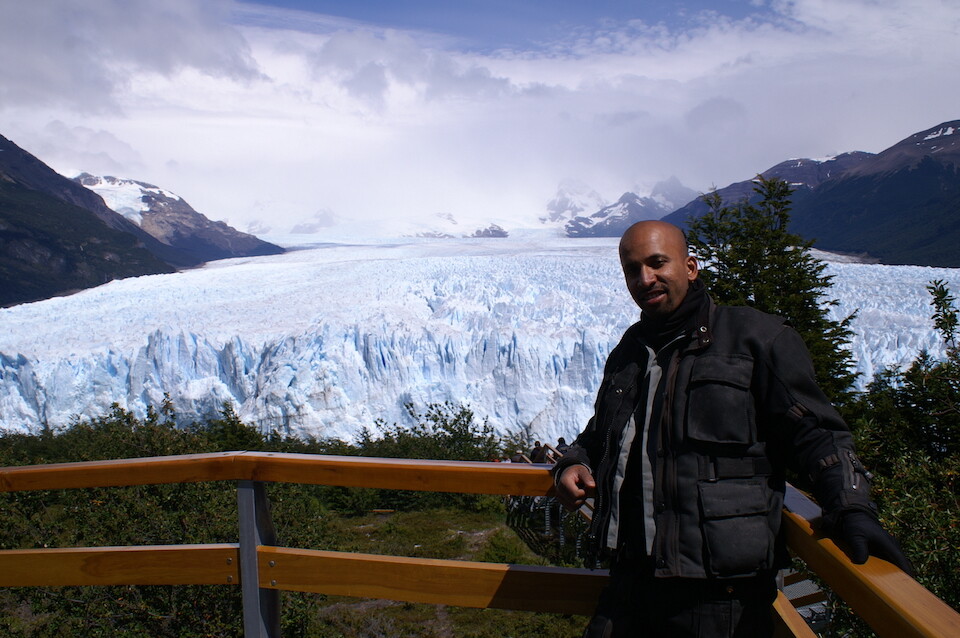
Within a few kilometers of entering the park, I caught my first glimpse of the famous Perito Moreno Glacier. It was overcast in the morning, but I was immediately impressed by seeing this massive river of ice coming down from the mountains.
Since I was here, I decided to splurge and spent an additional P50 on a boat trip that took you right up close to the glacier.
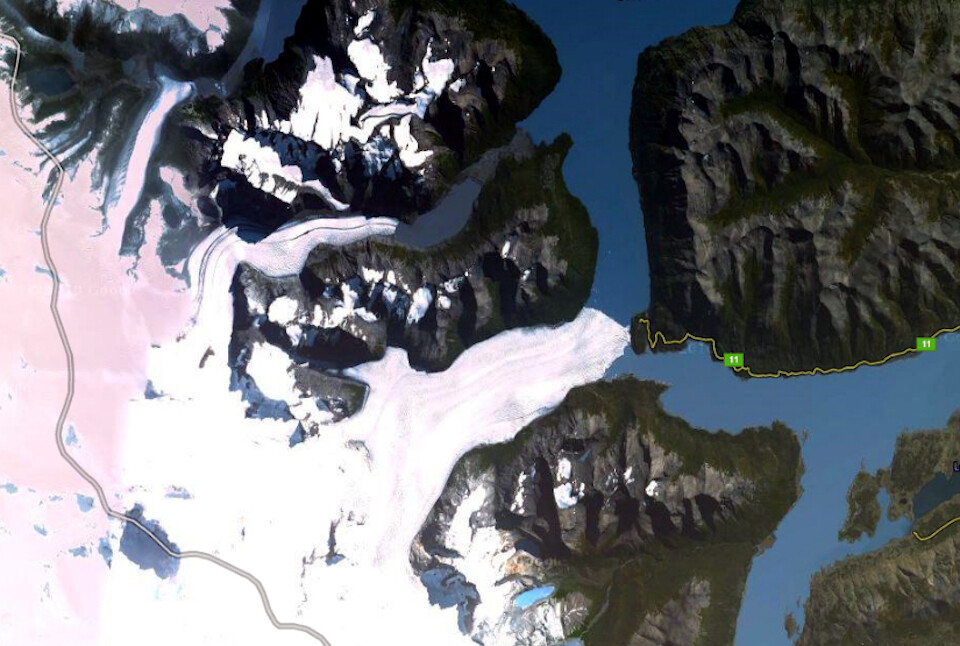
Here's a satellite view from Google Maps to put this glacier in context. It flows down from the Southern Patagonian Ice Field and is about 30 kms (19 mi) long. All the blue is part of Lago Argentino and as the glacier advances, it cuts off the southern portion of the lake, referred to as the Brazo Rico side and the rising waters on this side build up over a few years and then crash through the ice dam in a spectacular show.
The interesting fact about this glacier is that it is one of the few in the world that is still advancing (growing) despite the ever-warming of the climate. There's no disputing the data and the ice field itself is actually shrinking in line with all the other ice fields of the world, but this glacier, along with 2 others that flow from this ice field appear to advance, in contrast to the 45 other glaciers (from the same ice field) that are retreating. One theory that makes sense to me is called 'glacier surge,' whereby melting glacial water reduces the friction between the glacier and its rock bed, increasing its forward momentum that appears to us as a growing glacier, when in fact, it is just a glacier running to its death. Can you see the connection between advancing glaciers and cosmological black holes, as a star spins faster and faster to its death? Another theory, which came to mind is that as the ice field loses mass and shrinks, the heavy weight of so much dropping ice in the center (considered the third largest reserve of fresh water on the planet), might actually push the ice at the boundary faster through some glaciers, depending on the hydrological dynamics of said glacier. You could imagine pushing down on a piece of dough and seeing it squeeze out the sides.
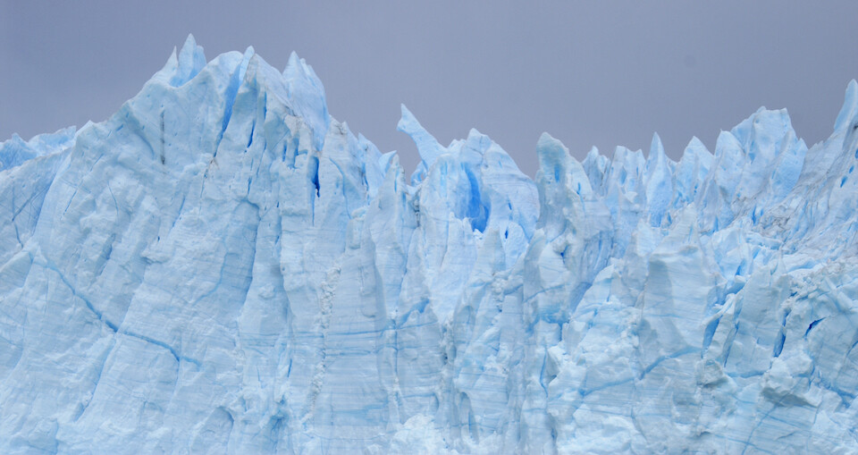
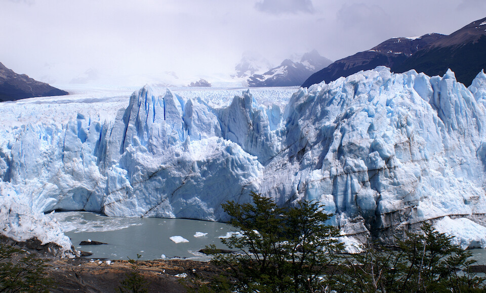
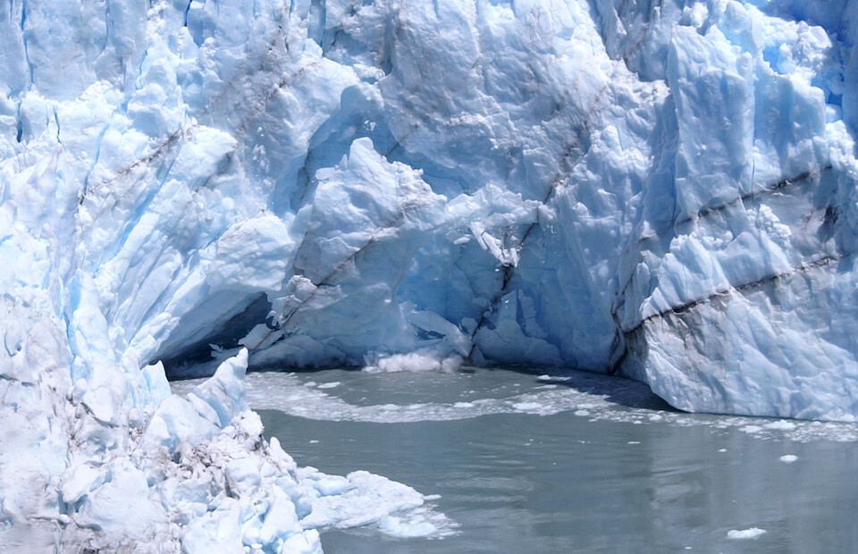
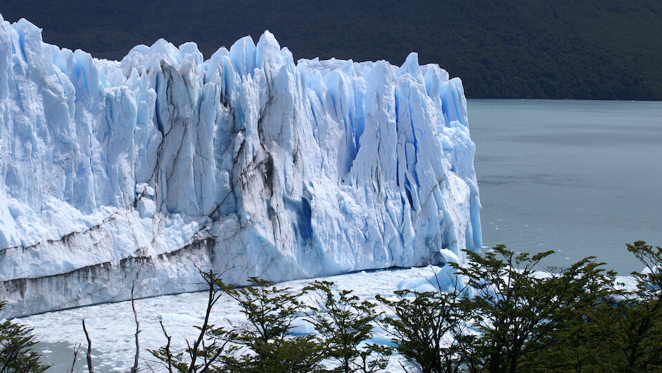
The terminus of the glacier with its dynamic skyline and prominent glacier cave, that forms from melting water at the surface taking advantage of air pockets and slowing growing over time.
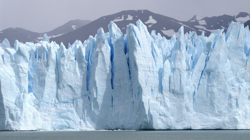
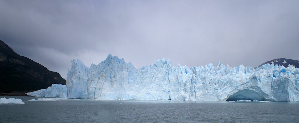
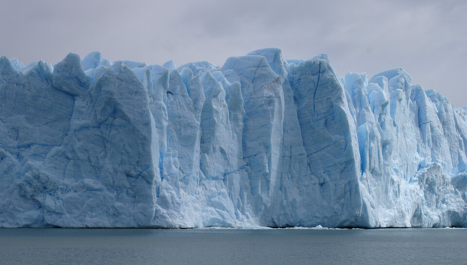
Spires of ice, towering 70 m (230 ft) above the water with another 100 m (328 ft) below. As the boat approached the glacier, the engines were turned down and everyone went silent, almost as if we were in the presence of a sacred, delicate sculpture that was alive. The sound-absorbing qualities of the ice also added to the hushed environment. I felt like I was on a pilgrimage to this spiritual site of astounding natural beauty. I wonder why humans still need to be awed by supernatural forces when nature itself can be so awe-inspiring.
The edge of the ice is highly ragged and looks like sculpted art.
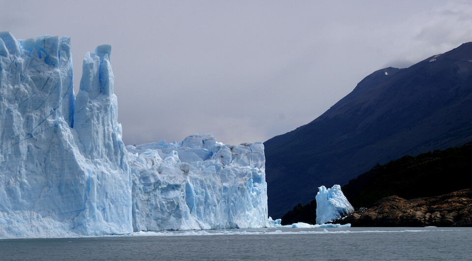
The point where the Perito Moreno Glacier touches land and creates a natural dam. The waters on the Brazo Rico side rise up to 30 m (98 ft) above normal water levels and this immense pressure buildup finally wins the battle against the ice and ruptures through in a dramatic event. Ruptures vary from once a year to once a decade. The first such event happened in 1917 and the most recent was in 2008. I can just imagine the show of force from nature in such an event. Note the effects of sunlight on the glacier.
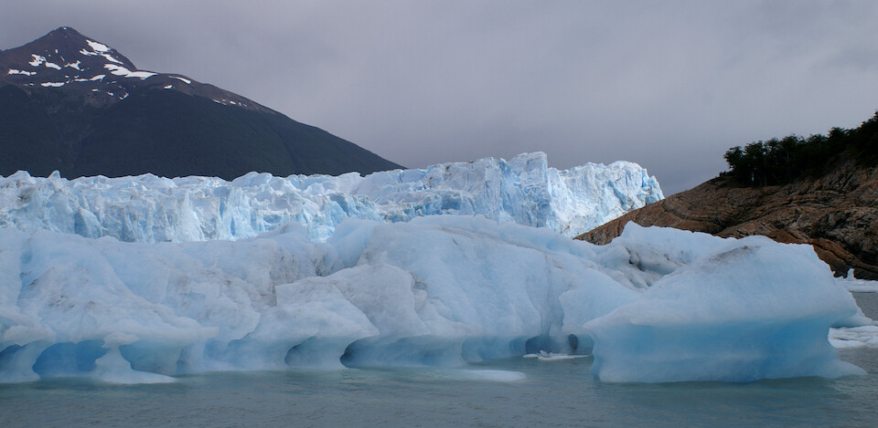
An iceberg floating near our boat with the changing water levels evident against the ice. The constant rising and falling of the water level on this side has prevented any trees from growing below the normal height of the water before rupture events.
I was mesmerized by the unique shapes that could be identified in the ice. Doesn't that look like a dog or a pointed finger from a hand in the ice?
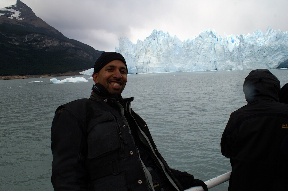
Thrilled to be up close and personal with the Perito Moreno Glacier. It's cold, of course, cause it's a river of ice, but not so bad. There was water misting in the air and I came prepared with a towel to constantly wipe off the lens and protect the camera.
The sunlight filtering through translucent clouds makes the glacier appear to glow from within.
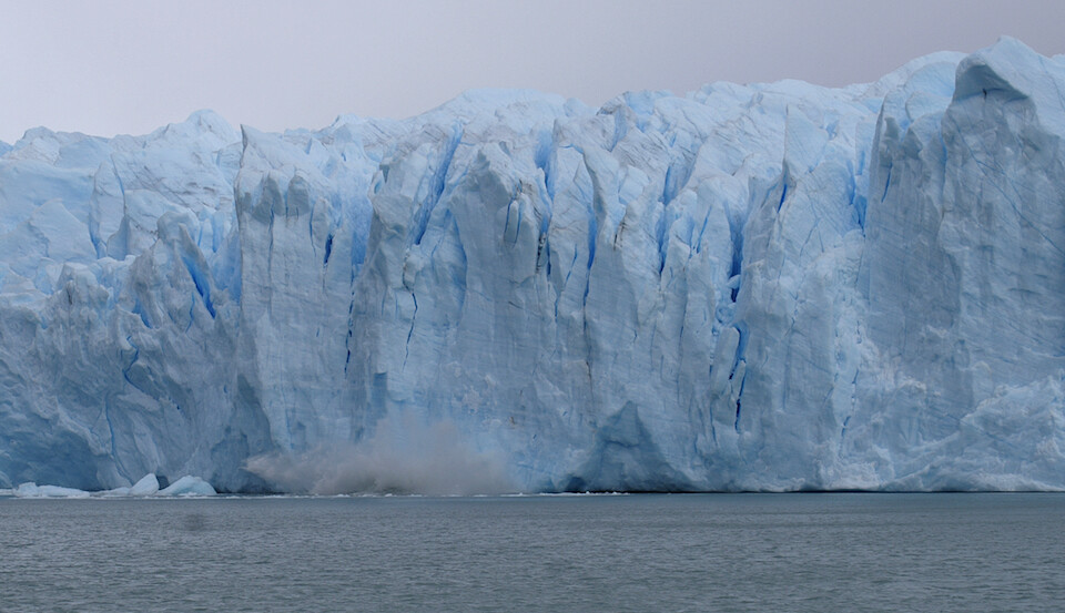
With my trigger finger on the shutter release, I captured one of the calving events that occur every 10 to 15 minutes, preceded by a thundering crack from within the ice and followed by gasps from the human admirers. As the glacier is advancing, ice is being pushed down the valley and this causes the face to crack and fall apart as the river of ice behind it continues its progress.
Within a few minutes, I managed to capture another smaller event. The boat hangs around long enough and goes up and down the face of the glacier until they've shown you at least a few calving events.
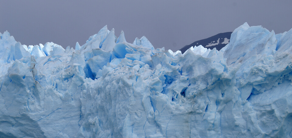
After the resplendent boat ride, I headed to the main visitors center, which gives you walking access to the point where the glacier meets land. How amazing to reflect on the fact that is a river of ice flowing down the valley from a huge ice field further aback in the mountains.
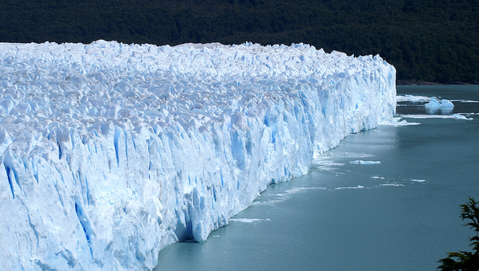
A view of the north end of the glacier, slowly inching forward.
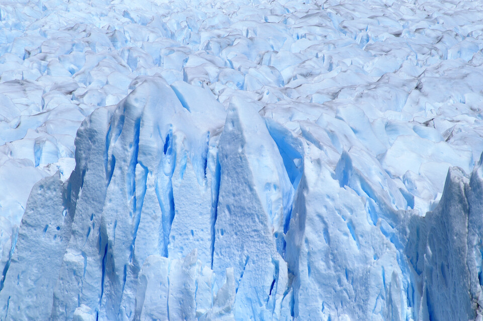
Some close-up shots to show the detail of the glacier's surface.
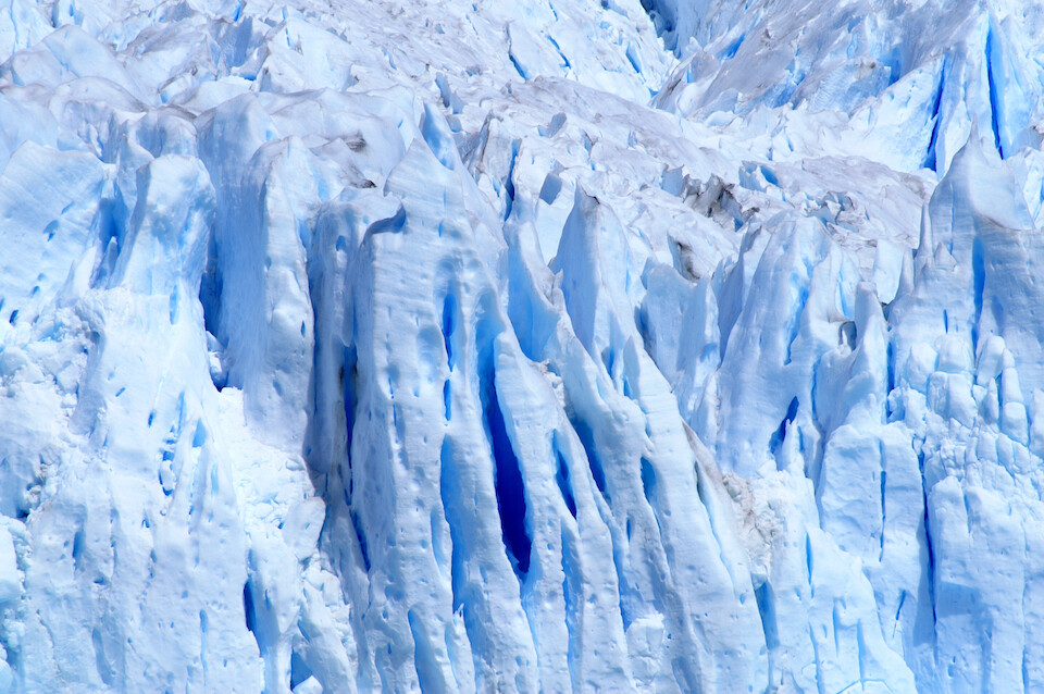
Melting water creating various channels in the ice. The deeper the blue, the deeper the sunlight has to penetrate before being reflected back to our eyes.
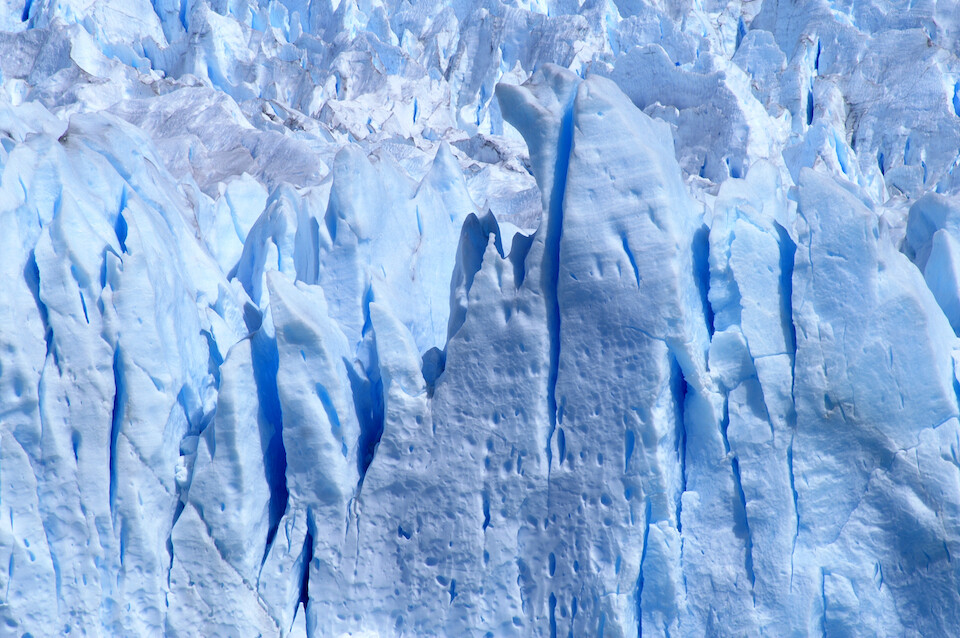
The stunning color of the glacier spans the spectrum from being almost purple to an ethereal white, depending on how the sunlight is reflecting off the ice crystals.
The reason glaciers appear blue is based on the same principle for why the sky appears blue, namely Rayleigh scattering. In the sky, when some of the photons from the Sun hit particles in our atmosphere, like oxygen, nitrogen, etc., the shorter wavelength of blue light gets scattered much more easily than the other longer wavelengths and that's what we see with our eyes down here. It's also the reason why sunsets appear red, since the longer wave lengths of red light have enough energy (like radio waves) to penetrate through lots of atmosphere and reach our eyes as we recede away from the Sun for the night. In large pieces of ice, red light gets absorbed by the ice crystals and only allows the shorter blue light to get reflected back out to our eyes. Rayleigh scattering is why we see different shades of blue from this reflected light as it has to travel through more ice to come back out.
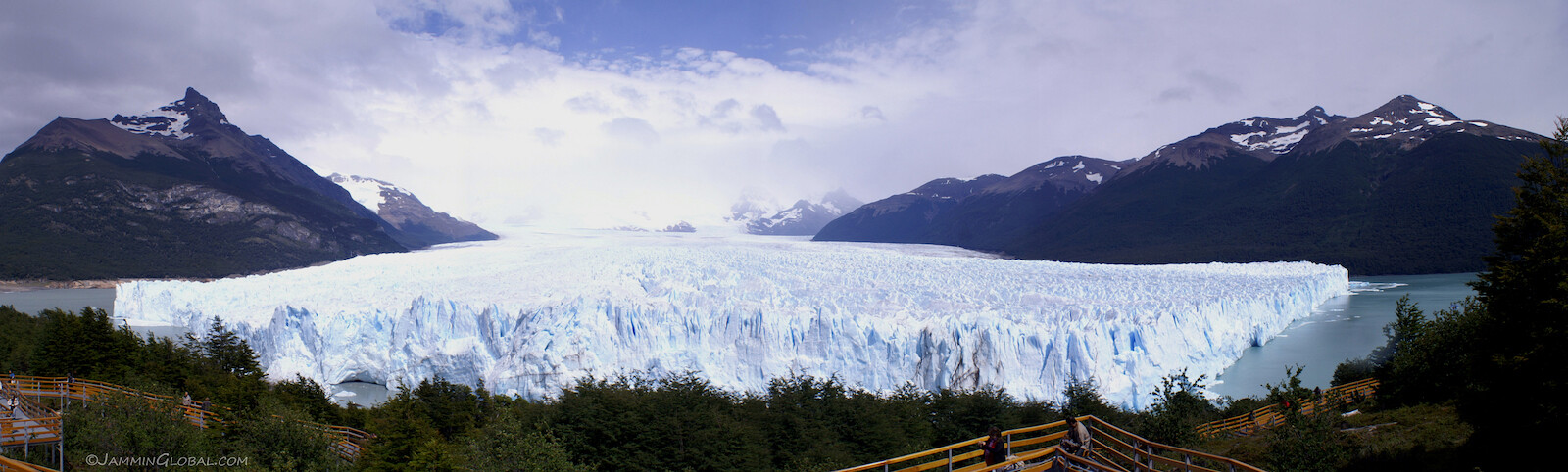
A panorama spanning the entire 5 km (3.1 mi) wide mouth of the Perito Moreno Glacier as it spills down from the Southern Patagonian Ice Field.
Click here to see the high resolution version.
Getting down to meet the glacier once again and waiting for a calving event. The glacier is named in honor of Francisco Moreno, who explored this area in the 19th century and was instrumental in defending Argentina's territorial claims against Chile in Patagonia. He was given the title of technical specialist or expert, which is Perito in Spanish. At one point, Chile laid claim to all of Patagonia but conceded a lot of this 'waste' land to keep Argentina neutral during its campaign against Peru and Bolivia in the War of the Pacific, where it forcibly took over the nitrate-rich Atacama desert and cut off Bolivia's access to the sea. This is part of the reason why Chile's neighbors hold a grudge against it.
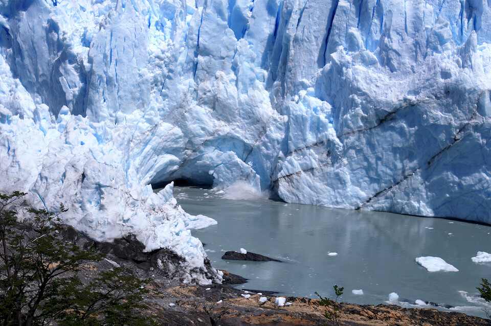
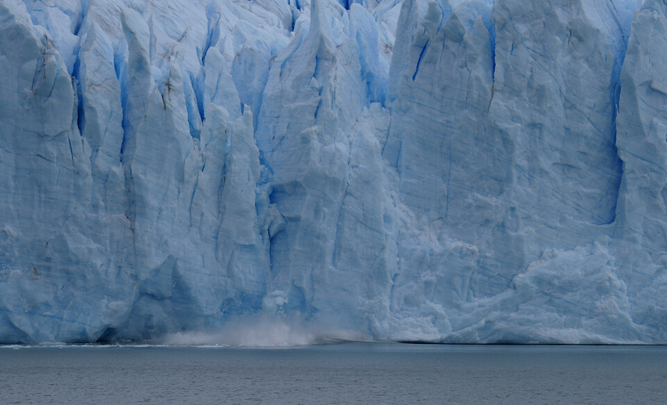
Within a few minutes of waiting, a chunk of ice broke free and...
...crashed into the waters below, followed by oohs and ahhs from the watching crowds. The black lines of debris mark the shear planes in the ice, where cracks are likely to form.
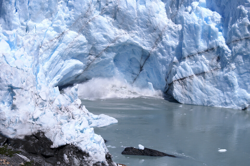
After about another 15 minutes, a few more rumblings emanated from the glacier, drawing everyone's attention to the start of the next calving event. First, a few lose elements fell, destabilizing that region and then...
...that whole section broke free, caught here in mid-flight. It's probably a piece about 20 m (65 ft) tall.
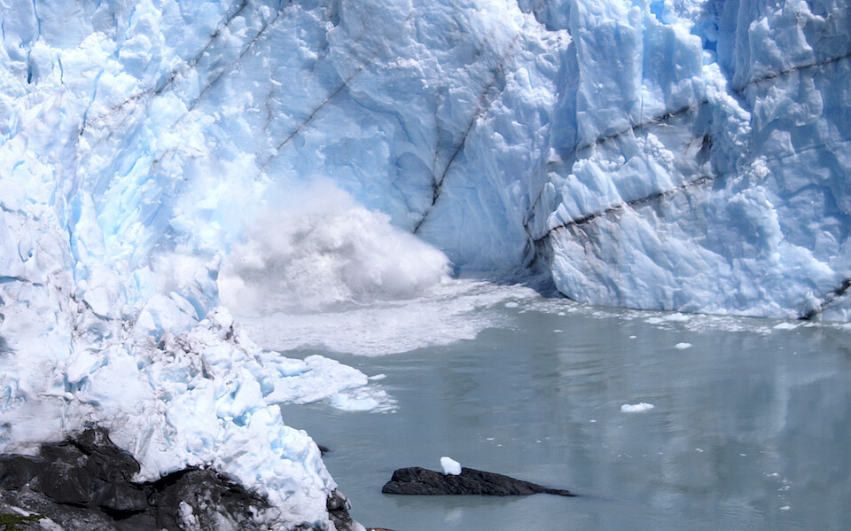
Resulting in a huge splash. This location delivers the most calving events because the glacier is coming against a sharp point of land, raising the compression pressures in the ice. I'd like to come back for one of the rupture events.
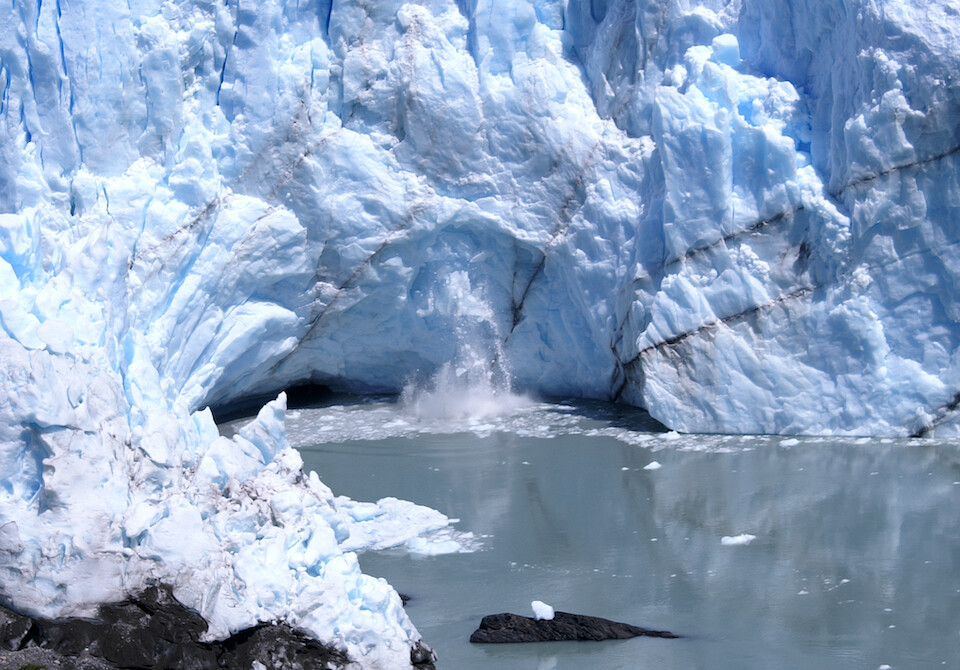
Just as everyone was glued to the last calving event, a huge spire of ice broke free on the northern side of the terminus. You can see the freshly fallen ice still floating near the glacier. What a dynamic place. Glaciers might move slow compared to human speeds, but it's mighty exciting to see this wall of ice steadily creaking and cracking forward.
A full, fun day experiencing the awesomeness of the Perito Moreno Glacier.
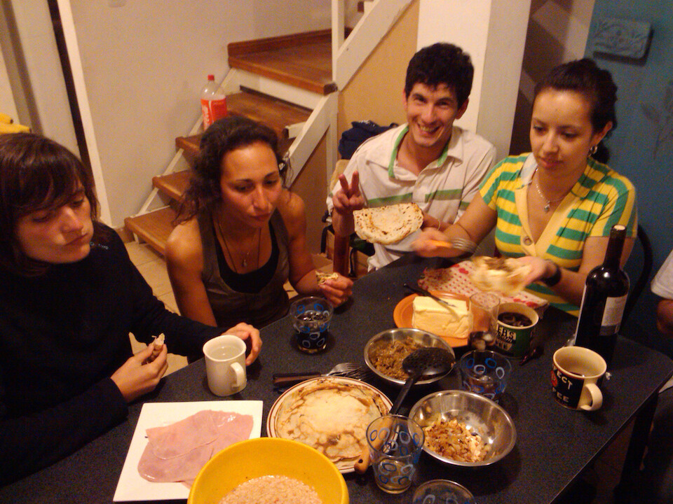
That night, back at Matias' place, Celine prepared crepes for us with savory and sweet fillings.
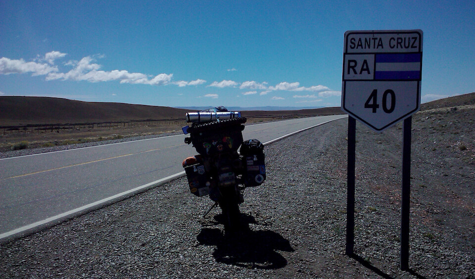
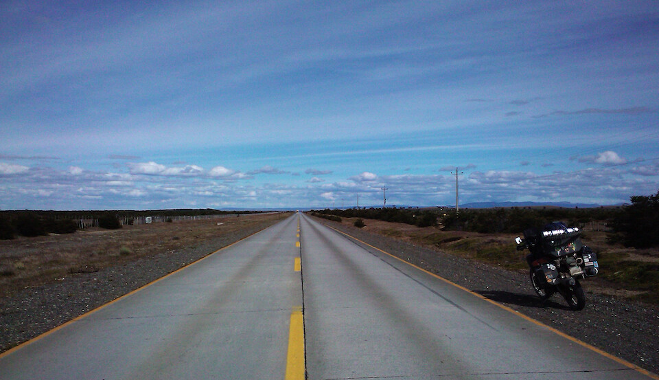
Back on the road, heading south on Ruta 40, one of the longest continuous routes in the world.
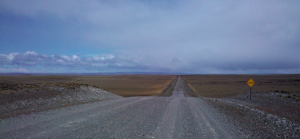
There's still a few stretches of gravel along the 40 in the Santa Cruz province, but all of it is slated to be paved to increase tourism to the region. However, for adventure travelers, a paved road is less of a draw than the more natural feel of a dirt road.
I crossed at the mining town of Rio Turbio back into Chile and its Southern Patagonia region, named as the Magallanes and Chilean Antarctic Region, home to Torres del Paine, the two cities of Puerto Natales and Punta Arenas, the Straits of Magellan, a part of Tierra del Fuego and Cape Horn, along with a claim of Antarctica.
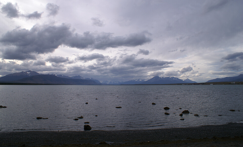
That's sea water, but the open ocean is much further away, beyond a maze of snow peaked mountains rising from the water.
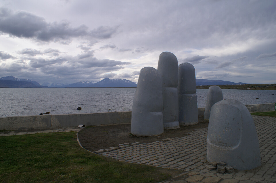
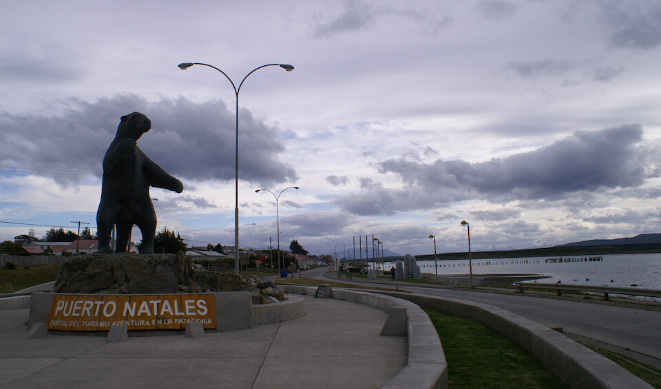
The Mano de Puerto Natales, an imitation of Mario Irarrázabal's Mano del Desierto in the other end of Chile, buried in the Atacama Desert.
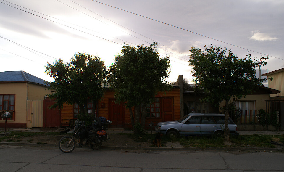
I connected with Gloria who has opened up her family and house to the spirit of CouchSurfing. She welcomes all travelers to stop by and has multiples beds for the weary.
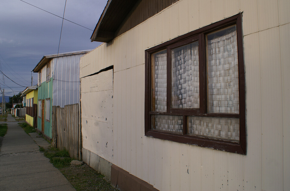
They lived in a more working class area of the city, but besides tourism to nearby Torres del Paine, this city is still mainly about the sheep and fishery industries. It was settled a few hundred years ago when explorers were seeking the passage to the Straits of Magellan but was officially formed into a city in 1911 in order to process the vast quantities of sheep products coming out from Patagonia.

Gloria, on the right, prepared hearty meals and had a bubbling energy that spilled over. She felt this was a great education for her kids to meet people from all over the world. They had lots of questions about India, especially since they had recently seen a documentary about my country. Another couple, on the left, Alfred and Catherine, were traveling from France and also stayed there.
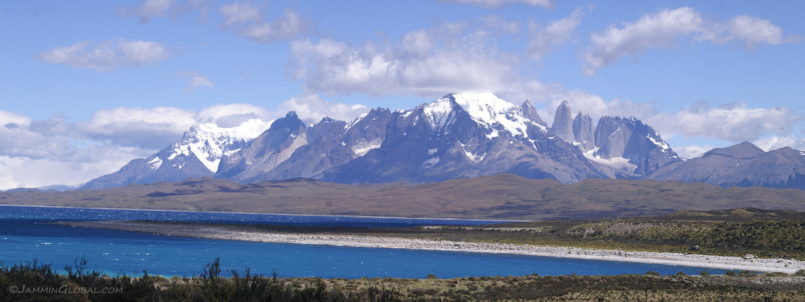
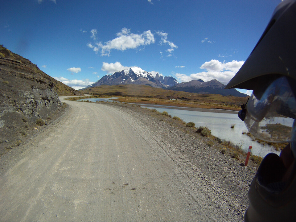
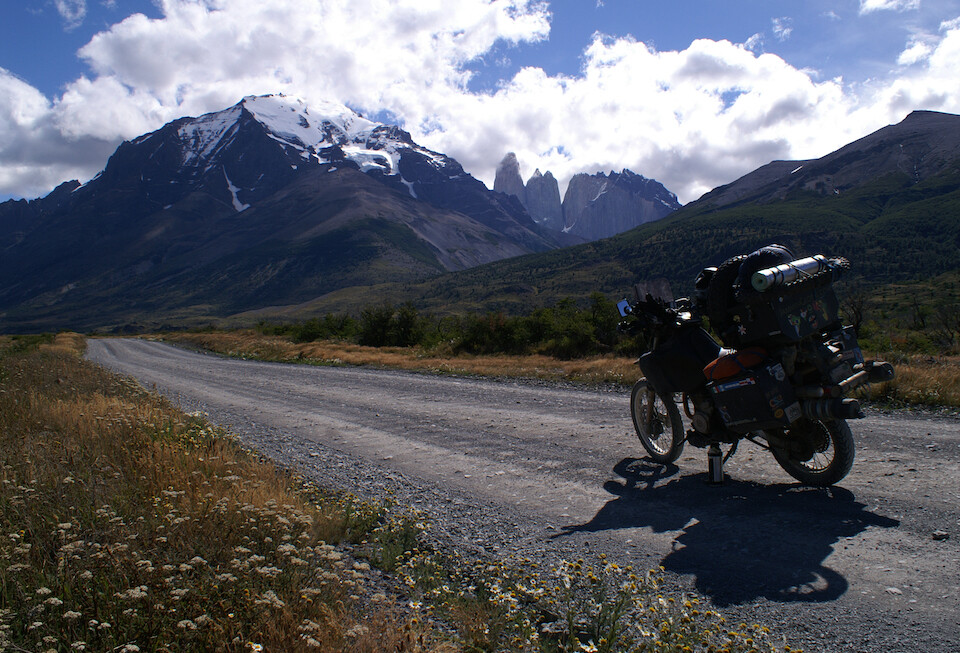
From Puerto Natales, a 110 kms (68 mi) north of town lies the famed Parque Nacional Torres del Paine. The route is mostly paved, except for the last 30 kms, which will probably be paved soon. After a bland ride through the surrounding Patagonian steppe, these jagged peaks show up on the horizon and I was happy to be here on a clear day, since seeing any isolated peak is always a gamble, especially in Patagonia where the weather changes on a whim.
Click here to see the high resolution version.
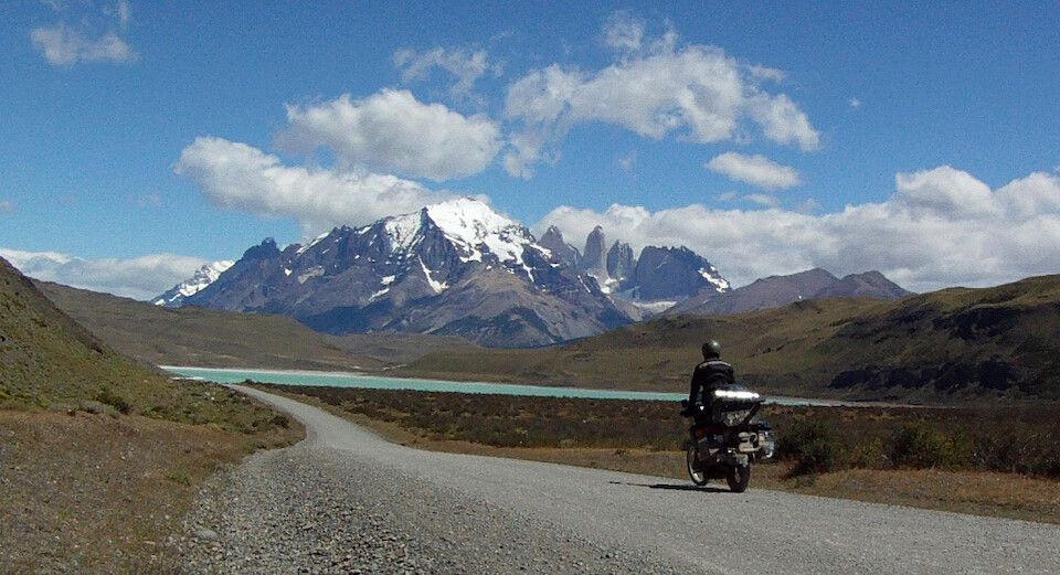
Riding under Torres del Paine, a part of the Paine Massif/Cordillera, referring to the compact group of granite mountains that form this independent portion of the Andes. The massif contains the three towers, another group of three horns (around the corner) and the massive forefront prominence of Almirante Nieto.
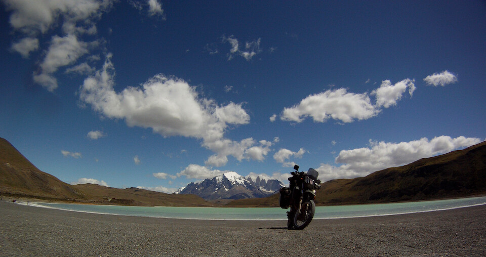
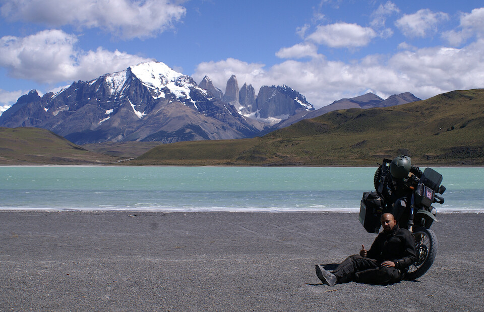
sanDRina basking under the strong Patagonian sun in front of Laguna Amarga under the gaze of the granite towers. The name 'Paine' either comes from an early European explorer to the area or refers to an ancient native word for 'blue' in the Tehuelche language.
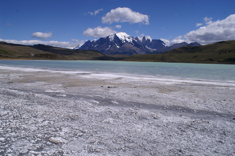
I love me some geology and live history of the Earth. Besides coming here to see the granite towers, I was attracted to these white structures growing on the edge of Laguna Amarga (Bitter Lagoon). The lagoon is named as such since it lies in an endorheic basin, meaning that there's no outlet for the mineraly-water flowing down from the glaciers. Over time, this becomes a hypersaline lagoon, where anything that evolved in the last billion years can't survive (and that's just about everything on this planet), except the white structures, which are living stromatolites. Besides the sharp mountains, this is what our planet looked like for most of its life. Stromatolites are one of the first forms of life to evolve, with fossil evidence of their existence going back to 3.5 billion years ago (bya), just a billion years after the Earth formed. They only thrive in locations where no other organisms can eat them and thus, their decline from dominance of the planet coincides with the explosion of large life froms at the start of the Cambrian period (about 530 million years ago).
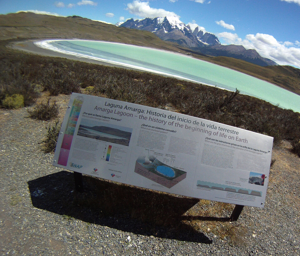
A signboard next to the lagoon explains some of the meaning behind this significant location.
Stromatolites are rocky structures that are formed by the all-important cyanobacteria. This microorganism forms as a thin film on the top of the structure and is the first organism to photosynthesize sunlight and carbon dioxide into food with waste products of calcium carbonate (limestone rock) and oxygen. Most every living thing on this planet owes its existence to the tireless work of cyanobacteria, which slowly over 2 billion years (from 3.5 bya to 1.5 bya) converted the early inhospitable carbon dioxide rich atmosphere into the oxygenated world we live in today. That is, all the oxygen we breathe in originated from a stromatolite. Respect. Also, since these structures formed on all of the coastlines of the oceans, their oxygen rusted out the iron that was suspended in the oceans into the vast bands of iron ore that we have been mining out of the Earth to support our civilizations. This process turned the oceans blue from their previous greenish appearance. It is humbling to note that our complex life today owes thanks to this sturdy bacteria, who is definitely going be around much longer than us. So, tread lightly on this planet that we think we dominate for this short blip in history.
I had a light lunch on the shores of this ancient lagoon just taking it all in and imagining what it was like before humans were around, that is, until a tour bus roared by and dumped a horde of my fellow bipedal tramplers.
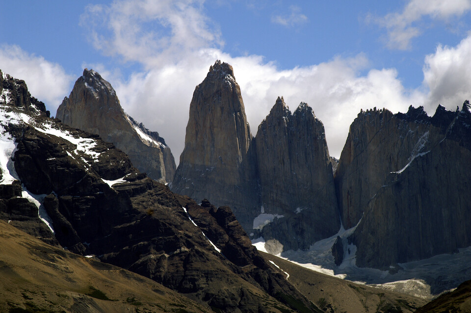
The iconic towers of granite of Torres del Paine, about 2,500 m (8,200 ft) tall. Their vertical faces are the dreams of rock climbers the world over, but just to marvel at the beauty of the erosional power of wind, water and ice that resulted in these formations was enough for me.
I headed further into the park (where I could bypass paying the entrance fee since Gloria's son worked at one of the park gates)...
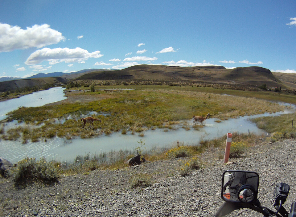
...and observed huge numbers of guanacos (relatives of the llama and alpaca), seen here wading across this stream along with flocks of rheas, an ostrich-like bird. Guanacos were almost hunted to extinction when the European settlers arrived as they cleared the land to make way for their grazing cattle. They also burnt down lots of surrounding forest for pastureland before the park was established in the 1950s, but now, the area is slowly recovering from man's heavy hand. The soft wool of the guanaco is considered only second to the highly-prized wool of vicuñas.
A parting shot of sanDRina under the late afternoon sun at Torres del Paine, a prime example of the grand beauty to be found in Patagonia.
After another night at Gloria's back in Puerto Natales, I headed down the easy ride of 250 kms (155 mi) to Punta Arenas.
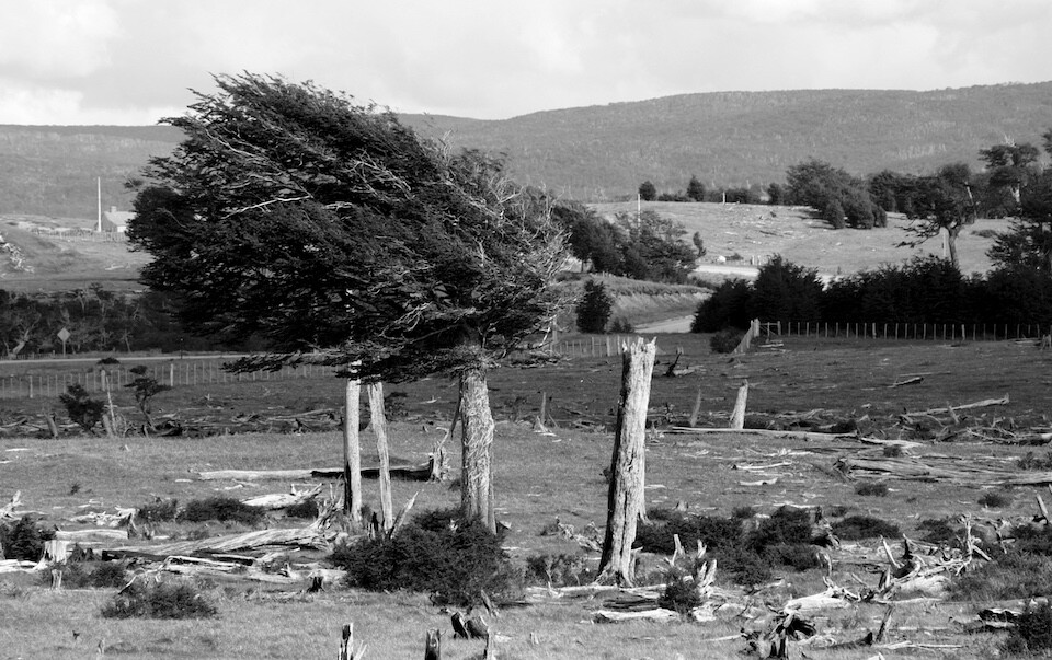
The windswept trees of Patagonia. If you ever doubted how strong and consistent the winds are, here's some convincing evidence. The winds constantly blow in from the west and in different places around the region, they start and die down at almost the same time everyday and one can time their daily life around the winds.
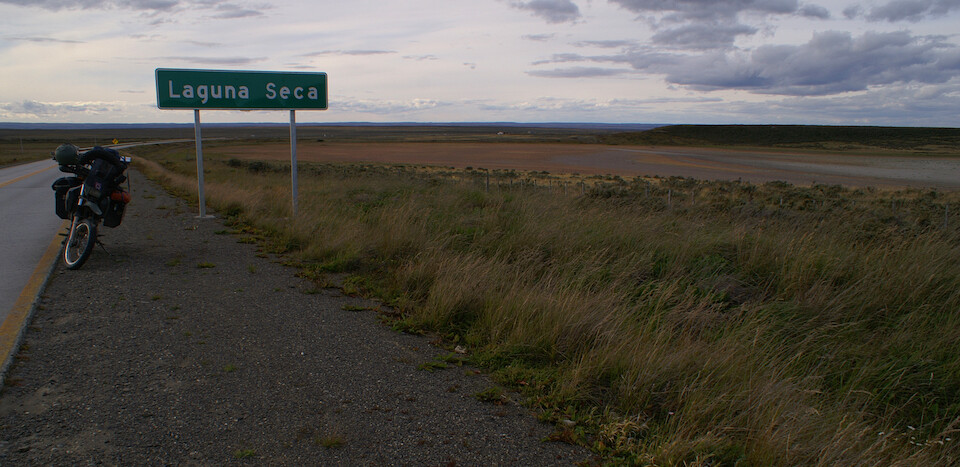
Coming across a sign for Laguna Seca and what do you know, it's actually indicating a dry lake. For all bikers, Laguna Seca refers to the famous race track of the same name near Monterey, California, where the annual US MotoGP race is held, with its famous 'corkscrew' set of turns.
I spent a day in Cecilia's home in the suburbs of Punta Arenas and started arranging things for the upcoming trip across the Atlantic, as I was nearing the end of my time in Latin America.
While Chile is generally considered a safe and stable country, just a few days before my arrival into the Magallanes, the region was in the midst of a general strike that turned violent, which seems very out-of-character for Chileans, but probably in-character for the hearty people that endure the rough Patagonian climate year-round. Because it's quite cold throughout the year, residents here need to use natural gas to heat up their homes constantly and previously, the government subsided the price of gas to offset the harsh living conditions. The central government's decision to drop the gas subsidy would've raised the price by 17%, which was seen as unacceptable by the people and they took to the streets, manning road blocks and cutting of the region to the outside world. This brought them attention, especially since about 4,000 all-important tourists were 'trapped' here and diplomatic pressure pushed Sebastián Piñera's government to come to a compromise, which was a 3% rise in the price of gas.
I'm not sure which side of the argument I stand on since on the one hand, yes, it's not fair for the residents here to have to allocate so much of their income to heating their homes, but they are paid higher than the rest of Chile for living in such a remote city. Cecilia moved here years ago with her then husband since they found higher paying jobs here. However, the environmentalist in me says that we can't go on subsidizing high consumption of fossil fuels and the only way to move beyond our current fossil fuel dependent civilization is for its price to rise so dramatically that every citizen on this planet demands that policy quickly makes a transition to a cleaner way of life. Sadly, this is going to lead to highly turbulent times for most people and the poor and less developed communities are going to be feel the brunt of this transition.
Even in the United States, USD 3/gallon is not going to ween that society off from the gas pump, but USD 10/gallon might bring the economy to a standstill or even crash and this is why this is a such a delicate game to play with its results affecting the coming decades. I enjoyed the cheap petrol prices in Bolivia, as there too, it is heavily subsidized by the government either to aid the poor or keep their support for their leftist president. A few days after I left Bolivia, the government tried to remove the subsidy on petrol there and just like in southern Chile, the people took to the streets and protested violently until the government backed down. This is going to become a more common occurrence in the coming years. India, too, recently decided to scrap subsidies on fuel but the transition was smooth since the price difference wasn't too drastic.
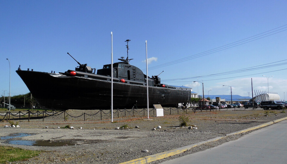
Punta Arenas, with the show of Chile's military power. This city was formed on the Straits of Magellan to protect Chile's ownership over this once important water passage in the early 20th century. It was a coaling station, where steamships fueled up on coal when transiting from the Atlantic to the Pacific, before the Panama Canal was built and was also the major center of administration for the vast sheep estancias all over Patagonia. Due to its isolated location, it was also used at one point as a penal colony to punish problematic soldiers.
Even though Southern Patagonia has been well-developed with tourist infrastructure, the draw of the outstanding natural attractions is still strong enough to enjoy this land. Torres del Paine was nice and perhaps a hike into the park would've left a stronger impression, but for me visiting the Perito Moreno Glacier lived up and beyond its expectations.
Next: Patagonia, Part 6: Ushuaia, Tierra del Fuego and Penguins
Previous: Patagonia, Part 4: Backtracking up the Austral and down the 40