
Bolivia II, Part 7: The Lagunas Route | Thermales and Geysers
— Bolivia, Lagunas Route — 5 min read
December 23 - 24, 2010
From Laguna Colorado, the southern third of the Lagunas Route takes you through some active geysers and hot springs before exiting at Laguna Verde and into Chile.
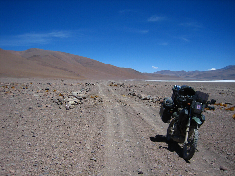
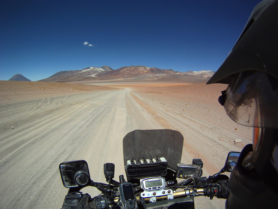
Setting off from Laguna Colorado.
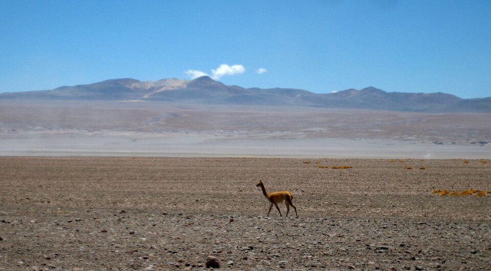
A vicuña strolling by in its homeland. Good thing it has no natural predators, cause there's nowhere to hide.
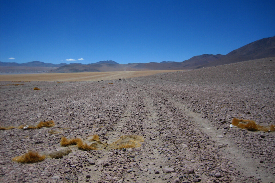
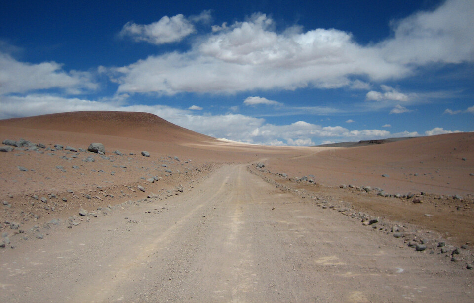
A pebbly track. I made sure to put a few psi back in the tires after the deep sand north of Laguna Colorado to avoid any punctures.
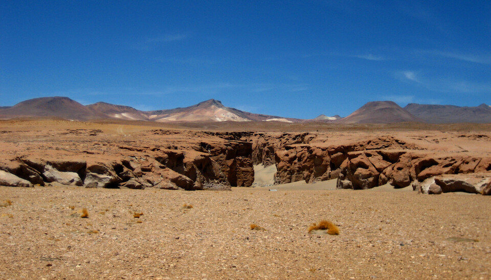
A crack in the earth's crust forming a small canyon, which was a departure from the usual landforms in this area.
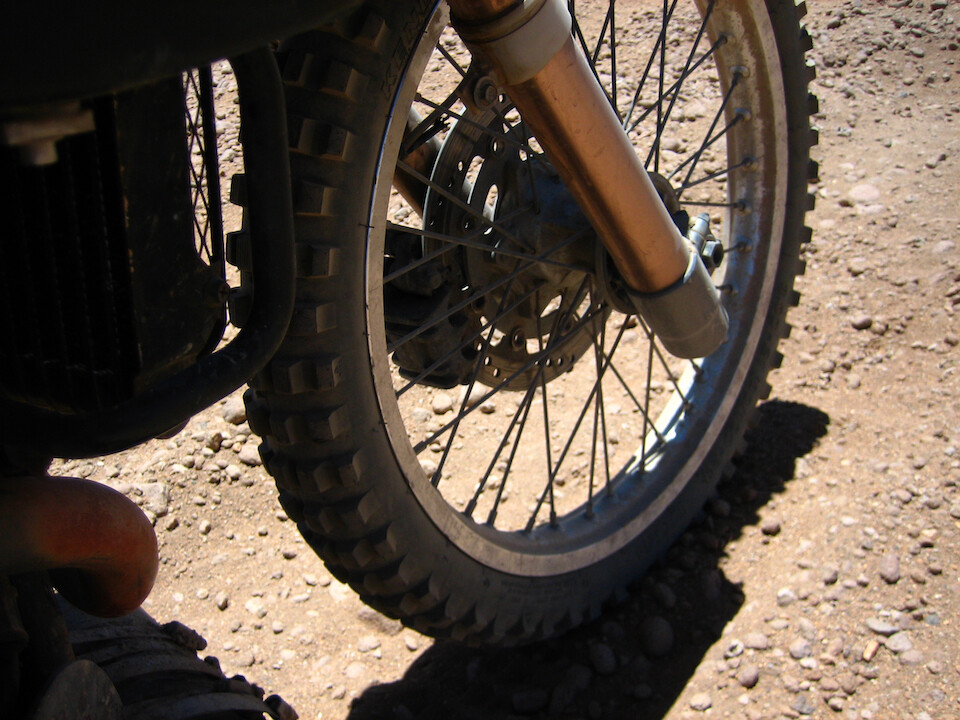
The kobby Kenda K257D did well in this terrain, aired down to spread the load and soften the ride.
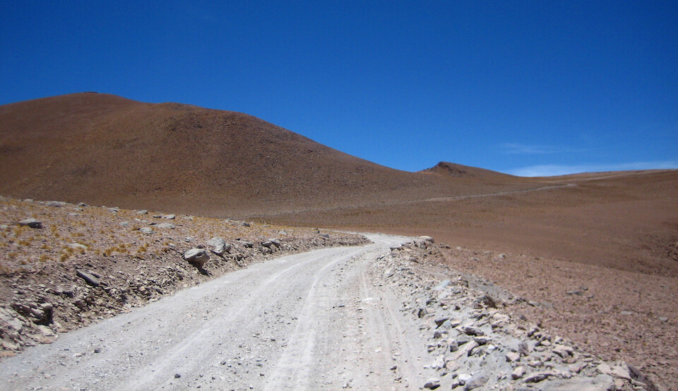
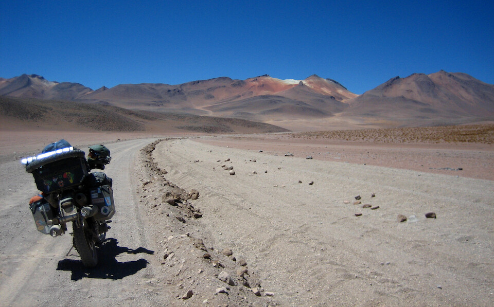
The route joined up with a better-graded highway that was maintained by a Chilean company extracting boric acid nearby.
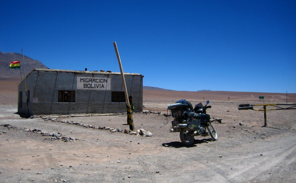
Besides all the fun and games of a nice off-road adventure, there was the business of crossing an international border towards the southern end of the ride. The Bolivian customs office is off the route and requires a small detour near the geysers.
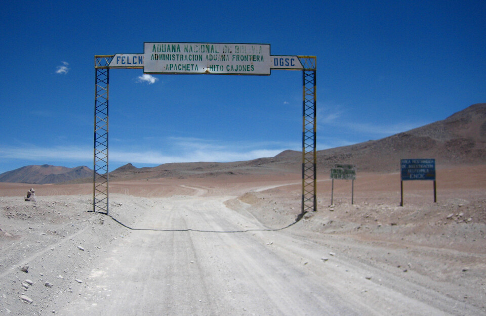
An out-of-place huge metal structure in this desolate land, welcoming you from the Bolivian customs, which was a few kilometers to the right with the route and the geysers straight ahead.
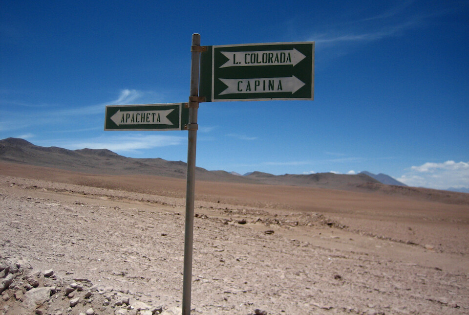
A street sign in the middle of the desert. Apacheta is where the customs office is.
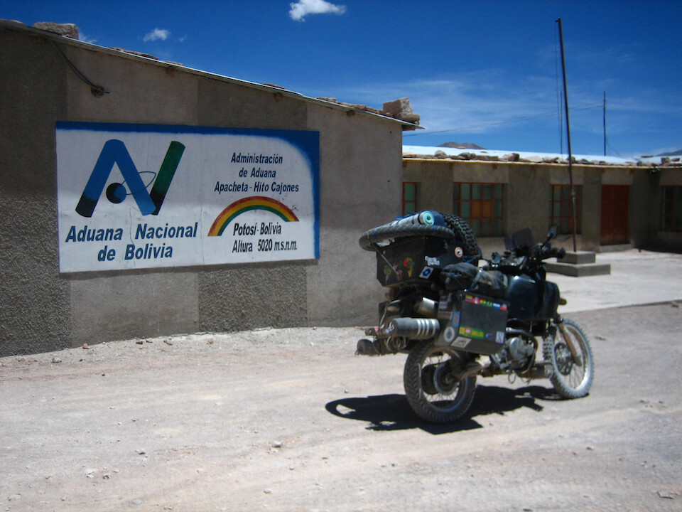
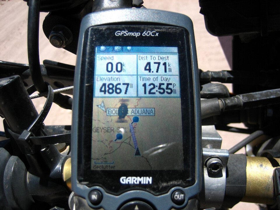
The highest customs office in the world at 5,020 m (16,470 ft). No one was in, but I waited for around twenty minutes in the freezing cold and nothing moved, so I continued without properly checking out the bike from Bolivia. I don't plan to return for a long, long time, so it's ok.
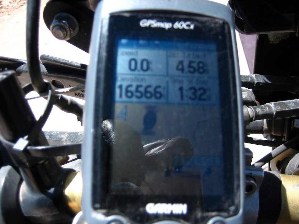
Reaching the highest point of the route near the customs office of 5,049 m (16,566 ft). I didn't get any headaches along the whole route, so either the coca leaves or the altitude sickness pills worked, or maybe both.
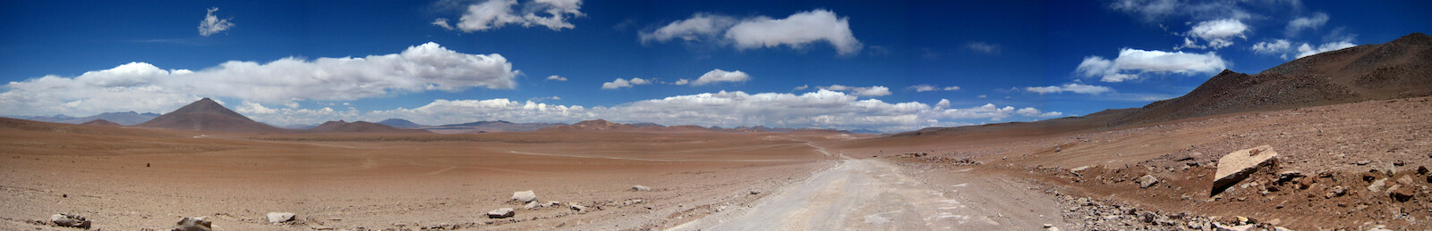
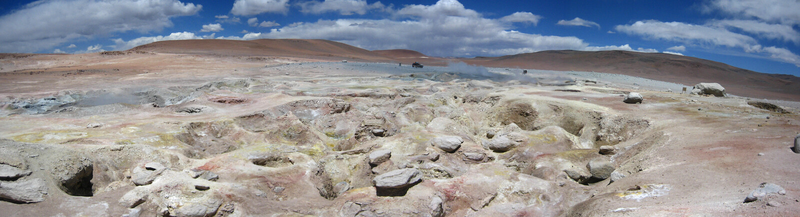
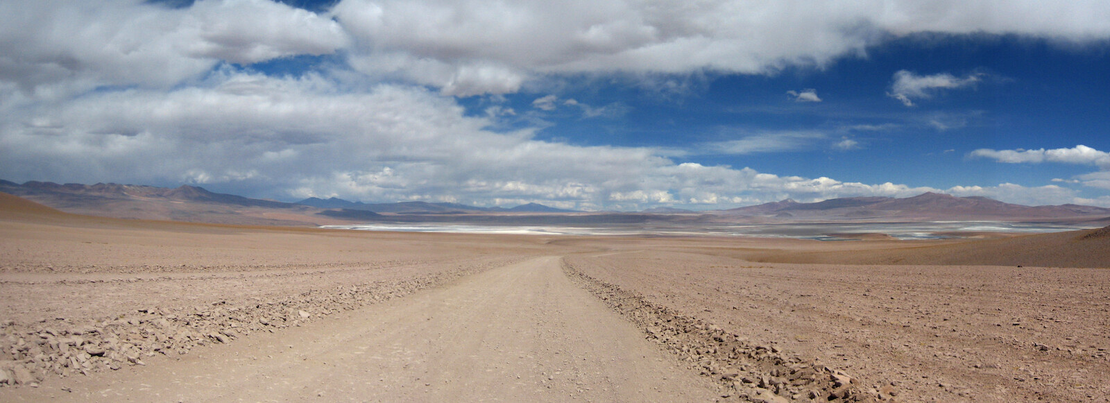
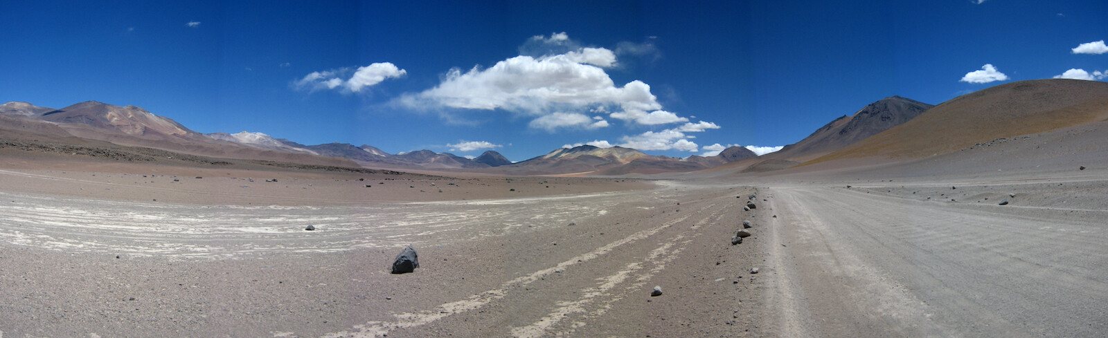
A panorama, coming back from the customs office at Apacheta. Laguna Colorado is to the left (north) with the geysers to the right.
Click here to see the high resolution version.
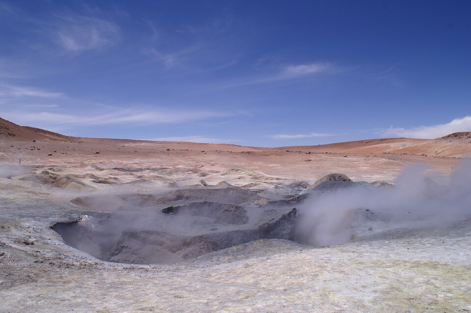
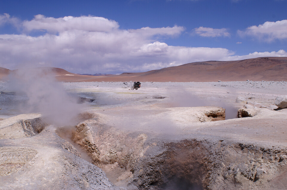
Geyser Sol de Manaña.
A wide angle view of the discoloration to the rocks from the hot scalding steam and sulphuric acid bursting up from the hot magma under this geologically active place.
Click here to see the high resolution version.
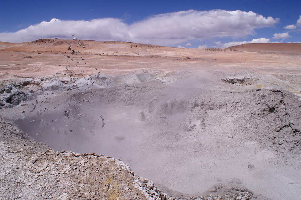
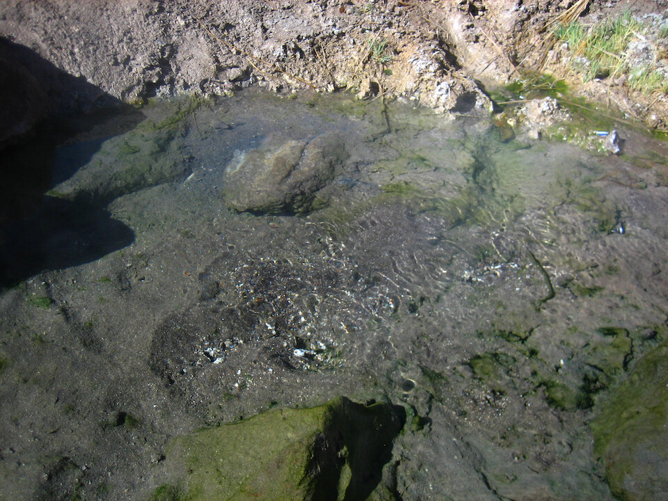
Fumaroles, fountains of hot mud.
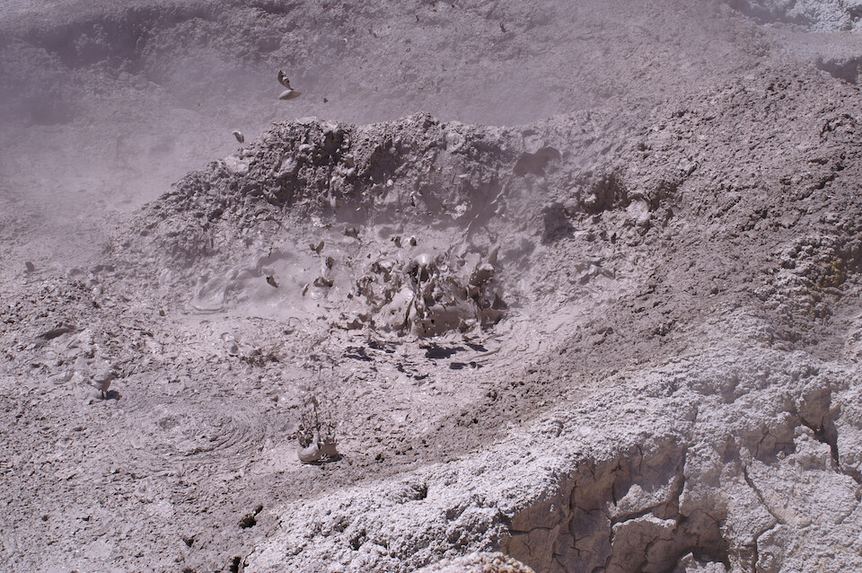
It was entertaining to see the different shapes captured in the mud as the liquefied surface bubbled and burst up.
I liked how open this whole area is with no restrictions anywhere, so you can get as close as you like to the steaming cavities. Of course, if something bad happened, you're on your own.
From the geysers, the route was very sandy back to the main piste and I lost momentum on an incline and had to ride the clutch quite heavily to make it over the top and from here on, the clutch would slowly lose its effectiveness. However, I didn't have to change it out for another 2,000 kms (1,250 mi).
A wide angle view as I got closer to the destination for tonight...
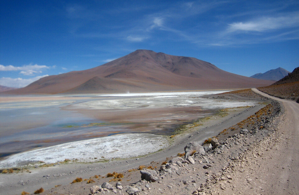
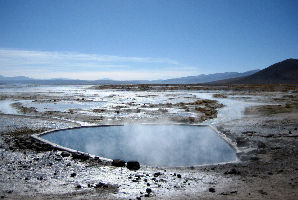
...the hot springs at Salar de Chalviri.
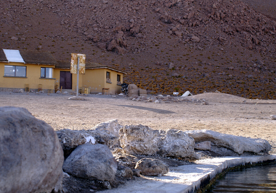
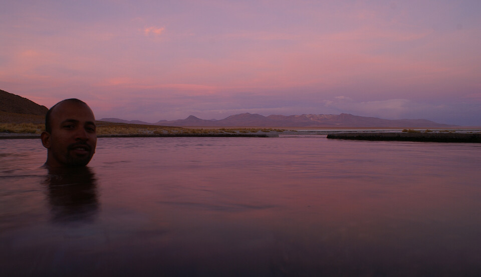
I got to the Polques Agua Thermales in the late afternoon and after setting up camp next to the guest house...
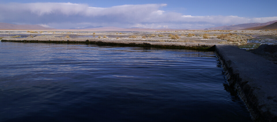
...I soaked my aching body in the comfortably warm waters of these hot springs.
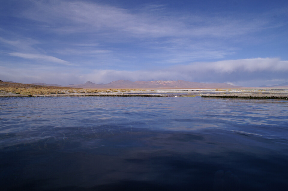
It was quite cold above the water as elevation was at 4,418 m (14,495 ft), but just fine if you stayed submerged.
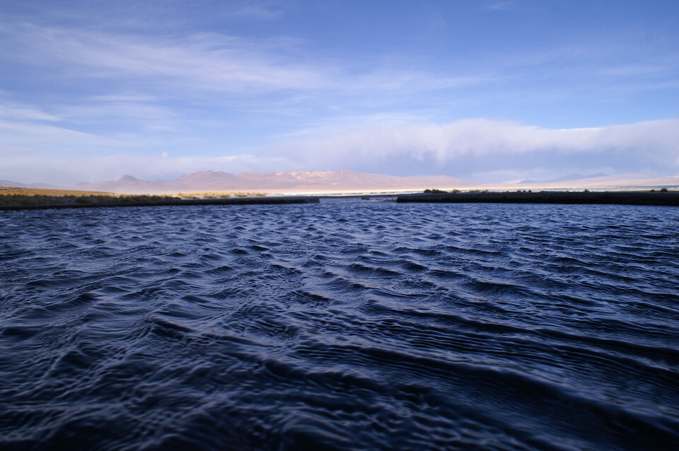
The winds were quite fierce and created waves on the surface.
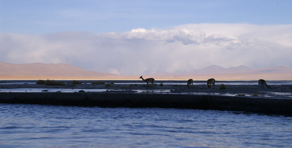
As I lay perfectly still in the waters, these guanacos slowly strode by, only glancing up upon hearing the shutter of the SLR.
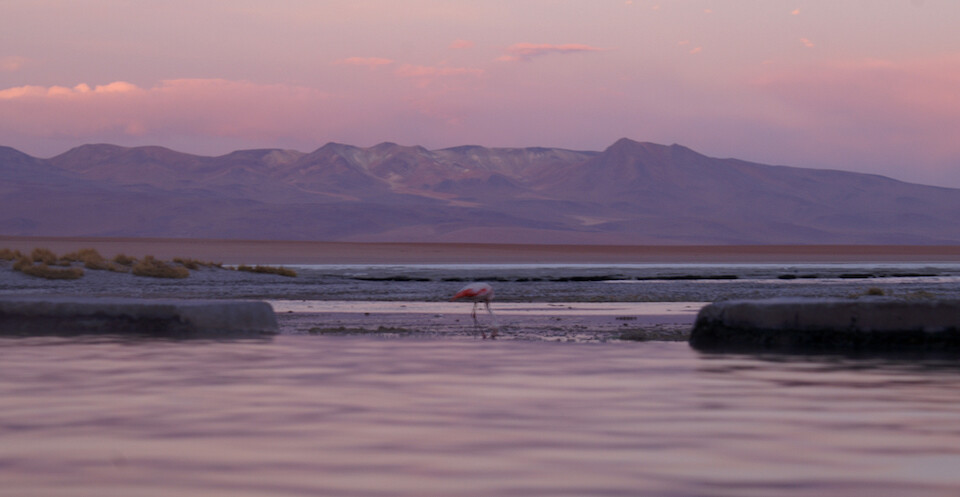
I sat there for about two hours through sunset and observed some flamingoes along with various other wildlife that came by. I know you're not supposed to stay more than 20 minutes at a stretch in a hot tub, but I kept hydrating and my head was cooled down by the chill winds, so all was good.
A perfect end to an epic adventure. Tomorrow would be the final day on the Lagunas Route and it's worth all the praise that's levied on it. Come here to see all the natural beauty and test yourself by riding your own vehicle. It's a grueling but rewarding journey.
The next morning, hordes of Land Cruisers turned up for a sunrise dip in the hot springs, so I suggest the end of the day for peace and quiet.
The hot springs are fresh water (which flow into the already salty lagoons) and I filled up my water bottles from a nearby spring. Don't take water from the hot tub!
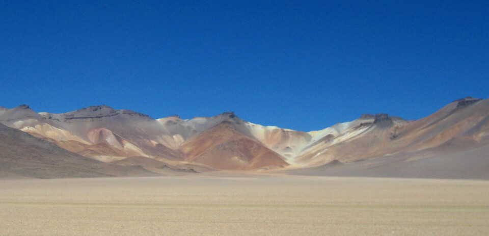
From Polques, the route passes through a valley called the Desierto de Dali and the coloring of the mountains sort of resembles one of his paintings.
And I think these rocks in the sand are supposed to resemble his trademark forms, but I was too far away to see.
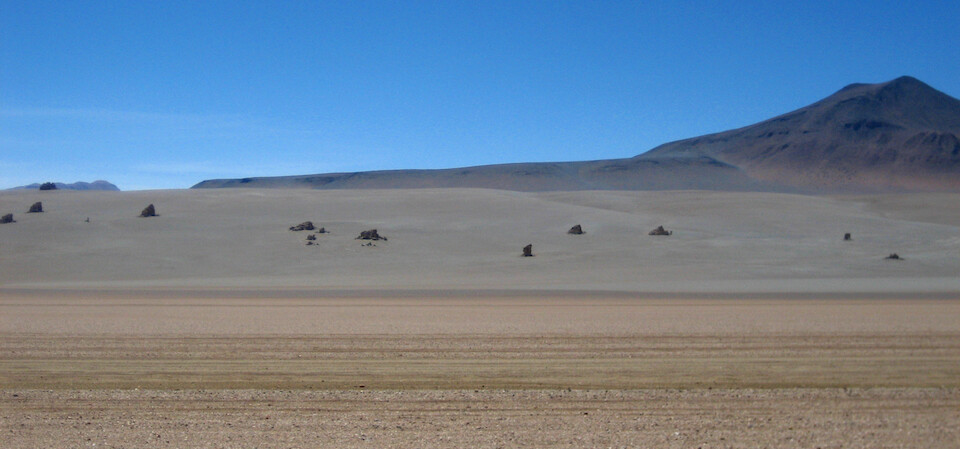
The route was still sandy and corrugated but much better maintained than further north.
It's sandy, but over a hard surface that was recently graded.
A panorama capturing the landscape dotted with volcanoes and mountains.
Click here to see the high resolution version.
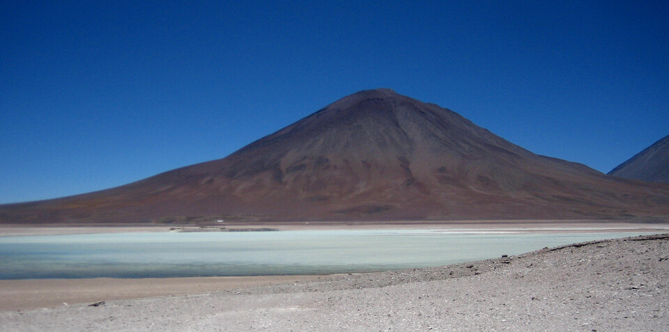
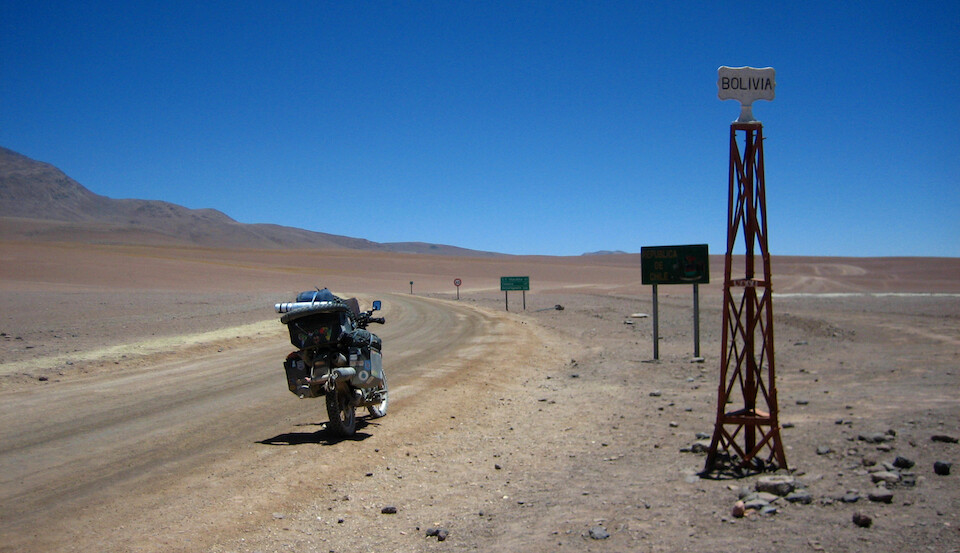
And finally, the last jewel in this desert, Laguna Verde (green lagoon).
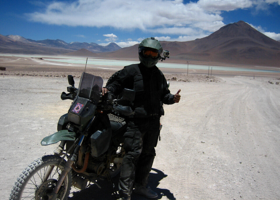
The guard at the southern gate offered to take my picture as must be customary for overlanders successfully making it across the Ruta de la Joyas Alto Andinas.
From there, it was a short climb up to the Bolivian immigration post at the border, which was quite high at 4,500 m (14,765 ft). I didn't tell them about the customs office being closed yesterday, because they probably would have made me go back. I think they're going to open a new customs office near Laguna Verde.
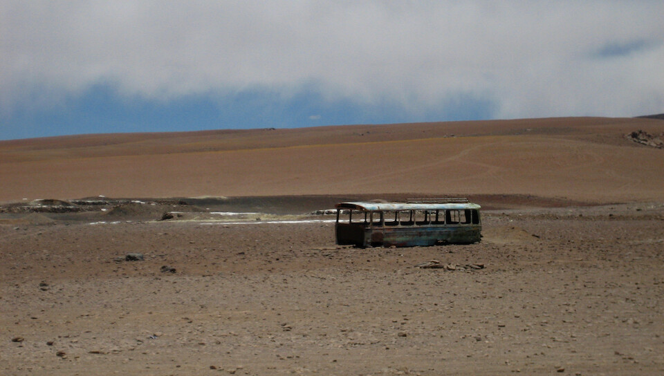
A school bus that didn't make it. Finishing off a strange and wonderful journey through this kaleidoscope of experiences that are waiting for anyone willing to swim in the sand of southwestern Bolivia.
Good-bye Bolivia, it's been a good time. Many travelers told me it was the highlight of their trip and I understand why now. I guess it's going to be hard to be impressed by the landscape after Bolivia, put Patagonia's calling...
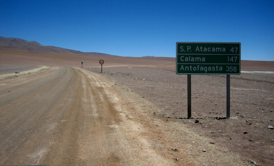
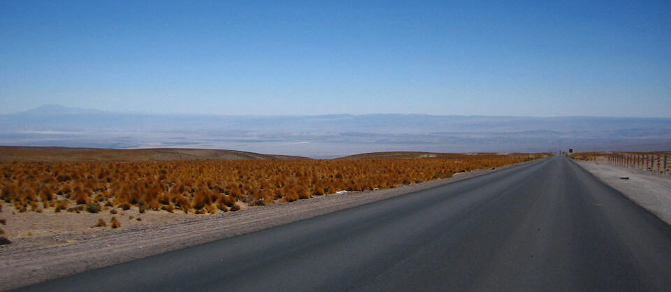
Hello, Chile. It's about 50 kms to San Pedro de Atacama for Chilean border formalities and after another 7 kms of well-graded piste, you arrive on...
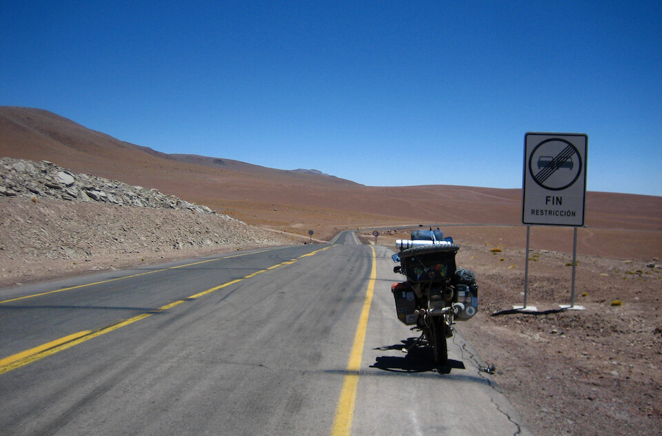
Pavement! I aired up the tires back to 32 psi in the front and 38 in the rear (it took a really long time at this high altitude). I was so pleased with myself for not having dropped the bike even once across the whole Lagunas Route. That surely boosted my confidence in my off-road riding ability. Good practice for Africa...
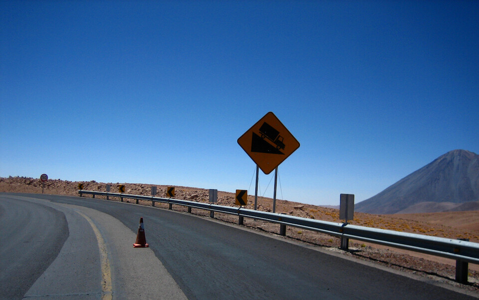
It's all the way down from up here. The paved road is coming from Paso de Jama, but if you enter Chile from Bolivia, you are required to head down to San Pedro to visit Chilean customs and immigration. I don't know if you're allowed to head straight to Argentina.
The road drops down constantly into the valley below where the Salar de Atacama is. You drop 2,100 m (6,890 ft) in 50 kms (31 mi) down to 2,500 m (8,200 ft). One of the Land Cruiser drivers told me he likes to turn off the engine and just coast all the way down.
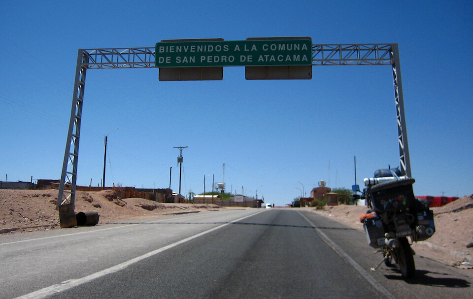
Arriving at San Pedro de Atacama and that concludes the journey across the Lagunas Route.
Next: Chile: San Pedro de Atacama
Previous: Bolivia II, Part 6: The Lagunas Route | Laguna Honda to Laguna Colorado